High in the northern folds of Nepal, where the Himalayas rise like ancient guardians between Nepal and Tibet, lies a valley that tells more than a trekking story. It tells a human story.
Welcome to the Langtang Valley — a region where snow peaks tower above prayer flags, where glaciers shape rivers, where yak bells echo through alpine pastures, and where a community rebuilt itself after unimaginable loss.
Located inside Langtang National Park, about 80 kilometers north of Kathmandu, Langtang is often described as “the closest Himalayan wilderness to the capital.” But geography alone cannot define it.
Langtang is ecology layered by altitude.
It is culture shaped by centuries of Tibetan influence.
It is resilience forged by the 2015 earthquake.
And it is beauty that shifts with every hour of light.
This is not just a trekking destination. It is a living Himalayan region.
Geographic Identity: Where Is Langtang Valley?
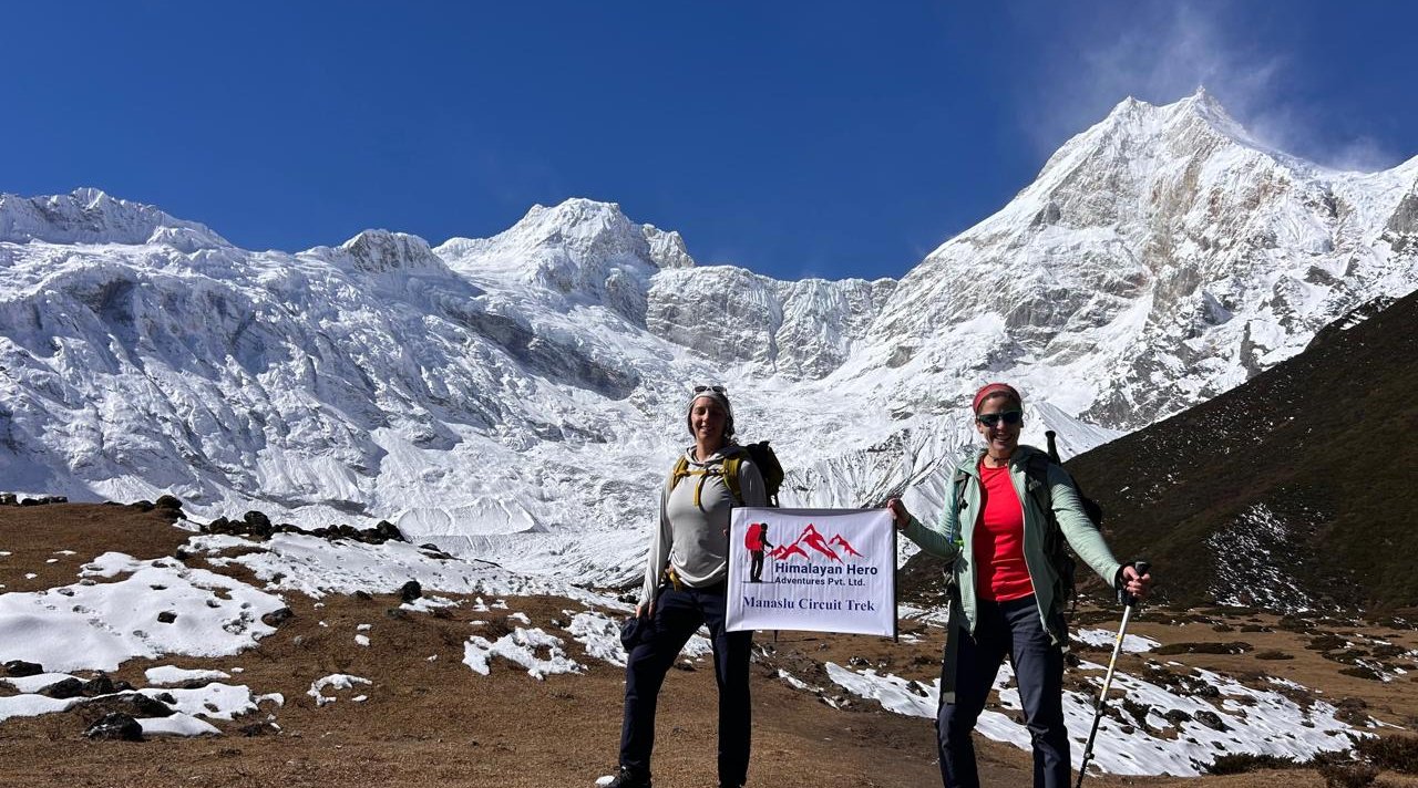
Langtang Valley lies in Nepal’s Rasuwa District, extending northward toward the Tibetan border. It is carved by the Langtang River, fed by glaciers descending from peaks like Langtang Lirung (7,227 m), the highest mountain in the region.
The valley’s formation is glacial. Over thousands of years, ice carved a broad U-shaped corridor. Even today, you can see:
- Ancient moraines
- Active glaciers
- Sharp ridgelines
- Wide alpine basins
Unlike the deep, narrow gorges of the Annapurna region or the dramatic verticality of Everest, Langtang feels open. Spacious. Expansive. Almost intimate.
And yet, within this openness lies ecological complexity.
Altitude & Ecological Zonation: A Vertical World
Langtang Valley rises from around 1,400 meters in Syabrubesi to nearly 5,000 meters at Tserko Ri. That vertical climb creates multiple climate zones stacked on top of each other.
Subtropical Zone (1,000–2,000 m)
Lower sections are warm and humid. Terraced fields dominate the landscape. Here you’ll find:
- Rice cultivation (seasonal)
- Millet and maize
- Mixed farming households
Temperate Forest Zone (2,000–3,000 m)
As you climb, forests thicken. Oak, pine, and rhododendron dominate.
In spring, rhododendrons bloom in red and pink waves across the hillsides.
This forest belt is also home to:
- Himalayan black bears
- Langur monkeys
- Barking deer
The biodiversity begins to shift dramatically.
Subalpine & Alpine Zone (3,000–4,500 m)
Trees thin out. Shrubs dominate. Yak pastures appear.
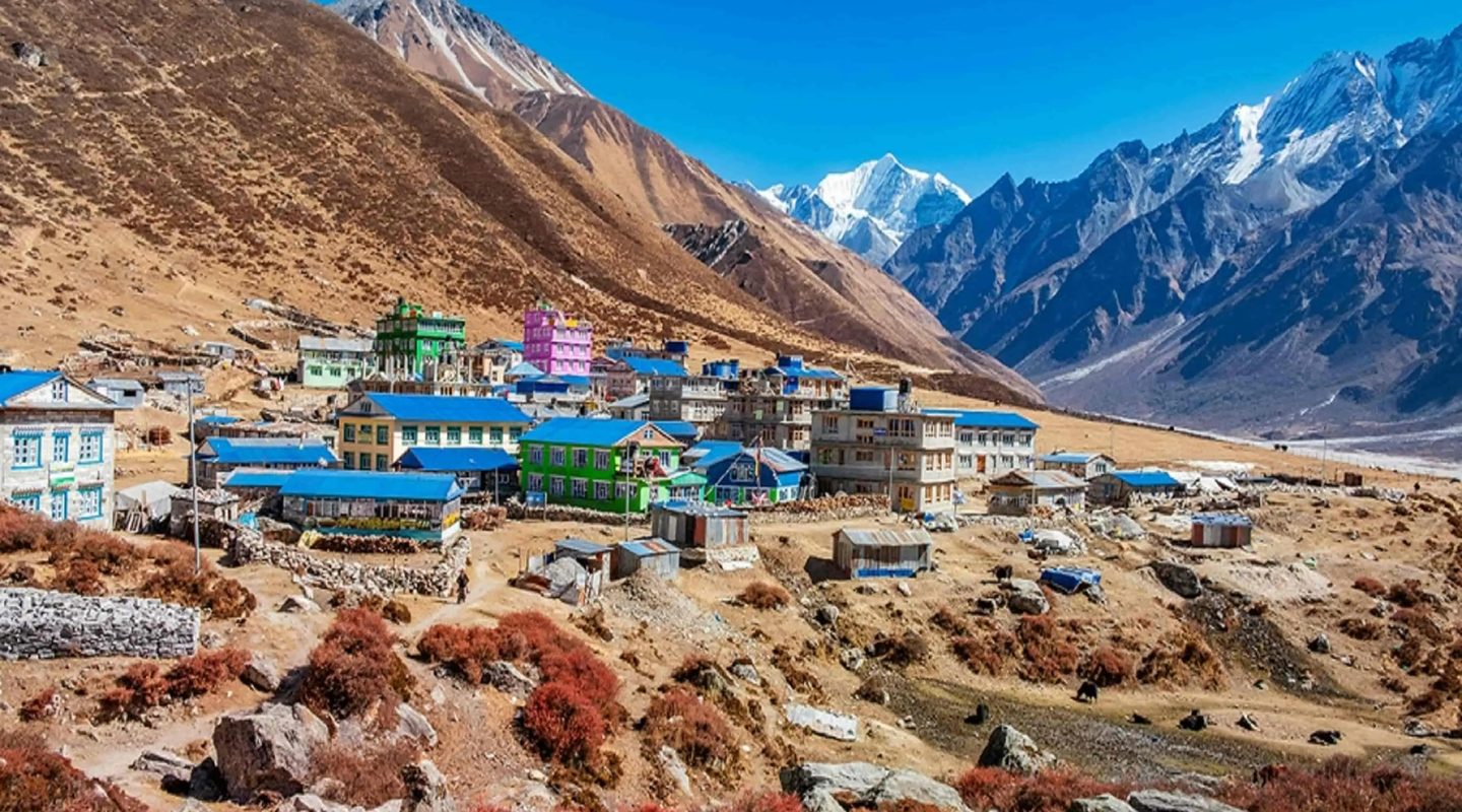
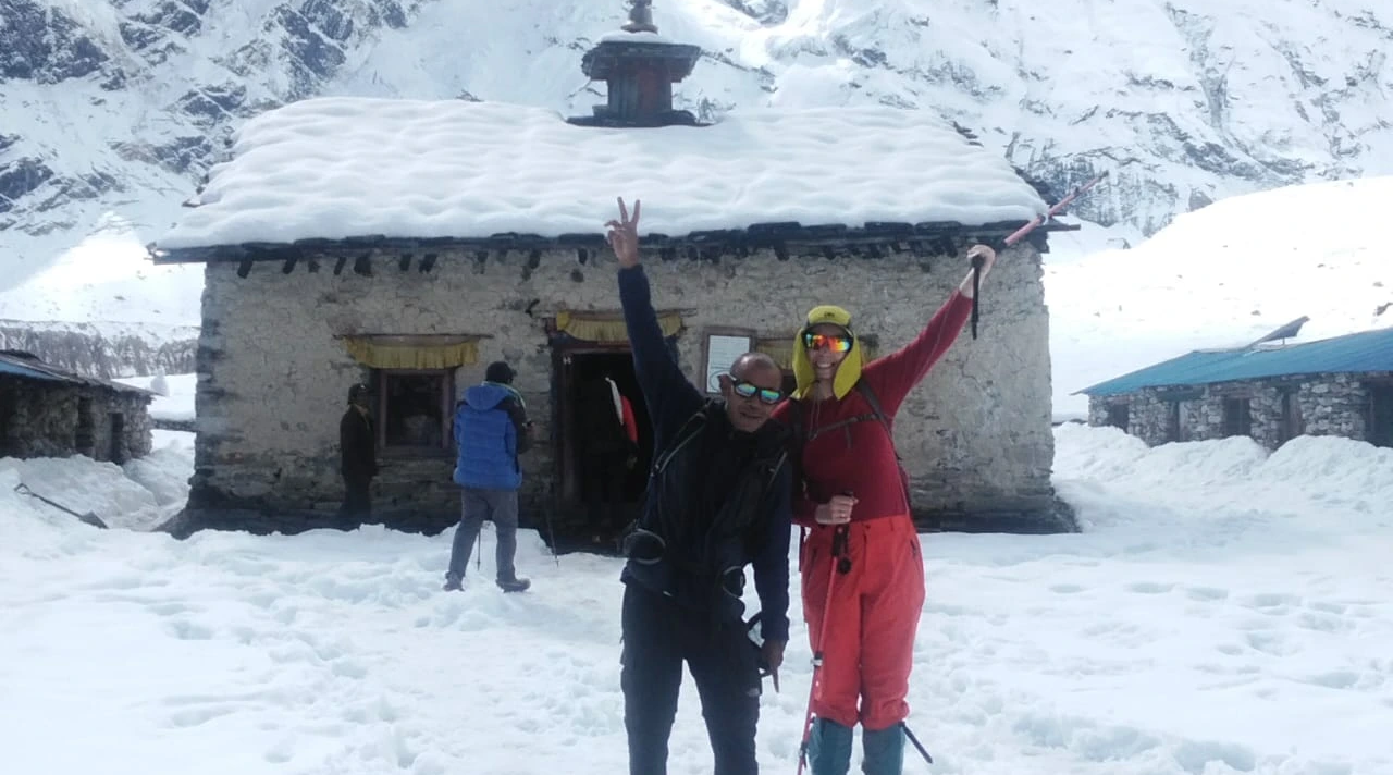
Stone houses cluster in villages like Langtang and Kyanjin.
This is where human settlement adapts to harsh climate. Growing seasons shorten. Winters become long and severe.
Glacial & Nival Zone (4,500 m+)
Above this line, life becomes sparse. Only mosses and lichens survive.
Snowfields and glaciers dominate.
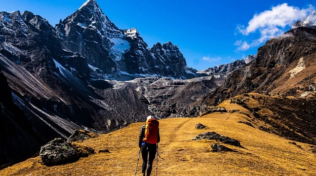
It is here that trekkers hike toward Tserko Ri — one of the best viewpoints in the region.
Climate & Temperature: The Rhythm of the Valley
Understanding Langtang Valley temperature is essential — not only for trekking but for understanding how people live here.
Temperature varies dramatically by season and altitude.
Spring (March–May)
Spring is arguably the most beautiful season.
Daytime temperatures:
- 10–20°C at lower elevations
- 5–15°C above 3,000 m
Night temperatures:
- Near freezing above 3,500 m
Rhododendrons bloom. Wildlife becomes more visible. Skies remain relatively stable.
Autumn (September–November)
Autumn offers the clearest mountain views.
Daytime:
Night:
- -5°C to 3°C at higher villages
This is peak trekking season due to stable weather and low humidity.
Winter (December–February)
Winter transforms Langtang into a snow kingdom.
Day:
- 5–10°C lower valley
- Below freezing above 3,000 m
Night:
- -10°C or colder at Kyanjin
Many lodges close at higher elevations due to heavy snowfall.
Monsoon (June–August)
Monsoon brings heavy rainfall to lower sections.
- 15–25°C daytime
- Wet trails
- Lush green forests
Higher altitudes may receive less rainfall but clouds often block mountain views.
This climate diversity shapes not only trekking seasons but agricultural cycles and daily survival strategies. To make the most of your journey, it’s important to know the best time to visit Langtang Valley, when the weather is clear and the mountains are at their most photogenic.
Wildlife & Biodiversity: A Himalayan Sanctuary
Langtang National Park was established in 1976, making it Nepal’s first Himalayan national park.
It protects ecosystems ranging from subtropical forest to alpine tundra.
Wildlife includes:
- Red panda (rare but present in forest belt)
- Snow leopard (extremely elusive)
- Himalayan tahr
- Musk deer
- Langur monkeys
Birdlife is extraordinary, with over 250 species recorded.
Spring mornings in Langtang forests are filled with bird calls echoing through mist-covered trees.
This biodiversity is not just scenic value — it is ecological wealth.
Cultural Identity: The Tamang Heartland
The people of Langtang are primarily Tamang, an ethnic group with deep Tibetan roots.
Buddhism shapes daily life.
Prayer wheels line the trails. Mani stones carved with sacred mantras sit at village entrances. Monasteries stand quietly above settlements.
One of the most important spiritual sites is Kyanjin Gompa, a monastery that has guided religious life for generations.
Unlike commercialized trekking areas, Langtang still feels deeply rooted in lived tradition.
Festivals like Sonam Lhosar mark the Tamang New Year with music, dance, and ritual.
Language, dress, food, and architecture all reflect Tibetan influence. Staying in local villages offers a chance to immerse yourself in Tamang culture and village life, learning about their festivals, cuisine, and daily routines.
Daily Life in Langtang
Daily life in Langtang is shaped by altitude and season.
Morning begins early.
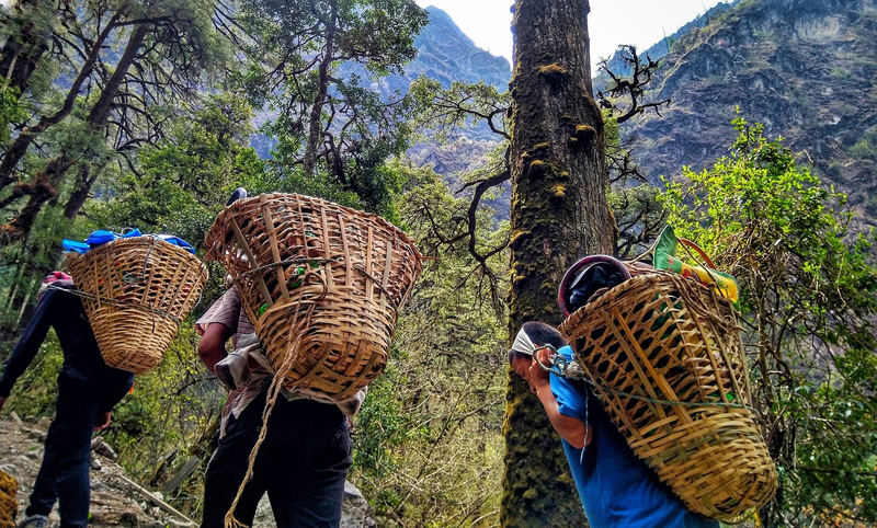
Yak bells ring as herders guide animals toward grazing slopes. Women prepare tea and tsampa (barley flour porridge). Children walk to small local schools rebuilt after 2015.
Farming is seasonal:
- Potatoes are staple crops
- Barley grows in short summers
- Yak milk becomes butter and cheese
Life here is not rushed.
It is practical. Rhythmic. Grounded.
Trekkers passing through glimpse only a few days of this life. But for locals, it is year-round resilience.
Economic Structure: Beyond Tourism
Tourism is critical today — but it was not always so.
Historically, Langtang’s economy relied on:
- Agro-pastoralism
- Trade with Tibet
- Yak herding
In the 1950s, a Swiss-supported cheese factory was introduced in Kyanjin. Yak cheese production remains part of the local economy today.
After the 1970s, trekking increased gradually.
Tea houses became primary income sources.
Today, economic sources include:
- Lodge ownership
- Trekking guides and porters
- Yak dairy products
- Small agriculture
Tourism directly supports recovery and development.
The 2015 Earthquake: A Valley Changed Forever
On April 25, 2015, Nepal was hit by a powerful 7.8 magnitude earthquake. Langtang Valley was one of the worst affected areas. A huge avalanche buried Langtang Village, destroying homes and taking the lives of many families. Trails were blocked, stone houses crumbled, and for months, the valley was silent. Nature had reshaped both the land and the lives of the people.
But the story of Langtang is also one of hope. The villagers slowly returned and rebuilt stronger homes, lodges, and schools. Paths and trails were cleared, and life began to flow again. Today, trekkers can visit the valley, not just for its breathtaking mountains, but to witness the courage and resilience of the community.
For more on how Langtang has recovered and turned into a cautious tourist spot, see this report by Al Jazeera: Nepal village ravaged by 2015 earthquake now a reluctant tourist hotspot.
Langtang Valley Rebuilt: A Story of Resilience
Rebuilding began slowly.
With support from NGOs, the government, and returning trekkers, villages were reconstructed with stronger, earthquake-resistant structures.
Today:
- Tea houses are operational
- Trails are safe
- Communication networks improved
- Schools and health posts were rebuilt
Langtang Valley rebuilt itself not just physically, but socially.
Tourism today supports that resilience.
Why Langtang Matters Today
Langtang is not Everest.
It is quieter. More intimate.
It offers:
- Glacier views
- Cultural immersion
- Biodiversity
- Accessible trekking from Kathmandu
- Deep human story
For Himalayan Hero, positioning Langtang as a living Himalayan ecosystem and cultural region — not just a trek itinerary — builds real authority.
Photography & Visual Landscape Storytelling
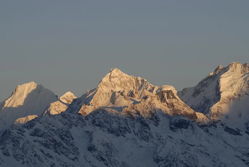
In Langtang Valley, light tells the story.
At sunrise, Langtang Lirung glows gold while the valley below remains wrapped in blue shadow. Prayer flags flutter. Yak bells echo. Frost sparkles on alpine grass.
Langtang is not just photogenic — it is layered.
Within days, your lens captures:
- Dense rhododendron forests
- Glacial rivers cutting through stone
- Tamang villages rebuilt with quiet strength
- Snow ridges stretching into Tibet
The beauty here feels intimate, not overwhelming. Every frame carries silence, resilience, and scale.
Geological Formation: A Valley Carved by Ice
Langtang Valley is a classic U-shaped glacial valley.
Formed by ancient ice flows during the last Ice Age, its wide floor and steep walls reveal the power of moving glaciers. Moraines, exposed rock faces, and glacier-fed rivers are still visible reminders of that force.
The Himalayas continue rising due to tectonic movement between the Indian and Eurasian plates. This means Langtang is geologically active — shaped by both deep time and living Earth processes.
You are walking through a landscape still evolving.
Sustainable Tourism & Conservation
Located inside Langtang National Park, the region balances conservation with community life.
After the 2015 earthquake, villages rebuilt stronger — and more consciously.
Most lodges are family-run. Food is locally sourced. Tourism income supports schools, health posts, and wildlife protection.
But the ecosystem is fragile:
- Glaciers are retreating
- Waste management remains a challenge
- Climate patterns are shifting
Responsible trekking matters here. Sustainability in Langtang is not optional — it is essential.
Future Climate Challenges
Langtang’s glaciers are visibly shrinking.
Warmer winters, unpredictable monsoons, and shifting snowfall patterns are changing both trekking conditions and local farming cycles.
High-altitude regions like Langtang respond faster to global warming than lowlands.
When you trek here, you witness climate change not as theory — but as lived reality.
Trekking Preparation Guide (Quick Essentials)
Langtang is moderate in difficulty but demands respect.
Prepare physically: cardio + leg strength training 6–8 weeks before.
Acclimatize properly: ascend slowly above 3,000 m.
Pack smart: layered clothing, down jacket, waterproof gear.
Permits required: Langtang National Park entry + TIMS card.
Best seasons: Spring (Mar–May) & Autumn (Sep–Nov).
Planning your trek? Check out our detailed Langtang Valley trek itinerary to see day-by-day highlights and elevation tips.
Why Langtang Stays With You
Some treks show you mountains.
Langtang shows you humanity within the mountains.
You remember the rebuilt stone homes.
You remember butter tea shared by a fireplace.
You remember the silence at sunrise above Kyanjin.
It is not just the scenery — it is the resilience.
Long after you leave for Kathmandu, Langtang lingers — in memory, in photographs, and in perspective.
And that is why this valley matters. If you prefer a guided experience, explore our Langtang Valley trek package, which include accommodation, meals, and expert local guides for a hassle-free adventure.
FAQ
1. How difficult is the Langtang Valley Trek?
The Langtang Valley Trek is considered moderate. It reaches nearly 5,000 meters at Tserko Ri, so proper acclimatization is important.
2. What is the best time for the Langtang Valley Trek?
Spring (March–May) and Autumn (September–November) offer clear skies, stable weather, and comfortable temperatures.
3. How cold does Langtang Valley get?
Night temperatures can drop below -10°C in winter, especially near Kyanjin Gompa. Autumn and spring nights are usually between -5°C and 5°C.
4. Is Langtang Valley safe after the earthquake?
Yes. The region has been fully rebuilt with stronger infrastructure since 2015. Trails and lodges are operational and safe.
5. How many days are needed for the Langtang Valley Trek?
The recommended duration is 10 days for proper acclimatization, though a fast 5-day version is possible for experienced trekkers.
6. Do I need permits for the Langtang Valley Trek?
Yes. You need a Langtang National Park entry permit and a TIMS card.
7. What wildlife can be seen in Langtang?
Wildlife includes red panda, Himalayan tahr, langur monkeys, and diverse bird species inside Langtang National Park.
8. How far is Langtang Valley from Kathmandu?
Langtang Valley is about 122 km north of Kathmandu, requiring a 6–8 hour drive to Syabrubesi.