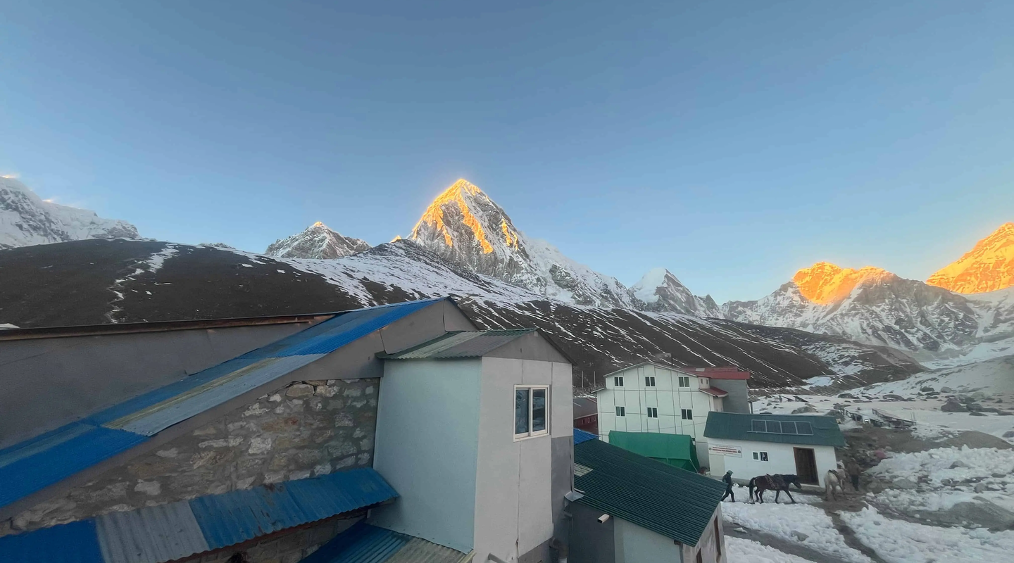
Introduction to Mount Annapurna
Mount Annapurna stands as one of Earth's most remarkable geological formations. Rising dramatically from the subtropical lowlands of central Nepal, this mountain has captivated geographers, climbers, and researchers for over a century.
The name "Annapurna" derives from Sanskrit, meaning "full of food" or "goddess of the harvests." This name reflects the mountain's importance to the agricultural communities living in its shadow.
Have you ever wondered about the majestic Mount Annapurna — how tall it is, where it stands among the world’s highest peaks, and what makes it so special?
In this guide, we’ll answer all the questions people search for most, including:
- What is the height of Annapurna?
- Is Annapurna I the 16th highest mountain?
- How does it compare with other Himalayan giants?
- Interesting facts every trekker and mountain lover should know
Let’s dive in
Key Facts About Mount Annapurna:
- Ranks as the 10th-highest mountain on Earth
- First 8,000-meter peak ever summited (1950)
- Part of the Himalayan mountain system
- Located entirely within Nepal's borders
- Comprises multiple peaks forming a massive horseshoe-shaped massif
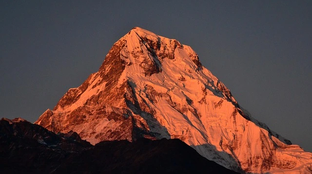
The Annapurna mountain holds significant importance in both mountaineering history and geological studies. French climbers Maurice Herzog and Louis Lachenal reached the summit on June 3, 1950, marking humanity's first successful ascent of any peak exceeding 8,000 meters.
This achievement opened a new era in high-altitude mountaineering. However, the mountain's significance extends far beyond climbing records into the realms of geography, ecology, and cultural heritage.
What is Mount Annapurna?
The Annapurna massif is a group of peaks in the Himalayas of Nepal, famous for its sheer height and dramatic rise above the surrounding landscape.
Among these peaks, Annapurna I is the most prominent and the one most people refer to when they say “Mount Annapurna.”
How Tall is Annapurna? (Height in Meters & Feet)
Official Height of Annapurna I
Annapurna I Main stands at:
8,091 meters (26,545 feet) above sea level.
This makes it one of the world’s tallest mountains — and one of the most dangerous to climb.
Where Is Mount Annapurna Located?
The Annapurna range lies in north-central Nepal, approximately 160 kilometers northwest of the capital city Kathmandu. This positioning places it within the Greater Himalayan range, the highest and most dramatic section of the entire Himalayan mountain system.
Geographically, Mount Annapurna occupies coordinates approximately 28°35'N latitude and 83°49'E longitude. The mountain falls within the Gandaki Province of Nepal, spanning portions of Kaski, Myagdi, and Manang districts.
Geographic Positioning:
- Country: Nepal (entirely within national borders)
- Province: Gandaki Province
- Mountain System: Central Himalayas
- Distance from Kathmandu: ~160 km northwest
- Nearest major city: Pokhara (approximately 50 km south)
The Annapurna massif forms a natural barrier between the Tibetan Plateau to the north and the Nepalese lowlands to the south. This positioning creates one of Earth's most dramatic elevation changes within a short horizontal distance.
The Kali Gandaki River gorge separates Annapurna from its neighboring giant, Dhaulagiri (8,167m). This gorge is considered one of the deepest in the world, with the river flowing at approximately 2,520 meters while peaks on either side exceed 8,000 meters.
Surrounding Geographic Features:
- Kali Gandaki Gorge to the west
- Marshyangdi River valley to the east
- Tibetan Plateau to the north
- Pokhara Valley to the south
Height of Mount Annapurna
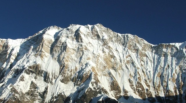
The Annapurna height reaches 8,091 meters (26,545 feet) above sea level at its main summit, known as Annapurna I. This elevation ranks it as the 10th highest mountain on Earth.
The Annapurna mountain height has been measured and verified through multiple surveying methods over the decades. Modern GPS technology and satellite measurements have confirmed the accepted elevation figure.
Elevation Comparisons:
- Annapurna I: 8,091 meters (26,545 feet)
- Mount Everest: 8,849 meters (29,032 feet)
- Difference from Everest: 758 meters shorter
- Ranking among world peaks: 10th highest
The mountain's prominence — the elevation above the surrounding terrain — contributes significantly to its visual impact. From the Pokhara Valley at approximately 800 meters elevation, the Annapurna range rises over 7,200 meters in less than 30 horizontal kilometers.
This dramatic relief creates some of the most spectacular mountain scenery visible from any populated area on Earth. The height differential also produces extreme variations in climate and ecology within a remarkably compact geographic area.
Height Context Within the Annapurna Range:
- Annapurna I: 8,091m (main summit, 10th highest globally)
- Annapurna II: 7,937m (16th highest)
- Annapurna III: 7,555m
- Annapurna IV: 7,525m
- Annapurna South: 7,219m
- Gangapurna: 7,455m
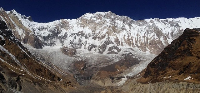
Annapurna Massif and Surrounding Peaks
The Annapurna massif represents a complex mountain formation rather than a single isolated peak. This massive geological structure spans approximately 55 kilometers from east to west, forming an imposing wall of ice and rock.
Understanding the distinction between a "massif" and a single peak is essential for geographical accuracy. A massif is a compact group of connected mountains forming an independent portion of a range.
What Defines a Massif:
- Multiple connected peaks sharing a common base
- Unified geological formation
- Distinct from surrounding terrain
- Often forms a watershed boundary
The Annapurna range peaks include numerous summits exceeding 7,000 meters. Six primary peaks carry the "Annapurna" name, while several additional significant summits comprise the broader massif.
Major Peaks of the Annapurna Massif:
- Annapurna I (8,091m): Main summit, highest point
- Annapurna II (7,937m): Eastern anchor of the massif
- Annapurna III (7,555m): Central peak with dramatic north face
- Annapurna IV (7,525m): Adjacent to Annapurna II
- Annapurna South (7,219m): Southern outlier, highly visible from Pokhara
- Gangapurna (7,455m): Northern section, feeds major glaciers
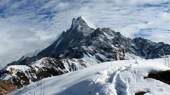
- Machapuchare (6,993m): Sacred "Fish Tail" peak, climbing prohibited
- Hiunchuli (6,441m): Guards the entrance to the Annapurna Sanctuary
The massif's horseshoe shape creates the famous Annapurna Sanctuary — a natural amphitheater enclosed by these towering peaks. This geological formation resulted from millions of years of tectonic uplift and glacial erosion.
Climate and Weather of Mount Annapurna
The Annapurna weather patterns reflect the mountain's position at the intersection of subtropical and alpine climate zones. Understanding these patterns is crucial for geographical and meteorological studies.
The region experiences four distinct seasons, each bringing dramatically different conditions. The Himalayan monsoon system dominates summer months, while winter brings extreme cold and heavy snowfall at higher elevations.
Seasonal Climate Overview:
- Spring (March-May): Warming temperatures, increasing visibility, rhododendron blooms at lower elevations
- Summer/Monsoon (June-September): Heavy precipitation, cloud cover, warmer temperatures, active glacial melt
- Autumn (October-November): Clear skies, excellent visibility, stable conditions, cooler temperatures
- Winter (December-February): Extreme cold, heavy snowfall above 4,000m, limited precipitation at lower elevations
Temperature varies dramatically with elevation. At the summit of Annapurna I (8,091m), temperatures can plunge below -40°C during winter nights. Meanwhile, valleys at 1,000-2,000m enjoy subtropical conditions.
Temperature Ranges by Elevation:
- Valley floors (1,000-2,000m): 15-30°C summer, 5-20°C winter
- Mid-elevations (3,000-4,000m): 5-15°C summer, -10 to 5°C winter
- High alpine (5,000-6,000m): -5 to 10°C summer, -25 to -5°C winter
- Summit zone (7,000-8,000m+): -15 to -5°C summer, -40 to -20°C winter
Precipitation patterns show extreme variation across the massif. The southern slopes receive 3,000-5,000mm annually during monsoon season, while the northern rain-shadow areas may receive less than 500mm.
Key Weather Characteristics:
- Monsoon brings 80% of annual precipitation
- Jet stream winds affect summit conditions year-round
- Thermal winds create daily weather cycles
- Rapid weather changes common due to massive elevation range
Annapurna Sanctuary and Physical Geography
The Annapurna Sanctuary represents one of Earth's most remarkable natural amphitheaters. This glacial basin sits at approximately 4,130 meters elevation, completely enclosed by the towering peaks of the Annapurna massif.
Geologically, the sanctuary formed through millions of years of glacial erosion. Ancient glaciers carved the basin while the surrounding peaks continued their tectonic uplift, creating the dramatic enclosed landscape visible today.
Physical Characteristics:
- Elevation: Approximately 4,130 meters at the basin floor
- Enclosure: Nearly complete ring of peaks exceeding 6,000m
- Access: Single natural entry point through Modi Khola gorge
- Area: Approximately 40 square kilometers
The sanctuary contains significant glacial features that continue shaping the landscape. The Annapurna South Glacier and several smaller ice fields feed the Modi Khola river, which drains the entire basin through a narrow gorge.
Glacial and Geological Features:
- Active glaciers covering approximately 30% of the sanctuary
- Terminal moraines marking historical glacier positions
- Glacial lakes at various stages of formation
- Dramatic U-shaped valley profiles from glacial carving
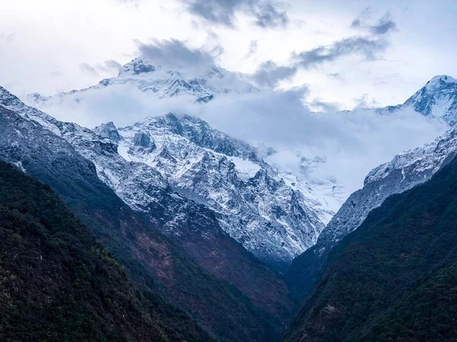
The basin floor supports limited vegetation due to elevation and harsh conditions. However, the approach valleys showcase remarkable biodiversity, transitioning through multiple ecological zones within short distances.
Ecological Zones (South to North):
- Subtropical forest (1,000-2,000m): Sal, rhododendron, bamboo
- Temperate forest (2,000-3,000m): Oak, maple, magnolia
- Subalpine zone (3,000-4,000m): Birch, juniper, alpine shrubs
- Alpine zone (4,000-5,000m): Grasses, mosses, lichens
- Nival zone (5,000m+): Permanent snow and ice, minimal vegetation
Cultural and Environmental Importance
The Annapurna region culture reflects centuries of human adaptation to high-mountain environments. Indigenous communities have developed unique traditions, agricultural practices, and spiritual beliefs shaped by the mountain landscape.
Two primary ethnic groups inhabit the Annapurna region: the Gurung people of the southern slopes and the Manangba (Manang) people of the northern valleys. Each group maintains distinct cultural identities despite shared geographic proximity.
Cultural Characteristics:
- Gurung Communities: Buddhist and Hindu traditions, terraced agriculture, historic Gurkha warrior heritage
- Manangba Communities: Tibetan Buddhist traditions, trade-based economy, unique architectural styles
- Thakali Communities: Kali Gandaki corridor, trade routes, distinctive cuisine
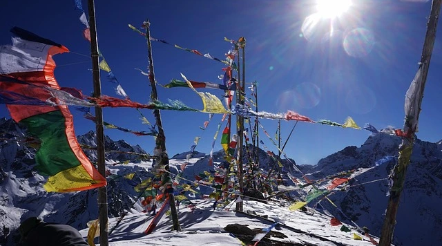
The mountain holds sacred significance in local belief systems. Machapuchare (6,993m), though technically lower than the main Annapurna peaks, is considered the home of the god Shiva. Climbing attempts on Machapuchare have been prohibited since 1964.
Sacred and Cultural Sites:
- Machapuchare (sacred, climbing prohibited)
- Muktinath Temple (Hindu-Buddhist pilgrimage site)
- Numerous Buddhist monasteries and Hindu shrines
- Traditional pilgrimage routes predating modern access
Environmental conservation efforts have established the Annapurna Conservation Area (ACA), the largest protected area in Nepal. Created in 1986, the ACA covers 7,629 square kilometers and pioneered community-based conservation approaches.
Conservation Achievements:
- First conservation area in Nepal (established 1986)
- Largest protected area: 7,629 km²
- Community-managed forests and resources
- Sustainable revenue generation model
- Wildlife protection programs
- Alternative energy initiatives reducing deforestation
The region supports diverse wildlife despite human presence. Snow leopards, Himalayan black bears, musk deer, and numerous bird species inhabit various elevation zones throughout the conservation area.
Why Mount Annapurna Is Considered Dangerous
The Annapurna massif holds a sobering distinction in mountaineering statistics: the highest fatality-to-summit ratio of any 8,000-meter peak. Understanding why requires examining the mountain's unique physical characteristics.
This danger assessment is presented for educational purposes regarding mountain geography and natural hazards — not as climbing guidance.
Natural Hazard Factors:
- Extremely steep terrain with limited safe routes
- Heavy snowfall creating unstable accumulation
- Frequent and unpredictable avalanches
- Severe weather exposure on all approaches
- Complex glaciated terrain with hidden crevasses
The mountain's southern face rises 8,000 meters in just 10 horizontal kilometers — one of the most dramatic vertical reliefs on Earth. This steepness contributes to persistent avalanche danger throughout the climbing season.
Geographic Risk Elements:
- 8,000m vertical rise in 10km horizontal distance
- Massive hanging glaciers prone to collapse
- Steep snow accumulation zones
- Limited shelter from storm systems
- Rapidly changing conditions due to elevation range
Historical analysis shows that approximately 32% of individuals who attempted the summit between 1950 and 2020 did not survive. This statistic reflects the mountain's objective dangers rather than climber error alone.
The geological composition contributes to instability. Sedimentary and metamorphic rock layers, uplifted and fractured during Himalayan formation, create loose terrain susceptible to rockfall and slope failure.
Natural Instability Factors:
- Fractured metamorphic rock formations
- Active seismic zone with regular tremors
- Glacial retreat exposing unstable material
- Permafrost degradation at higher elevations
- Extreme freeze-thaw cycles causing rock fracture
These factors combine to make Annapurna one of Earth's most dynamic and hazardous mountain environments. The information serves researchers studying mountain hazards, geomorphology, and climate impacts on high-altitude terrain.
Mount Annapurna Quick Facts
Geographic Information:
- Official Height: 8,091 meters (26,545 feet)
- Global Rank: 10th highest mountain
- Location: North-central Nepal, Gandaki Province
- Coordinates: 28°35'44"N, 83°49'13"E
- Mountain Range: Himalayas (Central section)
- First Summit: June 3, 1950
Physical Characteristics:
- Massif Length: ~55 kilometers east to west
- Number of Major Peaks: 6 named Annapurna summits
- Prominent Neighbors: Dhaulagiri, Machapuchare
- Primary Rivers: Kali Gandaki, Marshyangdi, Modi Khola
- Glacial Coverage: Extensive, feeding multiple river systems
Conservation and Administration:
- Protected Area: Annapurna Conservation Area (ACA)
- Conservation Area Size: 7,629 km²
- Established: 1986
- Management: National Trust for Nature Conservation
Understanding the Annapurna Region
The Annapurna region encompasses far more than the mountain peaks themselves. This geographic term describes the broader area of approximately 7,629 square kilometers surrounding the massif.
Understanding regional geography provides context for the mountain's ecological and cultural significance. The region spans elevation zones from 790 meters at the lowest point to 8,091 meters at the summit.
Regional Boundaries:
- North: Tibetan Plateau/Mustang
- South: Pokhara Valley/Middle Hills
- East: Marshyangdi River watershed
- West: Kali Gandaki River/Dhaulagiri range
The region contains remarkable geographic diversity within a compact area. From subtropical jungle to permanent ice, nearly every terrestrial biome exists within the Annapurna Conservation Area boundaries.
Ecological Diversity:
- Over 1,200 plant species documented
- 100+ mammal species including snow leopard
- 500+ bird species (significant global biodiversity)
- Multiple climate zones within 50km horizontal distance
- Active geological processes visible in real-time
This diversity makes the Annapurna region invaluable for scientific research across disciplines including geology, ecology, climatology, and anthropology.
Further Reading and Related Topics
For those seeking additional information about the Annapurna region, the following topics provide a deeper exploration of specific aspects:
Geographic Context:
- The Himalayan Mountain System: Formation and Structure
- Nepal's Major River Systems: Kali Gandaki and Marshyangdi
- Glacial Processes in High Mountain Environments
Related Areas:
- Annapurna Base Camp Trek Overview — Geographic route through the sanctuary
- Annapurna Circuit Trek Overview — Complete circumnavigation of the massif
- North Annapurna Circuit — Detailed cartographic resources
- How tall is Mount Annapurna?
Mount Annapurna stands 8,091 meters (26,545 feet) tall, making it the 10th highest mountain on Earth.
- Where is Mount Annapurna located?
Mount Annapurna is located in north-central Nepal, approximately 160 kilometers northwest of Kathmandu in the Gandaki Province.
- What is the Annapurna Sanctuary?
The Annapurna Sanctuary is a natural glacial amphitheater at approximately 4,130 meters elevation, enclosed by the peaks of the Annapurna massif.
- Why is Mount Annapurna considered dangerous?
Annapurna has the highest fatality rate of any 8,000-meter peak due to steep terrain, frequent avalanches, severe weather, and unstable geological conditions.
- What is the weather like at Annapurna?
Annapurna experiences four distinct seasons with monsoon rains June-September, clear conditions October-November, cold winters December-February, and warming spring March-May.
- How many peaks are in the Annapurna massif? The Annapurna massif contains six named Annapurna peaks plus additional significant summits including Gangapurna, Machapuchare, and Hiunchuli.
Is Annapurna part of Everest region?
No — Annapurna is in the Gandaki Province of Nepal, separate from the Everest region.
Is Annapurna taller than Kanchenjunga?
No — Kanchenjunga is the 3rd highest mountain in the world (8,586m), while Annapurna I is 16th (8,091m)
Can normal trekkers see Annapurna?
Absolutely! Trekking routes like Annapurna Circuit and Annapurna Base Camp offer spectacular views of the mighty Annapurna peaks.