Introduction
The Langtang Gosaikunda trek itinerary combines two of Nepal's most rewarding Himalayan experiences into a single unforgettable journey. This 12-day route takes you through the glacier-carved Langtang Valley, past ancient Buddhist monasteries, and up to the sacred waters of Gosaikunda Lake at 4,460 meters.
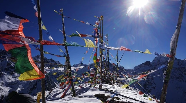
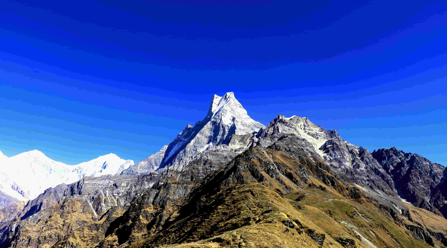
What makes this combined trek exceptional is its diversity. You'll walk through dense bamboo forests, cross suspension bridges over rushing rivers, and witness panoramic views of snow-capped peaks, including Langtang Lirung (7,234m) and Ganesh Himal (7,422m). The route also immerses you in authentic Tamang culture, visiting traditional stone villages where prayer flags flutter against dramatic mountain backdrops.
This Gosaikunda trek itinerary is particularly appealing because it avoids the crowded trails of the Everest and Annapurna regions while offering equally stunning scenery. Located just north of Kathmandu in Rasuwa District, the Langtang National Park region remains one of Nepal's best-kept trekking secrets.
Key highlights of this itinerary:
- Trek through the "Valley of Glaciers" to Kyanjin Gompa
- Visit the sacred Gosaikunda Lake, revered by Hindu and Buddhist pilgrims
- Experience genuine Tamang hospitality in traditional mountain villages
- Enjoy panoramic Himalayan views from multiple viewpoints
- Explore ancient monasteries and the famous Kyanjin cheese factory
Trek Overview: Langtang Gosaikunda Trek Itinerary
Before diving into the day-by-day details, here’s a quick overview of the Langtang Gosaikunda trek itinerary.
Key Trek Details
- Total Duration: 12 days
(10 trekking days and 2 driving days)
- Region: Langtang National Park, Rasuwa District
- Maximum Altitude: 4,460 meters
(Gosaikunda Lake)
- Starting Point: Syabrubesi (1,550m)
- Ending Point: Dhunche
(Drive back to Kathmandu)
- Total Trekking Distance: Approximately 95–100 km
- Difficulty Level: Moderate to moderately challenging
Who Is This Itinerary Suitable For?
This route suits trekkers with reasonable fitness who can walk 4-7 hours daily on mountain trails. You don't need previous high-altitude experience, but basic trekking stamina is essential.
This itinerary works well for:
- First-time Himalayan trekkers seeking a comprehensive experience
- Trekkers wanting cultural immersion alongside mountain scenery
- Those with 12 days available who prefer less crowded trails
- Photographers interested in diverse landscapes and cultural subjects
- Spiritual travelers drawn to sacred pilgrimage sites
The dedicated acclimatization day at Kyanjin Gompa (Day 5) makes this route safer and more enjoyable than rushed alternatives.
Detailed Day-by-Day Itinerary
The following Gosaikunda trek itinerary breaks down each day's journey with elevation details, walking hours, and highlights. This route follows the standard circuit operated by experienced trekking companies in Nepal.
Day 01: Kathmandu to Syabrubesi (1,550m)
Driving Time: 7-8 hours
Mode: Private vehicle or local bus
Terrain: Paved highway transitioning to winding mountain roads
Your trek begins with a scenic drive from Kathmandu, following the Trishuli Highway northwest toward the Tibetan border region. The journey takes you through terraced hillsides, past riverside settlements, and into increasingly dramatic mountain landscapes.
The road climbs steadily after Dhunche (the district headquarters), offering your first glimpses of snow-capped peaks in the distance. Syabrubesi sits at the confluence of the Langtang Khola and Bhote Koshi rivers, serving as the traditional gateway to Langtang National Park.
What to expect today:
- Early morning departure from Kathmandu (typically 6-7 AM)
- Lunch stop at Trishuli Bazaar or Dhunche
- Arrival in Syabrubesi by late afternoon
- First night in a teahouse lodge with mountain views
- Opportunity to explore the small Tamang village before dinner
Syabrubesi's teahouses offer basic but comfortable accommodation with attached or shared bathrooms. This is your last chance to stock up on snacks or forgotten supplies before heading into the valley.
Day 02: Syabrubesi to Lama Hotel (2,450m)
Trekking Time: 6-7 hours
Elevation Gain: 900 meters
Trail Type: Riverside path through dense forest
Day two marks your first full trekking day, and it's a beautiful introduction to the Langtang region. The trail initially descends to cross the Bhote Koshi River via suspension bridge, then begins a gradual ascent through the narrow river valley.
You'll walk through stunning temperate forests of oak, hemlock, and rhododendron, with the Langtang Khola rushing below. The trail passes through small settlements including Bamboo and Rimche, where you can stop for tea at simple trailside lodges.
Trail highlights:
- Cross multiple suspension bridges over rushing mountain streams
- Trek through diverse forest zones with excellent bird-watching opportunities
- Spot langur monkeys in the forest canopy
- Pass traditional Tamang homes with carved wooden windows
- Arrive at Lama Hotel, a collection of teahouses in a forest clearing
The name "Lama Hotel" doesn't refer to a single establishment but rather a cluster of lodges that developed as a rest stop for porters and trekkers. It's a peaceful spot surrounded by towering trees, and you may hear red pandas in the nearby bamboo groves at night.
Day 03: Lama Hotel to Langtang Village (3,430m)
Trekking Time: 4-5 hours
Elevation Gain: 980 meters
Trail Type: Gradual ascent through changing vegetation zones
This shorter day allows your body to adjust to increasing altitude while introducing some of the trek's most memorable scenery. The trail continues ascending through rhododendron and birch forests before emerging into the open Langtang Valley.
You'll pass Ghoda Tabela (the former Nepali Army checkpoint) and notice the landscape transitioning from dense forest to alpine meadows. The valley widens dramatically, revealing stunning views of Langtang Lirung and surrounding peaks.
Cultural and natural highlights:
- Observe the forest transition from rhododendron to birch and juniper
- See the memorial stones commemorating the 2015 earthquake victims
- Enter the rebuilt Langtang Village with its traditional stone houses
- Enjoy your first unobstructed views of Langtang Lirung (7,234m)
- Experience warm Tamang hospitality in the valley's main settlement
Langtang Village was tragically buried by a massive landslide triggered by the 2015 earthquake. The community has since rebuilt higher up the slope, and the memorial site serves as a poignant reminder of the mountain's power. Today's village continues its centuries-old traditions of yak herding and Buddhist practice.
Day 04: Langtang Village to Kyanjin Gompa (3,870m)
Trekking Time: 2-3 hours
Elevation Gain: 440 meters
Trail Type: Easy walk through open yak pastures
This deliberately short day prioritizes acclimatization over distance. The gentle morning trek follows the valley floor through wide yak pastures dotted with stone walls and prayer flags. The surrounding peaks seem close enough to touch.
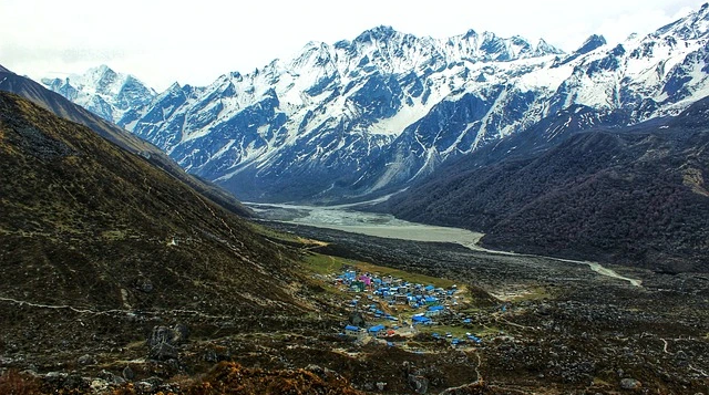
Kyanjin Gompa is the largest settlement in the upper valley and the trek's highest overnight point. The village centers around an ancient Buddhist monastery and the famous cheese factory established with Swiss assistance in the 1950s.
What you'll discover at Kyanjin Gompa:
- Visit the centuries-old Kyanjin Gompa monastery
- Sample yak cheese and curd at the local dairy
- Explore the collection of mani walls and prayer wheels
- Acclimatize with gentle walks around the valley floor
- Enjoy spectacular sunset views over the surrounding peaks
The afternoon is intentionally free for rest and gentle exploration. Walking slowly around the village helps your body adjust to the altitude before tomorrow's acclimatization hikes.
Day 05: Acclimatization Day at Kyanjin Gompa
Options: Kyanjin Ri (4,773m) or Tserko Ri (4,984m)
Time: 3-6 hours, depending on the chosen hike
Purpose: High-altitude adaptation and panoramic views
This crucial rest day isn't about resting in bed. The "climb high, sleep low" principle means you should hike to higher elevations during the day, then return to Kyanjin Gompa for overnight recovery.
Two excellent viewpoint options await you. Kyanjin Ri (4,773m) takes approximately 2-3 hours round trip and offers stunning valley views. The more ambitious Tserko Ri (4,984m) requires 5-6 hours but rewards you with one of Nepal's finest 360-degree Himalayan panoramas.
Why this acclimatization day matters:
- Allows your body to produce more red blood cells for oxygen transport
- Reduces the risk of Acute Mountain Sickness (AMS) on higher sections
- Provides buffer time in case of weather delays
- Offers optional hikes to spectacular viewpoints
- Prepares you physically for the Gosaikunda section ahead
From Tserko Ri's summit, you can see Langtang Lirung, Dorje Lakpa, Gangchenpo, and on clear days, even the distant peaks of Tibet. This is often the visual highlight of the entire trek.
Altitude awareness tips:
- Start hiking early when the weather is clearest
- Drink at least 3-4 liters of water throughout the day
- Ascend slowly, taking regular breaks
- Turn back immediately if experiencing severe headache, nausea, or confusion
- Eat well at dinner, even ifyour appetite is reduced
Day 06: Kyanjin Gompa to Lama Hotel
Trekking Time: 6 hours
Elevation Loss: 1,420 meters
Trail Type: Descent retracing the ascent route
Now well-acclimatized, you begin the long descent back through the Langtang Valley. Walking the same trail in reverse offers surprisingly different perspectives, with views you missed while climbing now clearly visible.
The descent is straightforward but requires attention on steep sections, especially if trails are wet. Your knees will work harder than your lungs today, so trekking poles are particularly useful.
Descent day considerations:
- Start early to arrive at Lama Hotel with afternoon daylight
- Take breaks to enjoy valley views from new angles
- Protect your knees by stepping carefully on rocky sections
- Stop at Langtang Village for a final look at the memorial site
- Arrive at Lama Hotel refreshed for tomorrow's divergence to Gosaikunda
The familiar teahouse at Lama Hotel welcomes returning trekkers with hot meals and comfortable beds at a more oxygen-rich altitude.
Day 07: Lama Hotel to Thulo Syabru (2,230m)
Trekking Time: 6-7 hours
Elevation Change: Initial descent, then climb
Trail Type: Forest trails with village sections
Today marks the transition from the Langtang Valley circuit to the Gosaikunda pilgrimage route. Rather than returning to Syabrubesi, you branch west toward Thulo Syabru, a traditional Tamang village perched on a hillside overlooking multiple valleys.
The trail descends through forest before climbing to Thulo Syabru, offering completely new scenery after retracing yesterday's path. The village's narrow stone lanes and traditional architecture provide a glimpse into pre-modern Himalayan life.
Day seven highlights:
- Leave the Langtang Valley via a different route
- Trek through mixed forests with rhododendron groves
- Arrive at a traditional Tamang village with authentic character
- Enjoy village exploration and local interactions
- Prepare mentally for tomorrow's climb toward Gosaikunda
Thulo Syabru sees fewer trekkers than the main Langtang route, and its teahouses offer a more intimate atmosphere. Evening brings spectacular views of Ganesh Himal glowing in sunset light.
Day 08: Thulo Syabru to Sing Gompa (3,330m)
Trekking Time: 3-4 hours
Elevation Gain: 1,100 meters
Trail Type: Steady forest climb
This shorter but steeper day takes you through some of the trek's most beautiful forest sections. The trail climbs through dense rhododendron forest that explodes with red, pink, and white blooms during spring months (March-May).
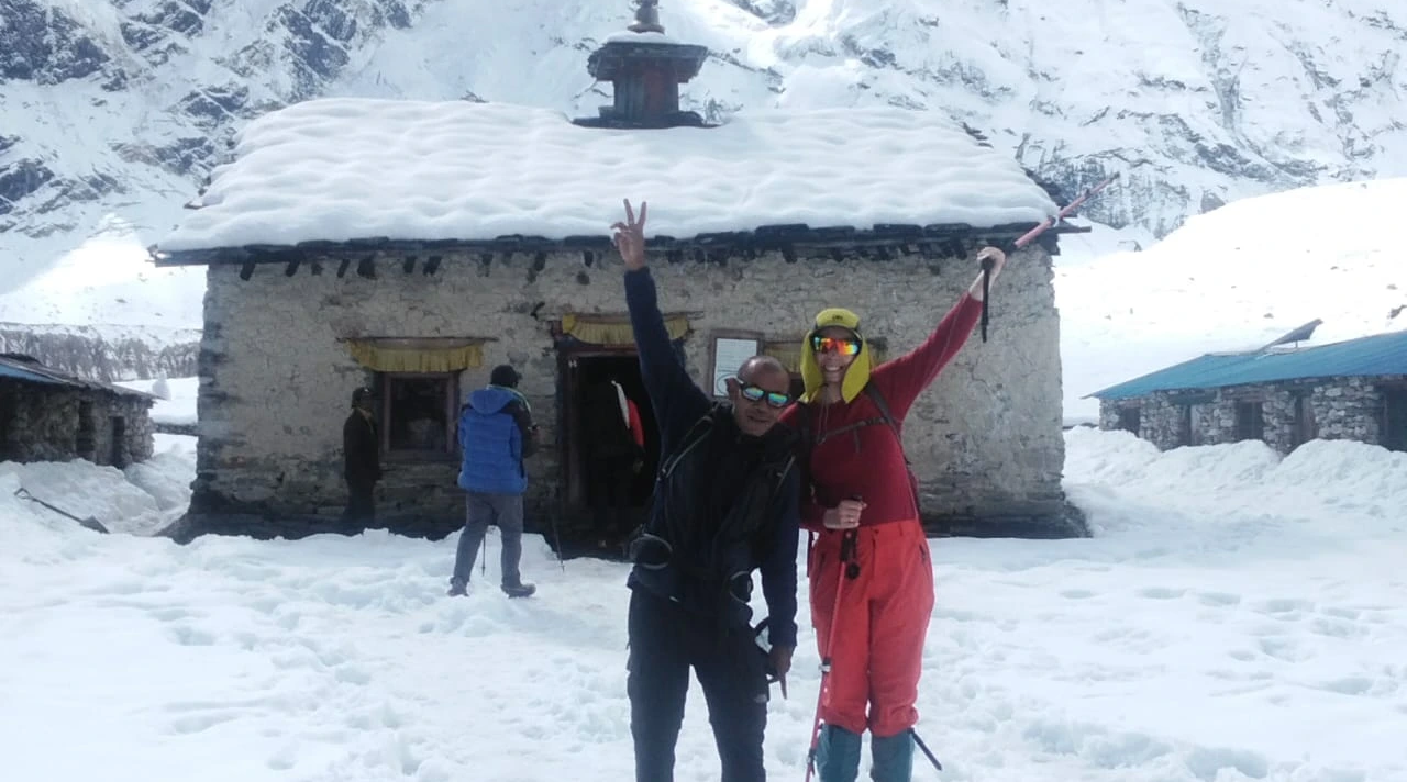
Sing Gompa (also called Chandanbari) is a small monastery settlement with basic but welcoming teahouses. The gompa itself houses ancient Buddhist artifacts and offers a peaceful atmosphere before the challenging climb ahead.
Forest and monastery highlights:
- Trek through one of Nepal's finest rhododendron forests
- Spot various bird species, including the Himalayan monal
- Visit the ancient Sing Gompa monastery
- Enjoythe views opening up as you gain altitude
- Rest well before tomorrow's push to Gosaikunda
The teahouses at Sing Gompa are more basic than lower elevation lodges, but the peaceful setting and mountain views compensate for simpler facilities.
Day 09: Sing Gompa to Gosaikunda Lake (4,460m)
Trekking Time: 4-6 hours
Elevation Gain: 1,130 meters
Trail Type: Steep climb through alpine terrain to a sacred lake
Today brings the trek's highest point and its spiritual climax. The trail climbs steeply above treeline into alpine terrain, passing Cholangpati viewpoint and Laurebinayak before reaching the sacred Gosaikunda Lake.
Gosaikunda holds deep religious significance for both Hindu and Buddhist pilgrims. According to legend, Lord Shiva created the lake by striking the mountain with his trident to obtain water after consuming poison that threatened to destroy the world. Thousands of pilgrims visit during the Janai Purnima festival each August.
Sacred lake experience:
- Climb through alpine meadows above treeline
- Stop at Laurebinayak (3,910m) for mountain views
- Arrive at the sacred Gosaikunda Lake (4,460m)
- Explore the multiple lakes in the Gosaikunda basin
- Witness the spiritual atmosphere of this pilgrimage site
- Overnight at basic teahouses beside the turquoise waters
The lake's turquoise waters reflect surrounding peaks, creating photographic opportunities throughout the day. Despite the altitude, the spiritual energy and natural beauty make this a memorable overnight location.
High altitude reminders:
- Drink plenty of water despite cooler temperatures
- Eat carbohydrate-rich meals even if appetite is reduced
- Report any AMS symptoms to your guide immediately
- Sleep with your head slightly elevated
- Expect cold nighttime temperatures (warm sleeping bag essential)
Day 10: Gosaikunda to Sing Gompa / Chandanbari (3,330m)
Trekking Time: 4-5 hours
Elevation Loss: 1,130 meters
Trail Type: Descent retracing yesterday's route
With Gosaikunda's heights conquered, you retrace the route back to Sing Gompa. The descent offers new perspectives on the alpine landscape and a welcome return to more oxygen-rich air.
Many trekkers find the descent more enjoyable, with energy levels higher and views stretching across multiple mountain ranges. Take time to appreciate details you may have missed during yesterday's focused climb.
Descent day features:
- Enjoy morning views over Gosaikunda's sacred waters
- Descend through alpine and subalpine vegetation zones
- Return to the rhododendron forest near Sing Gompa
- Afternoon rest and reflection on the pilgrimage experience
- Final night in the forest monastery settlement
The return to Sing Gompa's comfortable altitude allows for a good night's sleep before the final trekking days.
Day 11: Sing Gompa to Dhunche (1,960m)
Trekking Time: 6 hours
Elevation Loss: 1,370 meters
Trail Type: Long forest descent to road head
Your final full trekking day descends through beautiful forest to Dhunche, the administrative center of Rasuwa District. The trail winds down through rhododendron, oak, and pine forests, occasionally opening to valley views.
Dhunche marks your return to road access and more substantial facilities. The town offers shops, restaurants, and comfortable lodges for your last night on the trail.
Final trek day moments:
- Walk through diverse forest zones one last time
- Enjoy glimpses of Ganesh Himal through the trees
- Arrive in Dhunche by early afternoon
- Celebrate trek completion with your guide and porters
- Rest in a comfortable lodge with hot shower facilities
Many trekkers feel bittersweet on this day, sad to leave the mountains but satisfied with their accomplishment. Dhunche's teahouses often host celebration dinners for completing groups.
Day 12: Dhunche to Kathmandu
Driving Time: 5-6 hours
Mode: Private vehicle or local bus
Route: Mountain roads to Trishuli Highway to Kathmandu
The final day returns you to Kathmandu via the winding mountain road. The drive offers last views of the Himalayan foothills before descending to the Kathmandu Valley.
Journey home highlights:
- Morning departure from Dhunche after breakfast
- Scenic drive through Rasuwa District landscapes
- Lunch stop possible at Trishuli Bazaar
- Arrival in Kathmandu by afternoon
- Trek completion and time for rest or exploration
Back in Kathmandu, you'll have time to relax, shop for souvenirs, or begin planning your next Himalayan adventure.
Acclimatization and Altitude Considerations
Proper acclimatization separates enjoyable treks from miserable ones. This Langtang Gosaikunda trek itinerary includes built-in altitude adjustment time, but understanding the process helps you trek safely.
Why Day 5 Is Critical
The rest day at Kyanjin Gompa (3,870m) serves multiple purposes beyond physical recovery. At this altitude, your body works to produce additional red blood cells and adjust breathing patterns. The optional high hikes to Kyanjin Ri or Tserko Ri follow the "climb high, sleep low" principle that promotes healthy adaptation.
Skipping or shortening this day significantly increases altitude sickness risk for the Gosaikunda section ahead.
Altitude sickness prevention strategies:
- Ascend gradually following the itinerary's built-in pace
- Stay well-hydrated (3-4 liters daily at high altitude)
- Avoid alcohol and sleeping pills during the trek
- Eat regular carbohydrate-rich meals even if appetite decreases
- Communicate any symptoms to your guide immediately
Recognizing AMS Symptoms
Mild altitude sickness (headache, fatigue, mild nausea) affects most trekkers above 3,000m and usually passes. Severe symptoms (confusion, severe headache, difficulty breathing at rest, loss of coordination) require immediate descent.
Your guide monitors group members for altitude issues and makes decisions about pace and rest days accordingly.
Trek Route Highlights
This combined route showcases the best of Nepal's Langtang region across diverse landscapes and cultural experiences.
Langtang Valley Section
The Langtang Valley, sometimes called the "Valley of Glaciers," offers classic Himalayan trekking through ancient forests to high alpine terrain. Key highlights include:
- Dense rhododendron and bamboo forests teeming with wildlife
- Traditional Tamang villages with centuries-old Buddhist culture
- The reconstructed Langtang Village and earthquake memorial
- Kyanjin Gompa monastery and yak cheese factory
- Panoramic views of Langtang Lirung, Gangchenpo, and Dorje Lakpa
Gosaikunda Basin
The pilgrimage route to Gosaikunda adds spiritual dimension to the physical trek. This section features:
- Sing Gompa monastery in pristine rhododendron forest
- Alpine meadows above treeline with mountain panoramas
- The sacred Gosaikunda Lake and surrounding smaller lakes
- Rich religious history connecting Hindu and Buddhist traditions
- Some of the trek's highest and most dramatic scenery
Wildlife Possibilities
Langtang National Park protects diverse Himalayan wildlife. While sightings aren't guaranteed, the region hosts red pandas, Himalayan tahr, musk deer, and various pheasant species including the colorful Himalayan monal (Nepal's national bird).
For comprehensive details on this route including logistics and preparation, see the complete Langtang Gosaikunda Lake Trek guide.
Best Time to Follow This Itinerary
Weather significantly impacts trekking enjoyment and safety in the Himalayan region. This itinerary works best during Nepal's two main trekking seasons.
Autumn (September - November)
Autumn offers the clearest skies and most stable weather. Post-monsoon conditions mean dry trails, excellent visibility, and comfortable temperatures. October and November are peak months with the best mountain views.
Autumn conditions:
- Daytime temperatures: 10-20C at lower elevations, 0-10C at high points
- Clear skies and excellent visibility for photography
- Dry trails with minimal rain
- Peak season means busier trails and lodges
Spring (March - May)
Spring brings warmer temperatures and spectacular rhododendron blooms throughout the forest sections. March can still see occasional snow at high elevations, while May warms considerably.
Spring conditions:
- Daytime temperatures: 15-25C at lower elevations, 5-15C at high points
- Rhododendrons blooming in magnificent displays (March-April)
- Slightly hazier views than autumn but still impressive
- Fewer trekkers than peak autumn season
Winter and monsoon treks are possible but present additional challenges including cold temperatures, snow, rain, and potential trail closures.
Difficulty Level Assessment
This itinerary rates as moderate to moderately challenging, suitable for fit beginners with proper preparation.
Physical Demands
Most days involve 4-7 hours of walking on mountain trails. The terrain varies from well-maintained paths to rocky sections requiring careful footing. Elevation gains and losses range from 400m to 1,100m daily.
Fitness requirements:
- Ability to walk 5-7 hours daily for consecutive days
- Comfort with steep ascents and descents
- Cardiovascular fitness for moderate exertion at altitude
- No technical climbing skills required
Challenging Sections
Day 2 (a long initial trekking day), Day 7 (a lengthy transition day), and Day 9 (a climb to Gosaikunda) present the itinerary's most demanding sections. The rest day at Kyanjin Gompa provides crucial recovery before the ascent to Gosaikunda.
Recommended Preparation
Building basic fitness through walking, hiking, and stair climbing for 2-3 months before departure significantly improves trek enjoyment. Practice walking 4-5 hours continuously with a daypack to simulate trail conditions.
For those seeking a guided Langtang Gosaikunda trek with experienced local support, professional arrangements handle logistics while you focus on the experience.
Conclusion
The Langtang Gosaikunda trek itinerary offers one of Nepal's most rewarding 12-day mountain experiences. From the glacier-carved Langtang Valley to the sacred waters of Gosaikunda Lake, this route combines Himalayan grandeur with authentic cultural immersion.
The well-paced schedule includes proper acclimatization time, diverse daily experiences, and logical progression through increasingly dramatic scenery. Whether you're drawn by mountain photography, Buddhist heritage, Hindu pilgrimage traditions, or simply the joy of walking through one of Earth's most spectacular landscapes, this itinerary delivers.
With proper preparation and respect for altitude, trekkers of reasonable fitness can safely complete this route and return home with memories that last a lifetime. The Tamang people of the Langtang region welcome visitors with genuine warmth, and their ancient culture adds depth to every day on the trail.
HimalayanHero Adventures has guided trekkers through this region for years, and our local knowledge ensures safe, enriching journeys through these remarkable mountains. The Langtang Gosaikunda route remains one of our most recommended treks for those seeking an authentic Himalayan adventure away from the most crowded trails.
Frequently Asked Questions
How many days is the Langtang Gosainkunda trek?
This itinerary covers 12 days total, including 10 trekking days and 2 driving days between Kathmandu and the trailheads.
What is the highest point on this itinerary?
Gosaikunda Lake at 4,460m (14,632 ft) is the highest overnight point. Optional day hikes from Kyanjin Gompa can reach Tserko Ri at 4,984m.
Do I need previous trekking experience?
No previous Himalayan experience is required, but basic hiking fitness and the ability to walk 5-7 hours daily is essential.
What permits are required?
Trekkers need a Langtang National Park entry permit and TIMS (Trekkers' Information Management System) card. Your trekking company typically arranges these.
Is this trek suitable for beginners?
Yes, with proper fitness preparation. The moderate difficulty and built-in acclimatization day make it accessible to first-time Himalayan trekkers.