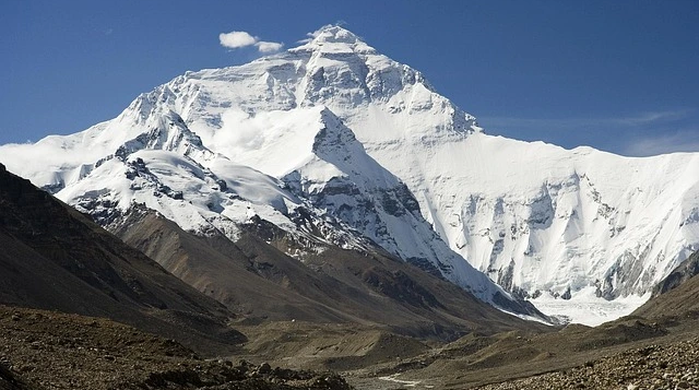
Standing sentinel at 8,848.86 meters (29,031.7 feet) above sea level, Mount Everest represents humanity's ultimate vertical frontier. Known in Nepal as Sagarmatha—meaning "Goddess of the Sky"—and in Tibet as Chomolungma—"Goddess Mother of the World"—this magnificent peak has captivated explorers, scientists, and dreamers for over a century.
Straddling the border between Nepal and the Tibet Autonomous Region of China, Mount Everest holds the undisputed title as Earth's highest mountain. On May 29, 1953, New Zealand mountaineer Edmund Hillary and Sherpa Tenzing Norgay etched their names into history by becoming the first confirmed climbers to reach the summit, marking the beginning of a new era in mountaineering.
Key Mount Everest Facts:
- Official height: 8,848.86 meters (29,031.7 feet) - jointly announced by Nepal and China in 2020
- Ranks as Earth's highest mountain above sea level
- Location: Nepal-Tibet (China) border in the Himalayas
- First ascent: May 29, 1953, by Edmund Hillary and Tenzing Norgay
- Total summits: Approximately 13,000 successful ascents by roughly 7,200 different climbers as of 2024
- Main climbing routes: Southeast Ridge (Nepal) and North Ridge (Tibet)
- Nepali name: Sagarmatha ("Goddess of the Sky")
- Tibetan name: Chomolungma ("Goddess Mother of the World")
The mountain continues to draw hundreds of climbers annually during the prime Everest climbing season, while thousands more trek to its base camps to witness this geological wonder firsthand.
Where Is Mount Everest Located?
Mount Everest occupies a unique geographical position at precisely 27°59'N latitude and 86°56'E longitude. This placement situates the peak directly on the international border between Nepal to the south and the Tibet Autonomous Region of China to the north, making it one of the few major Himalayan peaks shared between two nations.
The mountain lies within the Mahalangur Himal sub-range of the Greater Himalayas, approximately 160 kilometers northeast of Kathmandu, Nepal's capital city. This positioning places Everest in a remote region that remains challenging to access despite modern infrastructure improvements.
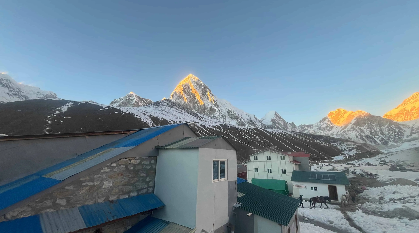
On the Nepali side, Mount Everest forms the centerpiece of Sagarmatha National Park, a UNESCO World Heritage Site designated in 1979. This protected area spans 1,148 square kilometers and encompasses the traditional homeland of the Sherpa people in the Khumbu region.
To the north, the Tibetan side falls within the Qomolangma National Nature Reserve, China's counterpart conservation area. The dual-country ownership creates interesting administrative and cultural dynamics, with both nations maintaining their own permit systems, base camps, and climbing regulations.
The surrounding landscape features some of the world's other highest peaks, including Lhotse (8,516m), Nuptse (7,861m), and Changtse (7,543m), creating a concentration of extreme elevations unmatched anywhere else on the planet.
Height of Mount Everest
Mount Everest reaches an official elevation of 8,848.86 meters (29,031.7 feet) above sea level—a measurement jointly announced by Nepal and China in December 2020 after years of collaborative surveying efforts. This figure represents the most accurate determination of Everest's height to date, utilizing advanced GPS technology, precise geodetic measurements, and sophisticated satellite imaging.
The 2020 measurement resolved decades of uncertainty regarding Everest's exact elevation. Historical measurements varied due to different survey methodologies: the British Survey of India established 29,002 feet in 1856, China's 1975 survey calculated 8,848.13 meters, while Nepal's 1954 survey determined 8,848 meters.
This makes Mount Everest significantly taller than its closest competitors among the world's highest mountains. K2, the second-highest peak at 8,611 meters, stands 238 meters shorter. Kangchenjunga, the third highest at 8,586 meters, falls 263 meters below Everest's summit.
The mountain continues to grow due to ongoing tectonic activity. The collision between the Indian and Eurasian continental plates, which formed the Himalayas 40-50 million years ago, continues today. Geological surveys indicate Everest rises approximately 4 millimeters annually—a testament to the dynamic nature of our planet's geology.
The extreme altitude creates distinct environmental zones. Climbers experience progressively harsher conditions as elevation increases. The base camp at approximately 5,364 meters already sits higher than any mountain in the Alps. The infamous "death zone" above 8,000 meters represents an environment fundamentally hostile to human life, where atmospheric pressure drops to roughly one-third of sea level.
Climate and Weather of Mount Everest
Mount Everest's climate represents one of the planet's most extreme weather environments. The mountain experiences dramatic seasonal variations, with conditions ranging from merely harsh to utterly lethal depending on the time of year.
Spring (March through May) constitutes the primary climbing season. During these months, a brief window of relatively stable weather occurs as the jet stream temporarily moves northward away from the summit. Daytime temperatures at Base Camp might reach 4°C, while summit temperatures hover between -19°C and -25°C. Most successful Everest expeditions occur in May, creating the peak Everest climbing season.
Summer monsoon season (June through September) brings heavy snowfall that accumulates rapidly, creating severe avalanche conditions. Thick cloud cover obscures visibility, and virtually no commercial mountaineering expeditions operate during these months.
Autumn (September through November) offers a second, shorter climbing window. As the monsoon retreats, clear skies return, and temperatures begin to drop. October can provide excellent weather for both climbing and Nepal trekking, though colder than in spring.
Winter (December through February) transforms Everest into a frozen fortress. Summit temperatures plummet to -36°C or lower, with wind chill factors driving the effective temperature far below -50°C. The jet stream generates sustained winds exceeding 160 kilometers per hour—equivalent to a Category 5 hurricane.
Wind patterns critically influence climbing conditions. When the jet stream dips south over Everest, winds can exceed 280 kilometers per hour—strong enough to blow climbers off the mountain. Modern weather forecasting has improved dramatically, allowing expeditions to identify brief periods when conditions become manageable.
Climbing Routes and Base Camps
Mount Everest offers multiple climbing routes, though two main approaches dominate modern mountaineering: the Southeast Ridge from Nepal and the North Ridge from Tibet.
Southeast Ridge Route (Nepal)
The Southeast Ridge route, pioneered by Edmund Hillary and Tenzing Norgay in 1953, remains the most popular approach. This route begins at South Base Camp, located at 5,364 meters on the Khumbu Glacier. During climbing season, Base Camp transforms into a temporary city hosting hundreds of climbers, guides, and support staff.
From Base Camp, climbers tackle the notorious Khumbu Icefall, a chaotic labyrinth of ice blocks, crevasses, and seracs extending approximately 600 vertical meters. This section represents one of the route's most dangerous passages, with the glacier moving continuously and causing ice formations to shift unpredictably.
Beyond the icefall lies the Western Cwm, a broad glacial valley where climbers establish Camp I (6,065m) and Camp II (6,400m). The route then ascends the Lhotse Face, a steep wall of blue glacial ice rising approximately 1,125 meters.
Camp IV sits on the South Col—a windswept saddle between Everest and Lhotse at 7,906 meters. This desolate platform serves as the launching point for summit attempts, typically beginning near midnight to ensure climbers reach the summit and return before afternoon weather deteriorates.
North Ridge Route (Tibet)
The North Ridge route from Tibet offers a contrasting experience. North Base Camp sits at 5,150 meters and benefits from road access. However, the Tibetan side generally offers fewer support services and more limited rescue capabilities compared to Nepal.
The route traverses exposed ridges with severe wind exposure and requires climbing the challenging Second Step at 8,610 meters—near-vertical rock requiring fixed ropes and technical climbing skills while severely oxygen-deprived.
The Death Zone and Dangers
Mount Everest has claimed over 340 lives since climbing attempts began, earning its reputation as one of the world's most dangerous mountains. Understanding these dangers requires examining both the physiological effects of extreme altitude and the objective hazards inherent in high-altitude mountaineering.
The term "death zone" describes elevations above 8,000 meters (26,247 feet), where atmospheric pressure drops to levels fundamentally incompatible with sustained human life. At Everest's summit, barometric pressure measures approximately one-third of sea level pressure. Each breath delivers roughly 33% of the oxygen available at sea level, insufficient to maintain normal bodily functions.
Within the death zone, the human body begins deteriorating immediately. Mental acuity declines—climbers report confusion, poor decision-making, and hallucinations. Without supplemental oxygen, most climbers can survive only hours before unconsciousness and death occur.
High-altitude cerebral edema (HACE) and high-altitude pulmonary edema (HAPE) represent the most dangerous altitude-related conditions. HACE occurs when fluid accumulates in the brain, while HAPE involves fluid accumulation in the lungs. Both conditions can develop rapidly and prove fatal within hours if not treated by immediate descent.
Major Hazards
Avalanches have caused more deaths than any other single factor, claiming at least 77 lives. The 2014 Khumbu Icefall avalanche killed 16 Sherpa guides in a single incident, while the 2015 earthquake triggered an avalanche at Base Camp that killed 19 people.
Falls account for approximately 75 deaths. Despite fixed ropes and safety equipment, exhausted climbers operating in the death zone make fatal mistakes.
Overcrowding has emerged as a modern danger. The 2019 photograph showing a long queue of climbers near the summit shocked observers—delays at extreme altitude increase death zone exposure and contribute to preventable deaths.
Over 200 bodies remain on the mountain, preserved in ice and snow. Removing bodies from extreme altitude can cost over $70,000 per recovery and requires additional climbers willing to take substantial risks.
Sherpa People and Cultural Significance
The Sherpa people represent far more than the mountain guides most Westerners recognize. They are an ethnic group with rich cultural traditions and a complex relationship with the mountains they call home.
The Sherpas migrated to the Khumbu region of Nepal from Tibet approximately 500 years ago. Genetic studies reveal that Sherpas possess unique adaptations to hypoxic conditions—their bodies produce more oxygen-carrying red blood cells and maintain more efficient oxygen utilization at the cellular level.
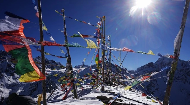
Traditional Sherpa culture centers on Tibetan Buddhism, which views mountains as sacred beings. Chomolungma is considered a deity's dwelling place. Before each Everest expedition, Sherpa teams conduct a Puja ceremony at Base Camp, asking the mountain's permission and blessing for safe passage.
Sherpa contributions to Everest mountaineering cannot be overstated. They establish routes through the Khumbu Icefall, ferry supplies between camps, fix thousands of meters of rope, and often rescue climbers in distress. Kami Rita Sherpa holds the record with 31 summits as of May 2024.
However, this work comes at a tremendous cost. Sherpas account for a disproportionate percentage of Everest deaths. A Sherpa guide might earn $5,000-7,000 for a two-month expedition—substantial income in rural Nepal but modest compared to what Western guides charge clients.
Environmental Concerns
Mount Everest faces severe environmental challenges stemming from decades of mountaineering activity and climate change impacts. Critics have called it "the world's highest garbage dump"—a stark assessment reflecting real environmental degradation.
Each Everest expedition generates substantial waste: oxygen bottles, camping equipment, food packaging, and human waste. In the death zone, climbers have historically abandoned equipment rather than expending precious energy carrying it down.
Human waste presents a particularly challenging problem. At Base Camp and lower elevations, rudimentary toilet facilities exist, but higher camps lack proper sanitation infrastructure. Waste freezes immediately at extreme altitude, remaining preserved indefinitely.
Melting glaciers driven by climate change have begun revealing the extent of historical pollution. The Khumbu Glacier has shown dramatic changes over the past 50 years, with significant thinning and retreat documented through comparative photography.
The Nepal government implemented a deposit system requiring each climber to return at least 8 kilograms of waste. The spring 2024 cleanup campaign removed over 10,000 kilograms of trash from Everest's slopes—illustrating both progress and the problem's scale.
Conservation efforts through organizations like the Sagarmatha Pollution Control Committee (SPCC) continue working to address these challenges while balancing economic benefits against ecological protection.
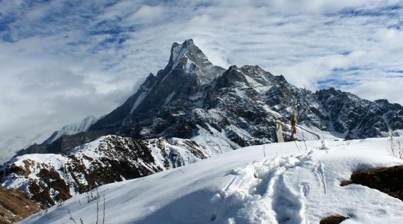
Trekking to Everest Base Camp
While summiting Mount Everest requires exceptional fitness, mountaineering skills, and substantial financial resources, visiting Everest Base Camp remains accessible to determined trekkers with moderate fitness levels. The trek to EBC offers an opportunity to experience the Everest region's magnificence without the extreme dangers of high-altitude climbing.
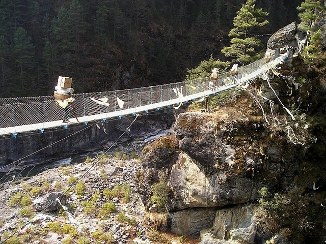
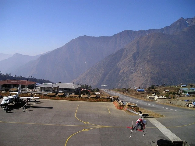
The journey typically begins with a dramatic flight from Kathmandu to Lukla, landing at 2,860 meters. This 35-minute flight provides the first stunning Himalayan views and delivers trekkers directly into the Khumbu region.
The classic Everest Base Camp trek spans 12-14 days, allowing proper acclimatization to progressively higher elevations. The route follows ancient trade paths through Sherpa villages, Buddhist monasteries, and increasingly dramatic mountain landscapes.
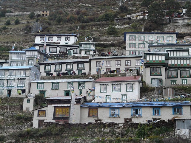
From Lukla, the trail descends initially before climbing to Namche Bazaar (3,440m), the region's commercial center. Namche serves as a critical acclimatization stop. The route continues through Tengboche (3,860m), site of the region's most important monastery, then proceeds through Dingboche (4,410m) and Lobuche (4,940m).
Everest Base Camp itself sits at approximately 5,364 meters on the Khumbu Glacier. During climbing seasons, the site transforms into a temporary city of colorful tents. For optimal mountain views, most trekkers climb to Kala Patthar (5,545m), offering spectacular dawn views of Everest's southwest face.
Acclimatization is critical for any Nepal trekking adventure at high altitude. Altitude sickness affects trekkers regardless of fitness level. Proper acclimatization requires gradual ascent, adequate hydration, and awareness of symptoms.
Best trekking seasons mirror climbing seasons: spring (March-May) and autumn (October-November). Spring brings warming temperatures and rhododendron blooms, while autumn provides the clearest skies and most stable weather.
Physical preparation should begin months before departure. Training should include long hikes with elevation gain, preferably carrying a backpack to simulate trekking conditions.
Frequently Asked Questions
How tall is Mount Everest?
Mount Everest stands 8,848.86 meters (29,031.7 feet) tall according to the official measurement jointly announced by Nepal and China in December 2020. This represents the most accurate determination of Everest's height using modern surveying technology. The mountain continues growing approximately 4 millimeters annually due to ongoing tectonic activity.
Where is Mount Everest located?
Mount Everest is located on the border between Nepal and the Tibet Autonomous Region of China at coordinates 27°59'N, 86°56'E. The mountain lies within the Mahalangur Himal sub-range of the Himalayas, approximately 160 kilometers northeast of Kathmandu. On the Nepal side, Everest sits within Sagarmatha National Park, while the Tibetan side falls within Qomolangma National Nature Reserve.
When was Mount Everest first climbed?
Edmund Hillary from New Zealand and Tenzing Norgay, a Sherpa from Nepal, first successfully climbed Mount Everest on May 29, 1953. They reached the summit at 11:30 AM as part of a British expedition led by John Hunt, marking the first confirmed human ascent to Earth's highest point.
How many people have died on Mount Everest?
Over 340 climbers have died on Mount Everest since climbing attempts began in the 1920s. The fatality rate has decreased over time as safety practices improved. Avalanches represent the leading cause of death, followed by falls, altitude sickness, and exposure. Approximately 200+ bodies remain on the mountain, preserved in ice and snow.
How much does it cost to climb Mount Everest?
Climbing Mount Everest from Nepal typically costs $30,000-$90,000 per person depending on expedition operator and service level. This includes the Nepal government climbing permit (~$11,000 for spring season), guide services, Sherpa support, equipment, food, and logistics. Budget operators charge $30,000-45,000, while premium Western guide services cost $65,000-90,000 or more.
What is the death zone on Mount Everest?
The "death zone" refers to elevations above 8,000 meters (26,247 feet) where atmospheric pressure drops to approximately one-third of sea level. At these altitudes, humans cannot survive indefinitely—the body begins deteriorating immediately as cells cannot receive adequate oxygen for normal function. Even with supplemental oxygen, climbers can only spend limited time in the death zone.
What is the best time to climb or trek to Mount Everest? The best time for climbing Mount Everest is spring (late April-May), particularly May, which offers optimal summit conditions during peak Everest climbing season. Autumn (September-October) provides a shorter secondary window. For trekking to Everest Base Camp, both spring (March-May) and autumn (October-November) are ideal with clear skies and stable weather.
Related Trekking & Climbing Adventures
Ready to experience the Everest region? Explore our comprehensive packages:
This comprehensive guide to Mount Everest was prepared by experienced Everest region specialists at Himalayan Hero Adventures. Our team has guided thousands of trekkers to Everest Base Camp and supported numerous climbing expeditions, bringing firsthand knowledge and a local Nepali perspective to this information.
Contact our expert team to plan your Everest adventure today.