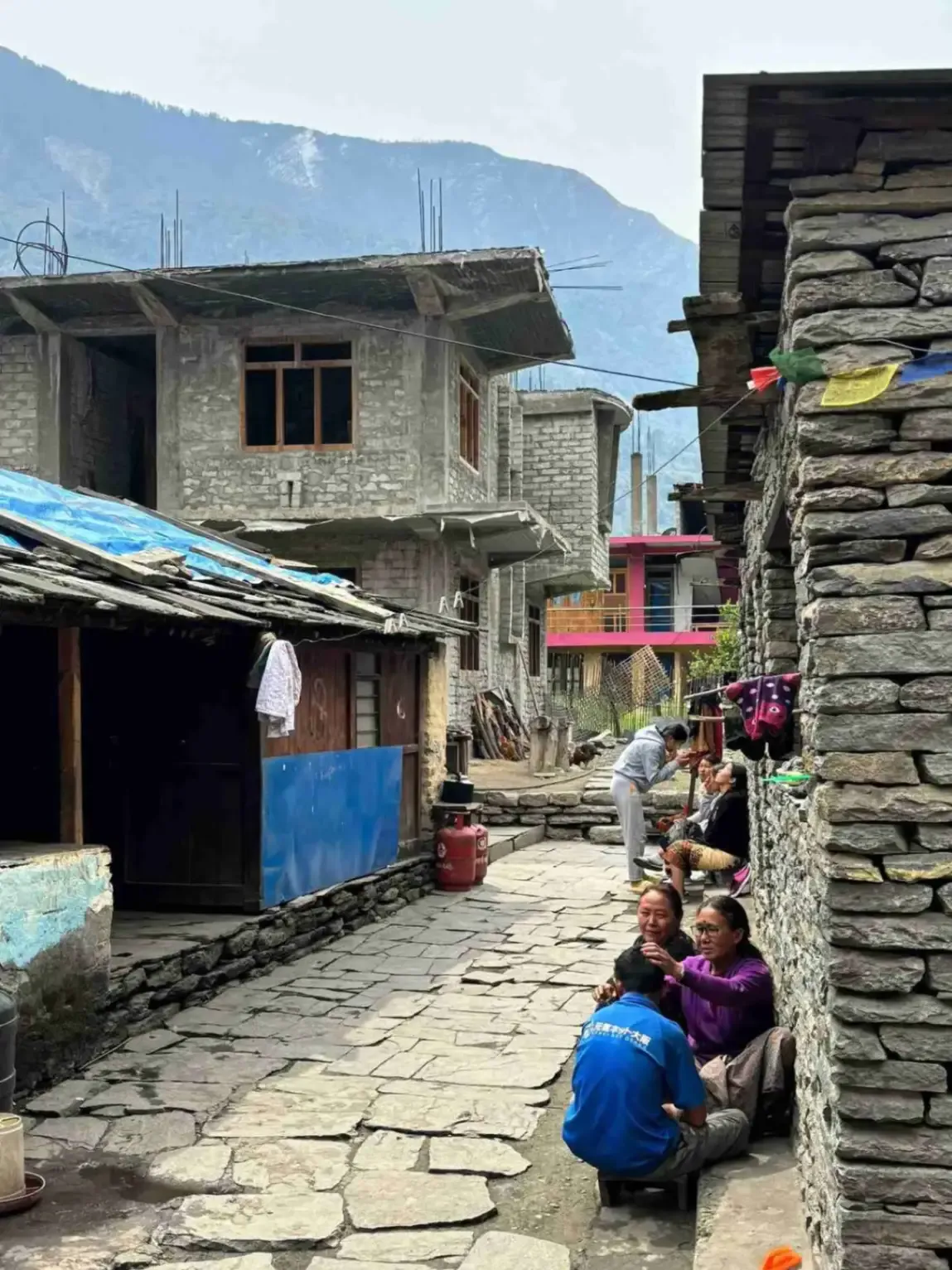
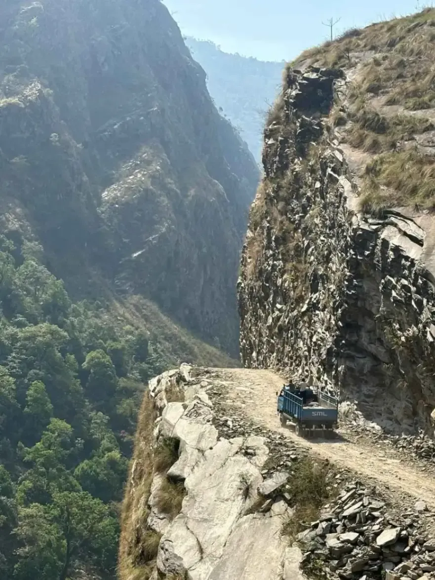
Have you ever wanted to walk beneath Mount Manaslu without joining a technical mountain expedition? The Manaslu Base Camp Trek takes you deep into the Himalayas through remote villages, Buddhist settlements, forests, glaciers and high mountain landscapes.
In this guide, you will find practical information about the Manaslu Base Camp Trek, including its itinerary, duration, cost, difficulty, permits, best seasons, accommodation, food, preparation and comparison with Everest Base Camp and Annapurna Base Camp.
The Manaslu Base Camp Trek is a high-altitude trekking journey in the Manaslu region of Nepal that takes you toward the base of Mount Manaslu, the world's eighth-highest mountain at 8,163 meters. It is a trekking route, not a technical climbing expedition, so you do not need mountaineering skills simply to reach the base camp.
The journey combines dramatic Himalayan scenery with remote mountain communities and Tibetan Buddhist culture. Compared with Nepal's more established trekking routes, Manaslu offers a quieter and more remote experience, with fewer trekkers and more basic facilities in some sections.
The route is particularly suitable for travelers who want to explore the Manaslu region beyond the main circuit trail. Depending on the itinerary, you can experience high mountain viewpoints, traditional villages, monasteries, glaciers and the spectacular landscape surrounding Manaslu
Yes, Manaslu Base Camp Trek is a challenging high-altitude trek because of its steep sections, long walking days, remote terrain and changing weather. It does not require technical climbing skills, but trekkers should be physically prepared and comfortable walking for several hours on uneven mountain trails.
The biggest challenges are usually altitude, continuous elevation gain, cold weather and the limited infrastructure in remote areas. The difficulty can also increase if snow covers higher trails or weather changes unexpectedly.
You should prepare for:
Previous Himalayan trekking experience is helpful, but it is not an absolute requirement. Fitness, gradual acclimatization and experienced guide support are more important for most trekkers.
Manaslu Base Camp can feel harder than Everest Base Camp because of its remoteness, less developed infrastructure and quieter trails. Everest Base Camp has a highly established trekking network, while some Manaslu sections have fewer facilities and require more careful logistical planning.
However, there is no universal answer to which trek is harder. The experience depends on your itinerary, fitness, acclimatization, weather and previous altitude experience.
| Factor | Manaslu Base Camp | Everest Base Camp |
|---|---|---|
| Remote feeling | Very strong | Moderate |
| Trekking infrastructure | More basic | More developed |
| Number of trekkers | Generally fewer | Generally higher |
| Accommodation | Basic in remote areas | More developed |
| Mountain scenery | Manaslu and surrounding peaks | Everest and Khumbu peaks |
| Cultural experience | Tibetan-influenced villages | Sherpa communities |
If you prefer a quieter and more remote adventure, Manaslu may be more suitable. If you want a classic Himalayan trek with more established infrastructure, Everest Base Camp may be the better choice.
Manaslu can be more demanding than shorter Annapurna trekking routes because of its remote location, altitude and limited infrastructure. However, Annapurna has several different routes, including demanding high-pass treks, so the comparison depends on the specific Annapurna itinerary.
Manaslu is a better fit for trekkers looking for wilderness and fewer crowds. Annapurna may be more convenient for travelers who prefer easier transportation, more accommodation choices and a more established trekking network.
| Day | Route | Max Altitude |
|---|---|---|
| Day 1 | Drive Kathmandu → Machha Khola | 869m |
| Day 2 | Machha Khola → Jagat | 1,340m |
| Day 3 | Jagat → Deng | 1,860m |
| Day 4 | Deng → Namrung | 2,630m |
| Day 5 | Namrung → Shyala | 3,500m |
| Day 6 | Shyala → Samagaon via Pungyen Monastery | 3,530m |
| Day 7 | Acclimatization: Samagaon → Manaslu Base Camp → Samagaon | 4,800m |
| Day 8 | Samagaon → Samdo | 3,875m |
| Day 9 | Acclimatization Day: Tibetan Border Hike from Samdo | 3,875m |
| Day 10 | Samdo → Dharamsala | 4,460m |
| Day 11 | Dharamsala → Larkya La Pass → Bhimtang | 5,160m |
| Day 12 | Bhimtang → Tilje | 2,300m |
| Day 13 | Trek Tilje → Dharapani, then drive to Besisahar | 1,300m |
| Day 14 | Drive Besisahar → Kathmandu | 1,350m |
The Manaslu Base Camp Trek cost depends on the duration, group size, permits, transportation, guide, accommodation, meals and services included in the package. A private trek generally costs more per person because fixed costs are shared among fewer travelers.
When comparing prices, look at the complete list of inclusions rather than choosing the cheapest advertised package. A lower price may exclude transportation, meals, permits or other important trekking services.
A standard guided package may include:
Personal expenses normally remain separate.
The Manaslu Base Camp Trek cost for Nepali travelers can be different from international package rates because transportation, accommodation and food arrangements may vary. The final cost depends on the chosen itinerary and services.
Nepali trekkers should budget for transportation, accommodation, food, guide or porter services if required, entry fees and personal expenses. Current permit and entry rules should always be confirmed before departure.
The cost for Indian travelers depends on group size, itinerary, transportation, accommodation, permits and included services. Indian travelers should confirm the current entry and permit requirements before booking because trekking regulations and fees can change.
A proper quotation should clearly show what is included, such as guide, accommodation, transportation, meals and permits, as well as what is excluded.
The Manaslu region is regulated because parts of the trekking area fall within restricted areas and conservation zones. The permits required depend on the exact route and sections covered by your itinerary.
Depending on the route and current regulations, trekkers may need:
Permit fees and regulations can change, particularly for restricted areas. A registered trekking agency should confirm the latest requirements before your departure and arrange the necessary permits.
| Permit | Cost | Issuing Authority | Permit |
|---|---|---|---|
| Manaslu Restricted Area Permit (MRAP) | USD $100/week during peak season / USD $75/week during off-season | Department of Immigration | Manaslu Restricted Area Permit (MRAP) |
| Manaslu Conservation Area Permit (MCAP) | NPR 3,000 (approx. USD $23) | NTNC | Manaslu Conservation Area Permit (MCAP) |
| Chumnubri Rural Municipality Entry Permit | NPR 1,000 per foreign visitor | Chumnubri Rural Municipality | Chumnubri Rural Municipality Entry Permit |
| TIMS Card | NPR 2,000 (approx. USD $15), where applicable | Nepal Tourism Board / authorized agency | TIMS Card |
The Chumnubri Rural Municipality Entry Permit is a local entry fee for foreign visitors entering Chumnubri Rural Municipality. The Manaslu Circuit, Manaslu Base Camp, and Serang Gumba routes pass through this municipality, so it should be included when explaining the current permit requirements.
Because restricted-area permit rules, seasonal rates, and TIMS requirements can change, trekkers should confirm the latest fees before departure. If booking through Himalayan Hero, the agency can handle the required permits and paperwork as part of the trekking arrangement.
A reasonably fit beginner can potentially complete the Manaslu Base Camp Trek with proper preparation, a suitable itinerary and experienced guide support. However, it should not be treated as an easy beginner trek because of its altitude, remote terrain and long walking days.
First-time high-altitude trekkers should allow enough time for acclimatization and avoid choosing an itinerary simply because it is the shortest available option.
Training can include:
Climbing Mount Manaslu and trekking to Manaslu Base Camp are completely different activities. A beginner should not attempt a Manaslu climbing expedition without previous mountaineering experience and proper technical training.
Mountaineering requires specialist equipment, rope skills, high-altitude experience, acclimatization and professional expedition support. The Manaslu Base Camp Trek itself does not require those technical climbing skills.
Spring and autumn are generally the best seasons for the Manaslu Base Camp Trek because weather conditions are usually more favorable and mountain visibility is often better. March to May and September to November are the main trekking periods.
Spring brings warmer temperatures at lower elevations, improving trail conditions and good mountain scenery. March can still be cold at higher elevations, while April and May are generally more comfortable.
The lower sections may also have blooming rhododendrons, adding color to the landscape.
Autumn is one of the most popular seasons for trekking in Nepal. October and November generally provide stable weather, clear mountain views and comfortable conditions for long trekking days.
September can still receive some rainfall, especially during the early part of the month.
Winter trekking is possible, but snow and freezing temperatures can make the higher sections more challenging. Accommodation and trail conditions may also be limited depending on weather.
Trekkers choosing winter should have suitable cold-weather equipment and check current trail conditions before departure.
Accommodation on the Manaslu Base Camp Trek is mainly provided by local teahouses and lodges. Rooms are generally simple, with beds and basic furniture, while bathrooms may be shared.
Dining rooms are usually the main social area and may have heating, particularly at higher elevations. Facilities become more basic as you move farther into the mountains.
You can generally expect:
A warm sleeping bag is recommended, especially during spring's colder periods and throughout winter.
Teahouses serve simple meals designed to provide enough energy for long trekking days. Dal bhat is one of the most common choices, along with noodles, rice, potatoes, eggs, soup, pasta and other basic dishes.
Food choices become more limited at higher elevations because supplies have to be transported into remote villages. Trekkers should therefore be prepared for simple meals rather than expecting restaurant-style variety.
Packing for Manaslu requires preparation for warm lower elevations, cold nights, rain and high-altitude conditions. Layering is the most practical approach because temperatures can change significantly during the day.
Bring:
You should also carry:
Avoid overpacking. A manageable backpack makes steep climbs and long walking days much easier.
Manaslu Base Camp is located at high altitude, and the exact elevation can vary depending on the base camp location and route used. The approach from Samagaon takes trekkers into an environment where altitude becomes a serious consideration.
The elevation gain should be gradual, with enough time for acclimatization. Headache, dizziness, nausea, unusual fatigue and breathing difficulties can be signs of altitude sickness and should not be ignored.
If symptoms become severe or worsen, descending is generally safer than continuing higher.
Trekkers seeking genuine Himalayan adventure beyond the mainstream routes find the Manaslu Base Camp Trek delivers experiences that popular destinations cannot match. The restricted area status creates a trekking environment closer to what Nepal offered decades ago — before teahouse menus listed pizza and WiFi became standard.
Key Benefits of This Route:
Ideal for: Intermediate to experienced trekkers, cultural enthusiasts, photographers seeking uncrowded mountain landscapes, trekkers wanting restricted area experience
Consider alternatives if: No prior high-altitude experience above 3,500m, unable to commit 14 days, prefer well-developed teahouse infrastructure, uncomfortable with basic mountain accommodation
| Factor | Manaslu Base Camp | High-Traffic Treks |
|---|---|---|
| Annual Trekkers | ~3,000 | 30,000-50,000 |
| Trail Traffic | Very Low | Moderate to High |
| Cultural Authenticity | High | Moderate |
| Difficulty Grade | Moderate to Strenuous | Moderate |
The Manaslu Conservation Area encompasses 1,663 square kilometers across Gorkha District in northern Nepal, bordering Tibet to the north. Established in 1998 and managed by the National Trust for Nature Conservation (NTNC), the conservation area protects the Budhi Gandaki watershed and surrounding peaks from 600m to Manaslu's summit at 8,163m.
Conservation Area Facts:
The Budhi Gandaki Valley — the central corridor of this trek — cuts one of the deepest gorges in the Nepal Himalaya, hosting 11 distinct forest types from subtropical sal to alpine meadow.
Altitude management is the single most important safety factor on the Manaslu Base Camp Trek. The itinerary incorporates a strategic acclimatization day at Samagaon (Day 9) before the base camp ascent.
| Location | Altitude | Risk Level |
|---|---|---|
| Soti Khola | 710m | None |
| Jagat | 1,340m | None |
| Deng | 1,860m | None |
| Namrung | 2,630m | Low |
| Lho | 3,180m | Moderate |
| Samagaon | 3,530m | Moderate |
| Manaslu Base Camp | 4,800m | High |
The itinerary limits sleeping altitude gain to 400-550m per day above 2,500m. The base camp day returns to 3,530m for sleeping — applying the climb-high, sleep-low principle.
Warning signs requiring immediate attention: Persistent severe headache, vomiting, loss of coordination, confusion, breathlessness at rest.
The Manaslu Base Camp Trek and Manaslu Circuit Trek explore the same broader region but provide different trekking experiences. The Circuit Trek is designed to travel around Manaslu and cross Larkya La Pass, while the Base Camp Trek focuses on reaching the base camp area.
| Feature | Manaslu Base Camp Trek | Manaslu Circuit Trek |
|---|---|---|
| Main goal | Reach Manaslu Base Camp | Complete Manaslu Circuit |
| Larkya La | Not always included | Major highlight |
| Duration | Usually shorter | Usually longer |
| Main experience | Base camp and mountains | Complete mountain circuit |
| Remoteness | High | High |
| Difficulty | Challenging | Challenging to strenuous |
Choose the Base Camp route if reaching the foot of Manaslu is your main goal. Choose the Circuit if you want to experience the complete Manaslu trekking route and cross Larkya La.
Annapurna Base Camp is generally more accessible and has more developed infrastructure than Manaslu. Manaslu offers a more remote and adventurous experience, with longer sections away from major settlements.
For a shorter and more accessible Himalayan trek, Annapurna Base Camp may be preferable. For travelers who want remote trails, fewer crowds and a stronger wilderness experience, Manaslu is often a better fit.
Before booking, look beyond the package price. A reliable trekking company should provide a clear itinerary, experienced guides, required permits, accommodation details, transportation arrangements and an emergency plan.
Ask the company:
Clear answers before booking can prevent confusion during the trek.
In the Manaslu restricted area, a licensed guide is a legal requirement. Beyond compliance, experienced local guides transform the trekking experience in this remote region.
Navigation and safety: The Budhi Gandaki Valley trail includes unmarked junctions, seasonal river crossings, and sections without clear path marking. Guides who trek this route regularly know current conditions and weather patterns.
Altitude management: Experienced guides monitor altitude sickness symptoms, adjust pace individually, and make critical decisions about proceeding or descending — particularly valuable on the base camp day hike.
Cultural access: Guides from the Manaslu region speak local languages, understand monastery protocols, and maintain village relationships that create encounters unavailable to independent travelers.
For restricted area treks like Manaslu Base Camp, operator selection directly impacts safety and experience quality.
The Manaslu Base Camp Trek is an excellent choice for trekkers who want to experience a quieter side of the Nepal Himalayas. From traditional villages and Buddhist monasteries to glaciers, high mountain trails and the impressive Manaslu range, the journey offers much more than a destination at the end of the trail.
Choose an itinerary that gives you enough time to acclimatize, prepare properly for the altitude, and travel with experienced support. With the right preparation and a well-organized trekking plan, the Manaslu Base Camp Trek can become one of the most memorable journeys in the Himalayas.
🏔️ Ready to explore the Manaslu region? Plan your Manaslu Base Camp Trek with Himalayan Hero Adventures and begin your Himalayan adventure.
Also, check out our Manaslu Circuit trekking package for 14 days.
USD $1,049 per person | 14 Days | All permits and guiding included
📧 [email protected]
📱 WhatsApp: +977 9801127073

🌐 himalayanhero.com
📍 Distance: Approximately 160 km by road
🕒 Walking/Driving Time: 7–8 hours driving
⛰️ Highest Altitude: 869m
🛏️ Overnight Altitude: 869m
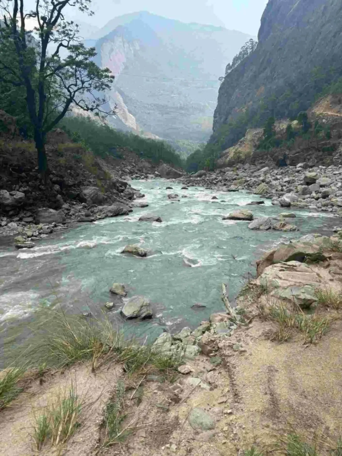
The journey begins early in Kathmandu with a drive toward Machha Khola. The first part of the road follows the highway toward Benighat and Muglin. You travel alongside the Trishuli River, passing towns, roadside settlements, green hills, and farmland along the way.
After Muglin, the route continues toward the Manaslu region. The road gradually becomes narrower and rougher as you leave the main highway and travel toward Arughat and Soti Khola. The scenery changes from busy highway settlements to quieter mountain villages and river valleys.
The route eventually follows the Budhi Gandaki River toward Machha Khola. Benighat, Muglin, Arughat, and Soti Khola are among the important places along the journey. Gurung communities live in many of the villages in this part of the region, and traditional houses and farmland can be seen along the road.
After reaching Machha Khola, check into the local teahouse and rest after the long drive. The village lies beside the Budhi Gandaki River and serves as the starting point for the main trekking section. Your guide will brief you about the next day's walk.
📋 Today's Journey
Route: Kathmandu → Benighat → Muglin → Arughat → Soti Khola → Machha Khola
Lunch Stop: Highway or roadside restaurant along the route
Villages and Towns We Pass: Benighat, Muglin, Arughat, Soti Khola
Major Attractions: Trishuli River, Budhi Gandaki River, green hills and rural settlements
Local Culture: Gurung communities and traditional hill villages
Trail/Road Condition: Highway followed by a rough and winding mountain road
Weather and Travel Tips: Start early and keep water, snacks, and a light jacket accessible. Road conditions can change with weather.
🍽️ Meals Included: Breakfast, Lunch, Dinner
🛏️ Accommodation: Teahouse in Machha Khola
📍 Distance: Approximately 22 km
🕒 Walking/Driving Time: 6–7 hours walking
⛰️ Highest Altitude: 1,340m
🛏️ Overnight Altitude: 1,340m
After breakfast, the trek begins from Machha Khola along the Budhi Gandaki River. The trail passes through forested areas and follows the river through a narrow valley. There are several rocky sections, stone steps, bridges, and short uphill climbs along the route.
The trail passes through Kholabesi before continuing toward Tatopani. The area has waterfalls, natural springs, and small streams flowing from the surrounding hills. The Budhi Gandaki remains close to the trail for much of the day.
Lunch is taken around Dovan at approximately 1,070m. After lunch, the trail continues along the river and crosses bridges, including sections with cantilever-style crossings. The route becomes more enclosed as the valley walls rise on both sides.
The day's walk ends at Jagat, a traditional mountain settlement. Jagat is an important point on the Manaslu route and a restricted-area checkpoint. After arriving, settle into the teahouse, have dinner, and rest for the following day's walk toward Deng.
📋 Today's Journey
Route: Machha Khola → Kholabesi → Tatopani → Dovan → Jagat
Lunch Stop: Dovan, approximately 1,070m
Villages and Towns We Pass: Kholabesi, Tatopani, Dovan, Jagat
Major Attractions: Budhi Gandaki River, waterfalls, springs, bridges
Local Culture: Gurung villages and traditional mountain settlements
Trail/Road Condition: Rocky river trails, stone steps, forest paths, and bridges
Weather and Travel Tips: Carry rain protection and use suitable footwear because some sections can be slippery.
🍽️ Meals Included: Breakfast, Lunch, Dinner
🛏️ Accommodation: Teahouse in Jagat
📍 Distance: Approximately 20 km
🕒 Walking/Driving Time: 7–8 hours walking
⛰️ Highest Altitude: 1,860m
🛏️ Overnight Altitude: 1,860m
The day starts after breakfast in Jagat. The trail continues along the Budhi Gandaki Valley through forests, rocky sections, and several suspension bridges. The valley becomes narrower in places, with steep hills rising above the river.
One of the main settlements along today's route is Philim, situated at approximately 1,590m. The village is surrounded by terraced farmland and traditional houses. Gurung culture is prominent in this part of the Manaslu region, and you can see local farming activities along the trail.
Lunch is planned around Chisopani at approximately 2,215m. After the meal, the trail continues through forest and river sections. Suspension bridges provide crossings over the river and its smaller tributaries, while waterfalls can sometimes be seen coming down the valley walls.
The trail eventually reaches Deng at 1,860m. This settlement is located along the Budhi Gandaki and provides a convenient overnight stop before the route climbs toward the higher villages. After checking into the teahouse, rest and prepare for the next day's walk to Namrung.
📋 Today's Journey
Route: Jagat → Philim → Chisopani → Deng
Lunch Stop: Chisopani, approximately 2,215m
Villages and Towns We Pass: Philim, Chisopani, Deng
Major Attractions: Budhi Gandaki River, suspension bridges, forests, terraced farmland
Local Culture: Gurung culture and traditional villages
Trail/Road Condition: Rocky trails, stone steps, forest paths, and suspension bridges
Weather and Travel Tips: Maintain a steady pace and drink water regularly as the elevation increases.
🍽️ Meals Included: Breakfast, Lunch, Dinner
🛏️ Accommodation: Teahouse in Deng
📍 Distance: Approximately 19 km
🕒 Walking/Driving Time: 7–8 hours walking
⛰️ Highest Altitude: 2,630m
🛏️ Overnight Altitude: 2,630m
The trek begins from Deng and follows the Budhi Gandaki Valley toward the higher settlements. The trail passes through forest and open sections, with several bridges and gradual climbs. As you gain altitude, the vegetation and landscape begin to change.
The route passes through Rana Gaon and Bihi before reaching Ghap. These villages have traditional stone houses and cultivated fields. Buckwheat and other crops are grown in the available farmland, showing how local communities use the limited agricultural land in the mountain environment.
Lunch is served at Ghap at around 2,160m. After lunch, the trail continues through forests and across suspension bridges. Tibetan Buddhist influence becomes increasingly visible, with prayer flags, mani walls, and other religious features appearing around the villages and trail.
Wildlife can sometimes be seen in the surrounding forests and mountains. Blue sheep, also known as bharal, may be present in higher areas, while langur monkeys can be found in forested sections. The day ends at Namrung, where you stay in a local teahouse.
📋 Today's Journey
Route: Deng → Rana Gaon → Bihi → Ghap → Namrung
Lunch Stop: Ghap, approximately 2,160m
Villages and Towns We Pass: Rana Gaon, Bihi, Ghap, Namrung
Major Attractions: Suspension bridges, forests, farmland, mountain scenery
Local Culture: Tibetan Buddhist culture and traditional Nubri villages
Trail/Road Condition: Forest trails, rocky sections, bridges, and gradual climbs
Weather and Travel Tips: Temperatures become cooler at night. Carry warm layers and keep your walking pace comfortable.
🍽️ Meals Included: Breakfast, Lunch, Dinner
🛏️ Accommodation: Teahouse in Namrung
📍 Distance: Approximately 15 km
🕒 Walking/Driving Time: 4–6 hours walking
⛰️ Highest Altitude: 3,500m
🛏️ Overnight Altitude: 3,500m
After breakfast, the trail leaves Namrung and continues higher into the Nubri Valley. The route gradually climbs through forests and open mountain terrain. As the elevation increases, the vegetation becomes thinner and the surrounding peaks become more visible.
The trail passes through Ligaon and Syogaon before reaching Lho, also known as Lhogaon, at around 3,180m. Lho is an important Tibetan Buddhist settlement and a natural stopping point on the route. Traditional houses and religious structures can be seen around the village.
Lunch is taken at Lho. From here, the trail continues toward Shyala through open landscapes with increasingly clear views of Manaslu at 8,163m and Himal Chuli. Naike Peak at approximately 6,211m is also visible from parts of the route.
The day's walk ends at Shyala. The village sits in an open section of the valley and provides excellent views of the surrounding mountains. After checking into the teahouse, rest and drink plenty of water as you prepare for the higher-altitude walk to Samagaon.
📋 Today's Journey
Route: Namrung → Ligaon → Syogaon → Lho → Shyala
Lunch Stop: Lho, approximately 3,180m
Villages and Towns We Pass: Ligaon, Syogaon, Lho, Shyala
Major Attractions: Mount Manaslu, Himal Chuli, Naike Peak, mountain valley
Local Culture: Tibetan Buddhist culture
Trail/Road Condition: Gradual uphill trail through forests and open mountain terrain
Weather and Travel Tips: Stay hydrated and walk slowly. Nights can be cold at this elevation.
🍽️ Meals Included: Breakfast, Lunch, Dinner
🛏️ Accommodation: Teahouse in Shyala
📍 Distance: Approximately 15 km
🕒 Walking/Driving Time: 4–6 hours walking
⛰️ Highest Altitude: 3,500m
🛏️ Overnight Altitude: 3,500m
The walk from Shyala to Samagaon is relatively short. After breakfast, the trail continues through the upper valley, with open mountain views and high pastures. Yaks and horses can often be seen grazing around the settlements and fields.
One of the important attractions along this section is Punggen Gompa, a Buddhist monastery located in the upper Manaslu area. The monastery and surrounding landscape provide views of Manaslu and the nearby mountain slopes. The route also gives a closer look at the Buddhist traditions of the Nubri Valley.
As you continue toward Samagaon, the valley becomes wider and more open. Samagaon is one of the main settlements in the upper Manaslu region. Traditional stone houses, prayer flags, mani walls, and Buddhist structures are part of the village landscape.
Lunch can be taken after reaching Samagaon or carried as a packed meal depending on the day's plan. After arriving at the teahouse, the remaining time is used for rest and acclimatization. The following day is reserved for the Manaslu Base Camp and Birendra Glacier Lake hike.
📋 Today's Journey
Route: Shyala → Punggen Gompa area → Samagaon
Lunch Stop: Samagaon or packed lunch
Villages and Towns We Pass: Samagaon
Major Attractions: Manaslu, Punggen Gompa, mountain pastures, yak and horse grazing
Local Culture: Tibetan Buddhist culture and Samagaon village life
Trail/Road Condition: Mountain trail with gradual climbs and open sections
Weather and Travel Tips: Drink plenty of water and avoid strenuous activity after reaching Samagaon.
🍽️ Meals Included: Breakfast, Lunch, Dinner
🛏️ Accommodation: Teahouse in Samagaon
📍 Distance: Approximately 15–18 km round trip for the Base Camp hike
🕒 Walking/Driving Time: Approximately 7–9 hours walking
⛰️ Highest Altitude: 4,800m
🛏️ Overnight Altitude: 3,530m
Today is an acclimatization day in Samagaon. The main activity is a day hike toward Manaslu Base Camp. You return to Samagaon to sleep at the same altitude, giving your body exposure to higher elevation without adding another high sleeping altitude.
The trail gradually leaves the village and enters a more rugged mountain environment. The vegetation becomes sparse as the route approaches the Manaslu Glacier. Rocky moraine, glacial slopes, and high mountain views replace the greener landscape around Samagaon.
Birendra Glacier Lake is one of the main natural attractions along the route. The lake sits beneath the surrounding mountains and provides a useful stop during the day's hike. If conditions and the group's pace allow, the route continues toward Manaslu Base Camp at approximately 4,800m.
A packed lunch is normally suitable for the Base Camp hike. After spending time at the high point, descend to Samagaon and return to the teahouse. Rest, eat, and hydrate well because the next days take you toward Samdo and the higher Larkya La section.
📋 Today's Journey
Route: Samagaon → Birendra Glacier Lake → Manaslu Base Camp → Samagaon
Lunch Stop: Packed lunch during the hike
Villages and Towns We Pass: Samagaon
Major Attractions: Manaslu Base Camp, Birendra Glacier Lake, Manaslu Glacier
Local Culture: Tibetan Buddhist culture
Trail/Road Condition: Rocky high-altitude paths and glacial moraine
Weather and Travel Tips: Start early, carry enough water, use sun protection, and follow your guide's advice regarding altitude.
🍽️ Meals Included: Breakfast, Lunch, Dinner
🛏️ Accommodation: Teahouse in Samagaon
📍 Distance: Approximately 8 km
🕒 Walking/Driving Time: 3–4 hours walking
⛰️ Highest Altitude: 3,875m
🛏️ Overnight Altitude: 3,875m
After breakfast, the trail leaves Samagaon and continues higher through the Budhi Gandaki Valley. The walk is intentionally short because you are moving to a higher sleeping altitude. The landscape becomes drier and more open, with fewer trees and more exposed rocky slopes.
The route provides views of the surrounding glaciers and high peaks. From parts of the trail, you can look back toward the Birendra Glacier area. Samdo Peak and other surrounding mountains become more prominent as you approach the village.
Samdo is a traditional high-altitude settlement close to the Tibetan border. Its stone houses are built close together, reflecting the cold and exposed environment. Local residents have traditionally relied on livestock, agriculture, and trade, with Tibetan Buddhist traditions forming an important part of village life.
You reach Samdo in time for lunch or an early afternoon meal. The rest of the day is kept relaxed for acclimatization. Your guide will also explain the next section toward Dharamsala and the preparation needed for the Larkya La Pass crossing.
📋 Today's Journey
Route: Samagaon → Samdo
Lunch Stop: Samdo
Villages and Towns We Pass: Samdo
Major Attractions: Birendra Glacier area, Samdo Peak, Tibetan border landscape
Local Culture: Tibetan Buddhist culture
Trail/Road Condition: Rocky, open, and gradually ascending high-altitude trail
Weather and Travel Tips: Walk slowly, drink water regularly, and keep warm clothing accessible.
🍽️ Meals Included: Breakfast, Lunch, Dinner
🛏️ Accommodation: Teahouse in Samdo
📍 Distance: Approximately 4–6 km, depending on the viewpoint reached
🕒 Walking Time: 3–5 hours
⛰️ Highest Altitude: Approximately 3,875m or higher depending on the border viewpoint
🛏️ Overnight Altitude: 3,875m
The day begins with breakfast at the teahouse in Samdo. There is no long-distance trek today because the main purpose is acclimatization. After breakfast, your guide will explain the planned hike and check how everyone is feeling before heading toward the higher slopes above Samdo.
The trail climbs gradually through the dry and rocky landscape surrounding Samdo. Vegetation becomes very limited at this elevation, and the valley has a distinctly high-altitude appearance. As you gain height, you can look back toward Samdo and see the village surrounded by barren hills and mountain slopes.
The hike continues toward a viewpoint in the direction of the Tibetan border. This area was historically connected with trade routes between Nepal and Tibet. From the higher slopes, you can see the wide Himalayan landscape, including surrounding peaks and the remote valleys near the border.
During the hike, take a steady pace and avoid rushing. The purpose is to spend time at a higher elevation and then return to the same sleeping altitude in Samdo. Your guide will monitor the group for signs of altitude sickness, and the route can be shortened if anyone feels unwell.
After returning to Samdo, you can have lunch and spend the rest of the afternoon resting. This is an important recovery period before the next day's walk to Dharamsala. You should drink plenty of water, organize your trekking gear and prepare warm clothing because the following days will take you to much higher elevations.
📋 Today's Journey
Route: Samdo → Higher viewpoint toward the Tibetan border → Samdo
Lunch Stop: Samdo
Villages and Towns We Pass: Samdo
Major Attractions: Tibetan border viewpoint, Samdo village, high-altitude Himalayan landscape, surrounding mountain peaks
Local Culture: Tibetan Buddhist culture and traditional mountain lifestyle
Trail/Road Condition: Rocky and mostly barren high-altitude trail with gradual uphill sections. Conditions can change with snow and weather.
Weather and Travel Tips: Temperatures can be cold and windy at higher elevations. Walk slowly, stay hydrated and keep warm layers, gloves and sun protection available.
🍽️ Meals Included: Breakfast, Lunch and Dinner
🛏️ Accommodation: Teahouse in Samdo
📍 Distance: Approximately 7 km
🕒 Walking/Driving Time: 3–4 hours walking
⛰️ Highest Altitude: 4,460m
🛏️ Overnight Altitude: 4,460m
The day begins with breakfast in Samdo before continuing toward Dharamsala. The trail climbs gradually through a dry and rocky landscape. Trees become very limited at this elevation, and the surrounding environment is dominated by exposed slopes, rock, and high mountain terrain.
As the route moves higher, views of the Manaslu North Face and surrounding peaks become more prominent. The trail continues toward the base of the Larkya La Pass, with sections of moraine and rocky ground along the way.
There are no major villages between Samdo and Dharamsala. The route is remote and facilities become very basic. The short walking distance helps limit the strain of gaining altitude, but the thin air can still make the walk feel harder than the distance suggests.
After reaching Dharamsala, settle into the basic shelter and have lunch. The afternoon should be used for rest and preparation. Your guide will check the weather and explain the early start required for the Larkya La Pass crossing the next day.
📋 Today's Journey
Route: Samdo → Dharamsala
Lunch Stop: Dharamsala
Villages and Towns We Pass: None
Major Attractions: Manaslu North Face, high mountain landscape, rocky slopes
Local Culture: Tibetan Buddhist influence
Trail/Road Condition: Rocky and exposed high-altitude trail
Weather and Travel Tips: Keep warm, stay hydrated, and prepare your clothing and equipment before sleeping.
🍽️ Meals Included: Breakfast, Lunch, Dinner
🛏️ Accommodation: Basic teahouse or shelter in Dharamsala
📍 Distance: Approximately 17–20 km
🕒 Walking/Driving Time: 7–9 hours walking
⛰️ Highest Altitude: 5,106m
🛏️ Overnight Altitude: 3,590m
The day starts before sunrise from Dharamsala because crossing Larkya La Pass is the highest and most demanding part of the trek. The trail climbs steadily over rocky ground and glacial terrain. The early start provides enough time to cross the pass before afternoon weather changes.
The ascent continues through a barren high-altitude landscape with views of glaciers and surrounding peaks. Larkya Glacier is one of the major natural features in this section. The final climb to Larkya La Pass reaches approximately 5,106m, where prayer flags mark the pass and views extend toward the Manaslu and Annapurna ranges.
After crossing the pass, the trail descends steeply toward Bhimtang. The landscape gradually changes as the elevation drops, with more vegetation appearing along the trail. Ponkar Lake and surrounding mountain scenery can be seen from parts of the descent when weather conditions provide clear visibility.
The long descent eventually brings you to Bhimtang. After reaching the village, check into the teahouse and enjoy a warm meal. This is an important rest point after the pass crossing, and the lower altitude should make breathing and recovery easier.
📋 Today's Journey
Route: Dharamsala → Larkya La Pass → Larkya Glacier area → Bhimtang
Lunch Stop: Bhimtang Phedi, around 3,950m, or packed lunch depending on progress
Villages and Towns We Pass: No major villages during the pass crossing
Major Attractions: Larkya La Pass, Larkya Glacier, Ponkar Lake, mountain views
Local Culture: Gurung culture around Bhimtang
Trail/Road Condition: Rocky high-altitude trail, possible snow, moraine, and steep descent
Weather and Travel Tips: Start early and carry warm layers, gloves, sunglasses, water, and sun protection.
🍽️ Meals Included: Breakfast, Lunch, Dinner
🛏️ Accommodation: Teahouse in Bhimtang
📍 Distance: Approximately 13 km
🕒 Walking/Driving Time: 5–6 hours walking
⛰️ Highest Altitude: Approximately 3,590m
🛏️ Overnight Altitude: 2,300m
After breakfast, the trail continues downhill from Bhimtang. The change in altitude brings warmer temperatures and more vegetation. The route passes through forests and open mountain sections, with the landscape becoming greener as you move farther from the high pass.
The trail continues toward Ghoa, where lunch is planned at around 2,515m. The route passes through forest and village areas, with farmland and traditional houses appearing more frequently. Local communities use the lower valley land for farming and livestock.
From Ghoa, the trail continues toward Tilije. The surrounding mountain views gradually change as the trail enters the lower Marsyangdi Valley. Larkya Peak and other surrounding mountains can still be seen from open sections of the route.
After reaching Tilije, check into the teahouse and rest. The lower altitude provides a comfortable recovery period after the Larkya La crossing. The following day combines a short trekking section toward Dharapani with a road journey to Besisahar.
📋 Today's Journey
Route: Bhimtang → Ghoa → Tilije
Lunch Stop: Ghoa, approximately 2,515m
Villages and Towns We Pass: Ghoa and surrounding settlements
Major Attractions: Forests, mountain views, Larkya Peak area, Marsyangdi Valley
Local Culture: Gurung culture and traditional mountain villages
Trail/Road Condition: Mostly descending forest and village trails
Weather and Travel Tips: The long descent can be tiring on the knees. Trekking poles can be useful.
🍽️ Meals Included: Breakfast, Lunch, Dinner
🛏️ Accommodation: Teahouse in Tilije
📍 Distance: Approximately 15 km walking plus road travel
🕒 Walking/Driving Time: 2–3 hours walking plus approximately 2–3 hours driving
⛰️ Highest Altn’/itude: Approximately 2,300m
🛏️ Overnight Altitude: Approximately 760m
The day begins with a walk from Tilije toward Dharapani. The trail continues through the lower Marsyangdi Valley, passing forests, farmland, and mountain settlements. The environment is warmer and greener compared with the high-altitude section of the trek.
Dharapani is an important settlement and transport point. Lunch is planned here at approximately 1,860m. After lunch, you continue by road toward Besisahar. The drive follows the Marsyangdi River and passes through sections of the lower valley.
The route includes views of the river, waterfalls, bridges, and steep green hills. Tal and Jagat are among the settlements associated with the route through the lower valley. As you approach Besisahar, the communities and landscape become more mixed and urban.
Besisahar is a larger town with more facilities than the mountain villages. After arrival, check into the hotel and rest. You can enjoy a comfortable evening before the final road journey to Kathmandu on the following day.
📋 Today's Journey
Route: Tilije → Dharapani → Besisahar
Lunch Stop: Dharapani, approximately 1,860m
Villages and Towns We Pass: Dharapani, Tal, Jagat and other Marsyangdi Valley settlements
Major Attractions: Marsyangdi River, waterfalls, bridges, green hills and valley scenery
Local Culture: Mixed communities and lower-valley culture
Trail/Road Condition: Trekking trail followed by a winding mountain road
Weather and Travel Tips: Keep your daypack accessible during the drive. Road conditions can change after rain.
🍽️ Meals Included: Breakfast, Lunch, Dinner
🛏️ Accommodation: Hotel in Besisahar
📍 Distance: Approximately 175–190 km
🕒 Walking/Driving Time: 6–8 hours
⛰️ Highest Altitude: Approximately 1,350m in Kathmandu
🛏️ Overnight Altitude: Not applicable if departing Nepal
The final day begins with breakfast in Besisahar. After breakfast, you start the drive toward Kathmandu. The route leaves the Marsyangdi River valley and gradually joins the main highway, connecting the mountain town with central Nepal.
The journey continues through different highway towns and settlements. You will see terraced farmland, rivers, hills and roadside communities along the way. The scenery becomes more urban as the vehicle moves closer to Kathmandu.
A lunch stop is taken along the highway, depending on the road and traffic conditions. After lunch, the journey continues toward Kathmandu. Road conditions can vary, so the actual travel time may be longer during busy periods or unfavorable weather.
On reaching Kathmandu, the 14-day Manaslu Base Camp Trek officially comes to an end. If you have an onward flight, your team can arrange the necessary airport transfer according to your departure time.
📋 Today's Journey
Route: Besisahar → Kathmandu
Lunch Stop: Benighat or a suitable highway restaurant
Villages and Towns We Pass: Different highway towns and settlements between Besisahar and Kathmandu
Major Attractions: Hills, rivers, terraced farmland and changing landscapes toward Kathmandu
Local Culture: Mixed communities and roadside settlements along the highway
Trail/Road Condition: Mainly paved highway with sections that may experience traffic, roadwork or delays.
Weather and Travel Tips: Keep water and snacks with you during the drive. Allow extra time if you have an international flight because highway traffic can affect arrival time.
🍽️ Meals Included: Breakfast and lunch
The trek rates moderate to strenuous overall. Most trekking days involve 5-7 hours of walking on varied terrain. The base camp day hike (Day 8) climbs 1,270m to 4,800m over loose moraine, and the Larkya La Pass crossing (Day 12) at 5,160m is the most physically demanding day. Prior trekking experience above 3,500m is strongly recommended.
This trek is best suited for intermediate trekkers with previous multi-day hiking experience. The Larkya La Pass crossing at 5,160m and the base camp hike to 4,800m demand solid fitness and altitude awareness. Fit beginners with 8-12 weeks of dedicated preparation and prior experience above 3,000m can complete the trek, but it should not be your first Himalayan trek.
This itinerary covers 14 days including two drive days and two acclimatization days (base camp hike and Tibetan border hike). The trek involves 10 trekking days and 2 driving days.
October and November (autumn) offer the best conditions — clear skies, stable weather, and excellent mountain views. April and May (spring) provide warmer temperatures and rhododendron blooms.
Our all-inclusive 14-day package is USD $1,049 per person, covering permits, transportation, accommodation, meals, guide, and porter. Budget an additional $150-250 for personal expenses.
No. The Manaslu region is a restricted area requiring a licensed guide, a minimum of two trekkers, and permits issued through a registered trekking agency. Independent trekking is prohibited.
Manaslu Base Camp sits at 4,800 meters (15,748 feet), reached as a day hike from Samagaon. The trek's overall highest point is Larkya La Pass at 5,160m (16,929 feet). The route starts at 869m (Machha Khola) and gains over 4,000 meters total elevation across the journey.
The itinerary includes two dedicated acclimatization days — the base camp hike from Samagaon (Day 8) and the Tibetan border hike from Samdo (Day 10). This progressive altitude exposure is specifically designed for safe Larkya La crossing. Stay hydrated (3-4 liters daily), maintain a slow pace, eat high-carbohydrate meals, and report any symptoms to your guide immediately.
Significantly. The Manaslu region receives approximately 3,000 trekkers annually compared to 50,000+ at Everest Base Camp. Restricted area regulations and limited infrastructure keep numbers low, preserving an authentic mountain experience.
Manaslu Base Camp reaches 4,800m compared to Everest Base Camp's 5,364m. Manaslu offers stronger cultural immersion in Tibetan Buddhist villages, far fewer trekkers, and restricted area exclusivity. Everest offers higher altitude, more developed infrastructure, and the iconic Khumbu Valley experience.
""The Manaslu Base Camp Trek exceeded every expectation. Standing at 4,800m with Manaslu's north face towering overhead was the most humbling moment of my life. The Budhi Gandaki Valley felt untouched compared to busier trails. Our guide from Himalayan Hero knew every village, every monastery, every safe water source. Samagaon village alone was worth the journey. This is Nepal trekking as it should be.""
Feb. 25, 2024
""I have trekked Everest Base Camp and Annapurna, but Manaslu Base Camp Trek felt completely different. Fewer trekkers, stronger cultural immersion, and landscapes that changed dramatically every single day. The acclimatization day hike to base camp was demanding but incredibly rewarding. Pungyen Gompa monastery above Samagaon offered the best mountain views I have seen anywhere. Himalayan Hero handled every permit and logistic perfectly.""
June 10, 2024
""Crossing Larkya La Pass at sunrise was the most beautiful moment of my trekking career. The Manaslu Base Camp Trek combines remote wilderness with genuine Tibetan Buddhist culture in ways that popular routes simply cannot match. Our Himalayan Hero guide monitored altitude carefully and adjusted our pace through Samdo and Dharamsala. The restricted area status keeps this trek authentic. Highly recommended for experienced trekkers.""
Dec. 15, 2024
""The Manaslu Base Camp Trek exceeded every expectation. Standing at 4,800m with Manaslu's north face towering overhead was the most humbling moment of my life. The Budhi Gandaki Valley felt untouched compared to busier trails. Our guide from Himalayan Hero knew every village, every monastery, every safe water source. Samagaon village alone was worth the journey. This is Nepal trekking as it should be.""
Feb. 25, 2024
""I have trekked Everest Base Camp and Annapurna, but Manaslu Base Camp Trek felt completely different. Fewer trekkers, stronger cultural immersion, and landscapes that changed dramatically every single day. The acclimatization day hike to base camp was demanding but incredibly rewarding. Pungyen Gompa monastery above Samagaon offered the best mountain views I have seen anywhere. Himalayan Hero handled every permit and logistic perfectly.""
June 10, 2024
""Crossing Larkya La Pass at sunrise was the most beautiful moment of my trekking career. The Manaslu Base Camp Trek combines remote wilderness with genuine Tibetan Buddhist culture in ways that popular routes simply cannot match. Our Himalayan Hero guide monitored altitude carefully and adjusted our pace through Samdo and Dharamsala. The restricted area status keeps this trek authentic. Highly recommended for experienced trekkers.""
Dec. 15, 2024
""What surprised me most about the Manaslu Base Camp Trek was the cultural depth. Walking through Nubri villages like Namrung and Samagaon felt like stepping into another century. Prayer flags, mani walls, ancient monasteries everywhere. The base camp hike over glacial moraine to 4,800m was physically tough but absolutely worth the effort. Himalayan Hero provided excellent guides and fair porter treatment throughout the entire journey.""
Feb. 11, 2025
""I chose the Manaslu Base Camp Trek specifically because it was less crowded, and it delivered completely. Some days we saw only a handful of other trekkers. The Budhi Gandaki Gorge was dramatic, Samagaon village was fascinating, and Birendra Tal glacial lake near base camp was stunning. Himalayan Hero arranged everything professionally from permits to accommodation. The restricted area experience makes this trek truly special and worth every dollar.""
June 30, 2025