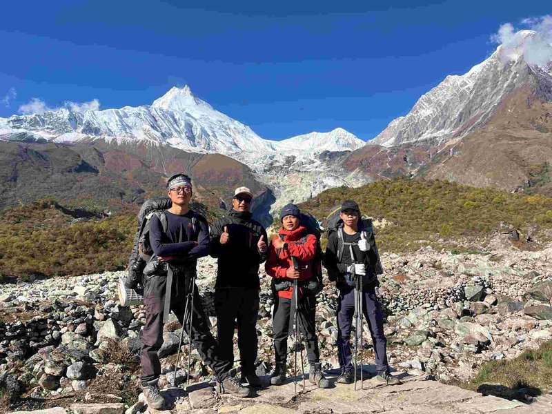
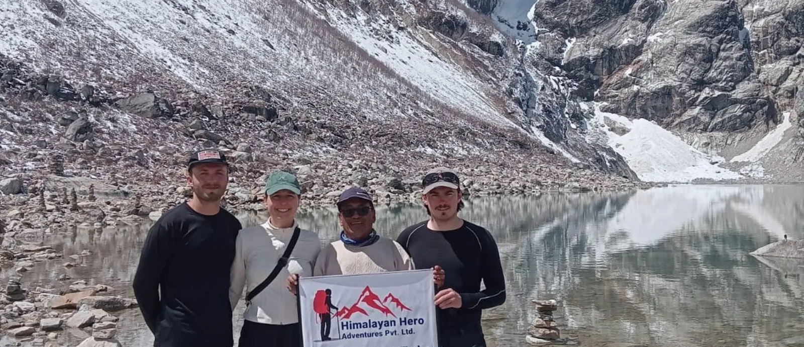
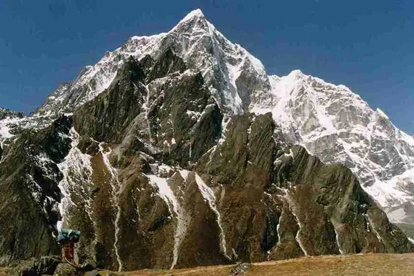
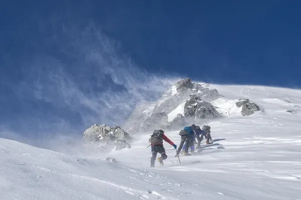
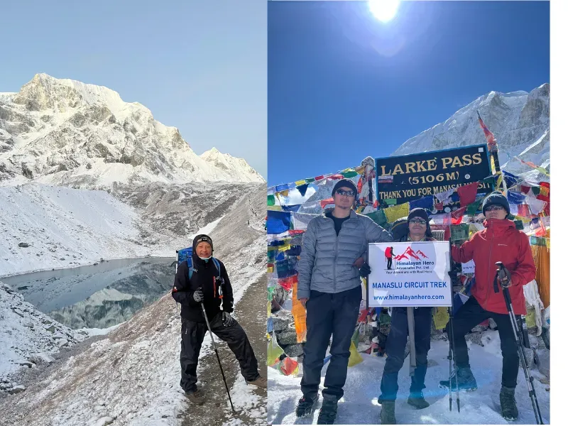
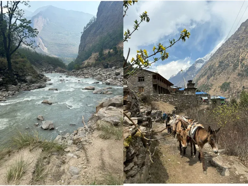
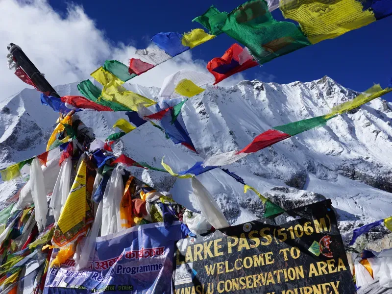
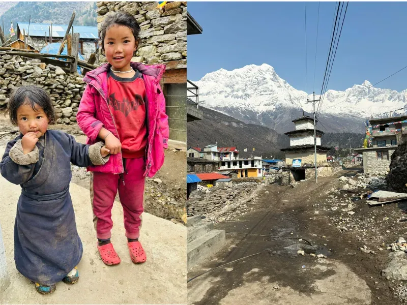
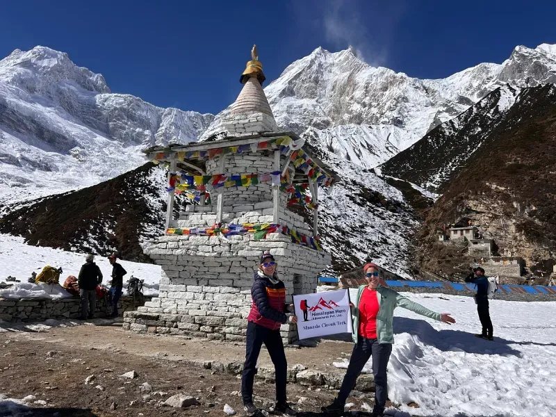
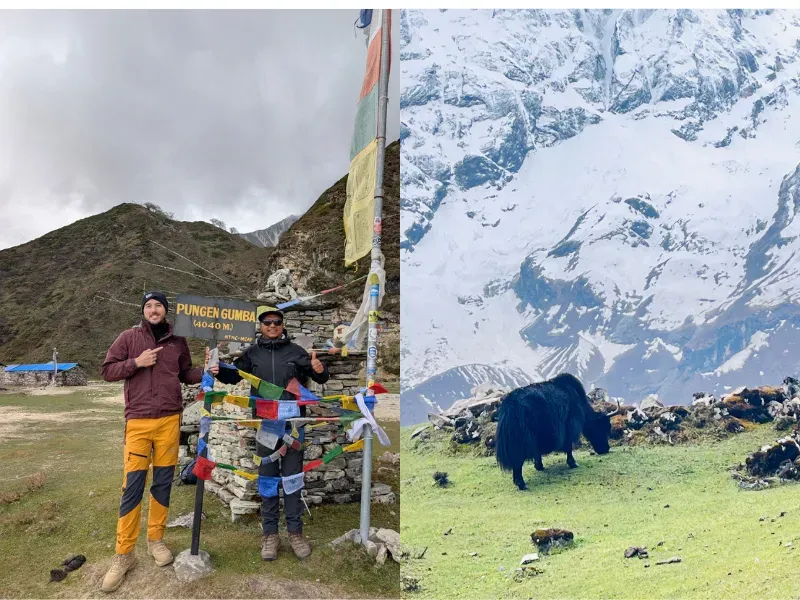
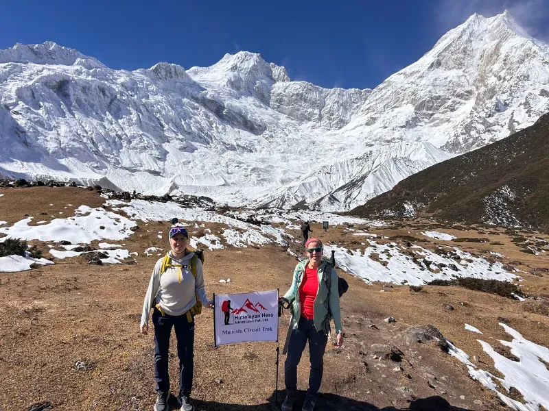
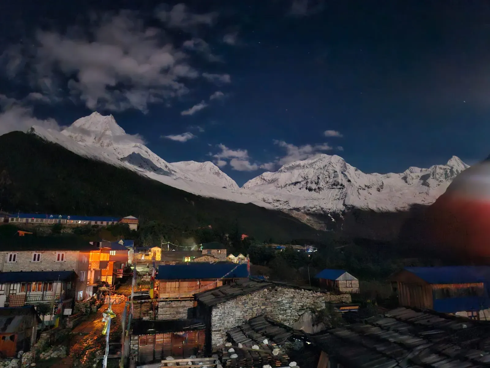
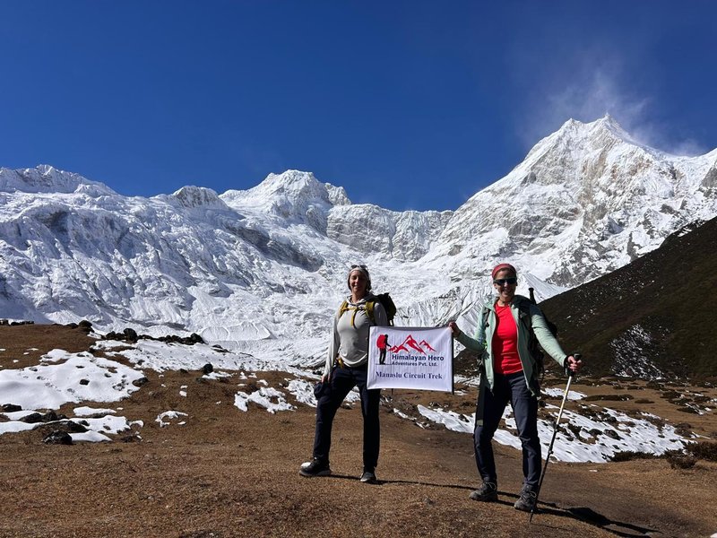
Group of trekkers celebrating at Larkya La Pass on the Manaslu Circuit Trek with colorful prayer flags and snow-covered Himalayan peaks in the background.
Trip Duration
14 Days
Location
Manaslu Region ( Manaslu Circuit )
Grading
Moderate
Best Season
Oct-Nov-Dec-Mar-Apr-May
Max Altitude
5106m
Starts from
Kathmandu
Ends at
Kathmandu

Manaslu Circuit Trek: Complete Guide, Itinerary, Cost & Booking

Trek through remote Himalayan villages, cross the 5,106 m Larkya La Pass, and experience one of Nepal’s most rewarding high-altitude adventures. The Manaslu Circuit Trek circlesMount Manaslu, the world’s eighth-highest mountain at 8,163 m. The trail follows the Budhi Gandaki Valley through villages, forests, waterfalls, monasteries, and dramatic mountain landscapes before reaching Larkya La Pass.

The route remains quieter and more remote than many popular Nepal treks. You’ll pass through Gurung and Tibetan-influenced villages, stay in local teahouses, and travel from subtropical valleys to high Himalayan terrain.

Manaslu Circuit Trek at a Glance

Feature Details
Trek Duration 14 Days
Average Walking Hours 5–8 hours/day
Maximum Altitude Larkya La Pass, 5,106 m
Difficulty Moderate to Challenging
Best Months March–May and September–November
Accommodation Tea Houses
Permits RAP + MCAP + ACAP
Starting Point Machha Khola
Ending Point Dharapani (trek) → Besisahar (road) → Kathmandu
Group/Private Options Small Group (max 6) and Private
Cost From USD 950/person (group)
Guide Required Yes — mandatory under Nepal government regulation
Solo Trekkers Allowed with a licensed guide as of March 2026 (no second-trekker requirement)

Manaslu Circuit Trek Highlights

  • Larkya La Pass (5,106 m): The highest point of the Manaslu Circuit Trek, crossed from Dharmasala to Bhimthang, with views of Himlung Himal, Cheo Himal and Annapurna II.
  • Mount Manaslu (8,163 m): The world's 8th-highest mountain, seen close up from Lho, Sama gaun and Samdo.
  • Manaslu Base Camp (4,800 m) and Birendra Lake: Two acclimatization hike options from Sama gaun on Day 7, a glacial lake or base camp for stronger trekkers.
  • Ribung Monastery (Lho): An active Tibetan Buddhist monastery at 3,180 m where monks hold daily prayers.
  • Pungyen Monastery (4,040 m): A high-altitude monastery below Manaslu, reached by a side trip on the Shyala to Sama gaun day.
  • Sama gaun (3,530 m): A Tibetan Buddhist village with a 450-year-old monastery, prayer wheels and mani walls.
  • Samdo village (3,865 m): The last permanent village before Larkya La Pass, on the historic Nepal–Tibet trade route.
  • Budhi Gandaki gorge: A river gorge trail with a cantilever bridge near Dovan and many suspension bridges.
  • Tatopani hot spring: A natural hot spring on the Machha Khola to Jagat trail.
  • Diverse landscapes: Subtropical valleys, forests, terraced fields, yak pastures and glacial terrain above 4,400 m.
  • Wildlife: Blue sheep and Himalayan marmots at higher altitudes, and langur monkeys near Ghap.
  • Restricted-area trail: A Restricted Area Permit, MCAP, ACAP and a licensed guide are required, which keeps the route far quieter than Everest Base Camp or the Annapurna Circuit.
  • Annapurna Circuit junction: The trek meets the Annapurna Circuit at Dharapani and passes Octopus Waterfall on the drive to Besisahar.

Why Trek the Manaslu Circuit?

The Manaslu Circuit Trek combines remote trails, mountain scenery, cultural experiences, and a challenging high-altitude pass in one journey.

What makes the trek special?

  • Remote Himalayan landscapes away from the busiest trekking trails
  • Views of Mount Manaslu and surrounding peaks
  • Crossing the 5,106 m Larkya La Pass
  • Traditional Gurung and Tibetan-influenced villages
  • Buddhist monasteries and prayer walls
  • Forests, waterfalls, rivers, and suspension bridges
  • Teahouse accommodation along the route
  • A gradual change from low valleys to high alpine terrain
  • Optional extensions such as Tsum Valley

Manaslu Circuit Trek – Itinerary Outline

Day Route Altitude Distance & Time
Day 1 Drive from Kathmandu to Machha Khola 930 M / 3,051 Ft 160 km, 7–8 hrs drive
Day 2 Trek from Machha Khola to Jagat 1,340 M / 4396 Ft 22 km, 5–6 hrs trek
Day 3 Trek from Jagat to Deng 1,804 M / 5,918 ft 20 km, 6–7 hrs trek
Day 4 Trek from Deng to Namrung 2,630 M / 8,629 ft 19 km, 6–7 hrs trek
Day 5 Trek from Namrung to Shyala 3,575 M / 11,730 Ft 16 km, 5–6 hrs trek
Day 6 Trek from Shyala to Sama gaun (via Pungyen Monastery) 3,530 M / 11,581 Ft 10 km, 4–5 hrs trek
Day 7 Acclimatization at Sama gaun (Manaslu Base Camp / Birendra Lake) 4,800 M / 14,435 ft ( Manaslu Base Camp ) 8–16 km, 2–7 hrs hike
Day 8 Trek from Sama gaun to Samdo 3,865 M / 12,680 Ft 8 km, 3–4 hrs trek
Day 9 Trek from Samdo to Dharmasala 4,460 m (14,632 ft) 11 km, 4–5 hrs trek
Day 10 Trek from Dharmasala to Bhimthang via Larkya La Pass Larkya La Pass: 5,106 m (16,752 ft) Bhimthang: 3,590 m (11,778 ft) 24 km, 8–10 hrs trek
Day 11 Trek from Bhimthang to Tilije 2,300 m (7,546 ft) 19 km, 5–6 hrs trek
Day 12 Trek to Dharapani & Drive to Besisahar Dharapani: 1,860 m (6,102 ft)Besisahar: 760 m (2,493 ft) 8 km trek + 43 km drive, 6–8 hrs
Day 13 Drive from Besisahar to Kathmandu 1,400 m (4,593 ft) 175 km, 6–7 hrs drive
Day 14 Final Departure 1,400 m (4,593 ft) Airport transfer (30–45 mins)

Not sure which itinerary is right for you? Compare the different route options in our guide to the short vs long Manaslu Circuit Trek.


Manaslu Circuit Trek Altitude and Acclimatization

Altitude is one of the most important things to understand before starting the Manaslu Circuit Trek. The route begins in the lower hills and gradually climbs into the high Himalayas, gaining roughly 400–500 m per day on average, before reaching 5,106 m at Larkya La Pass. Two acclimatization points are built into the itinerary: a rest day at Sama gaun and the gradual pacing through Samdo and Dharmasala.

Highest Point: Larkya La Pass (5,106 m), usually the toughest day of the trek, best crossed early morning with a slow, steady pace.

How to Prevent Altitude Sickness: Gradual ascent, proper hydration, regular meals, enough sleep, and a comfortable walking pace all reduce risk. Tell your guide immediately if you notice symptoms like headache, dizziness, nausea, or difficulty sleeping — don't try to push through them.

For a closer look at symptom management and emergency response, read our complete guide to preventing altitude sickness on the Manaslu Circuit.
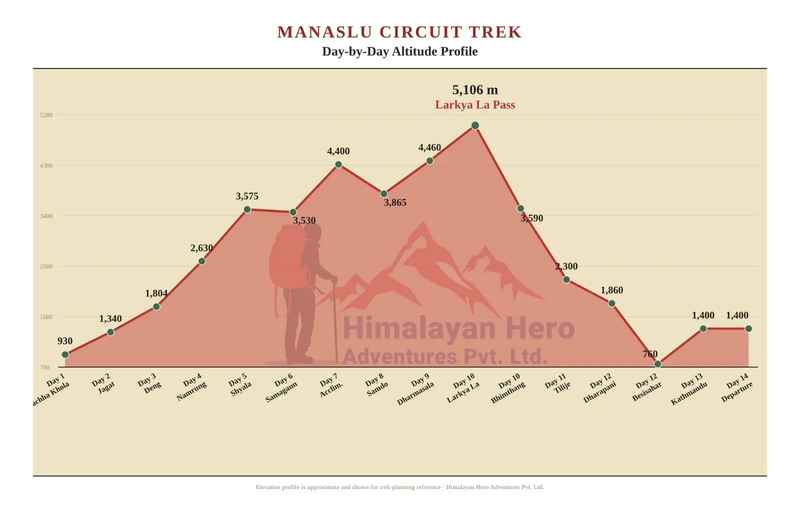
manaslu-circuit-trek-altitude-chart


Manaslu Circuit Trek Map, Route & Elevation


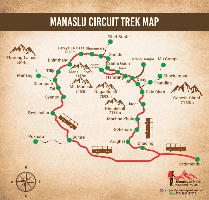
The Manaslu Circuit Trek starts at Machha Khola and ends at Dharapani, crossing Larkya La Pass at 5,106 meters, the highest point of the trek. The route follows the Budhi Gandaki River through traditional mountain villages before climbing into the high alpine landscape.
manaslu-circuit-trek-map

The map shows the main Manaslu Circuit Trek route, villages, elevation changes, and key stops. The trail passes through Jagat, Deng, Namrung, Lho, Sama Gaun, Samdo, and Dharmasala before crossing Larkya La Pass and descending to Bhimthang and Dharapani.

Key elevation markers on the Manaslu Circuit Trek elevation profile:

Checkpoint Elevation
Machha Khola (Start) 930 m
Jagat 1,340m
Sama Gaun 3,530m
Samdo 3,865m
Larkya La Pass (Highest Point) 5,106
Bhimthang 3,590m
Dharapani (End) 1,860m

Manaslu Circuit Trek Route in Brief

Machha Khola → Jagat → Deng → Namrung → Lho → Sama Gaun → Samdo → Dharmasala→ Larkya La Pass → Bhimthang → Dharapani

The route gains altitude gradually, with Sama Gaun serving as an important acclimatization stop before the trek continues toward Samdo and Dharmasala. After crossing Larkya La, the trail drops toward Bhimthang and Dharapani.

Manaslu Circuit Trek Cost

The cost of the Manaslu Circuit Trek depends on trek duration, group size, permits, transportation, accommodation, guide and porter services, and what your package includes. The Manaslu Circuit Trek costs around USD 950 per person for a standard 14-day group trek. A private trek can cost about USD 1,800 per person, depending on group size, season, and extra services.

Your budget should account for:

  • Restricted Area Permit
  • Manaslu Conservation Area Permit
  • Annapurna Conservation Area Permit where required
  • Guide and porter costs
  • Transportation
  • Teahouse accommodation
  • Meals
  • Insurance
  • Personal expenses
  • Tips
  • Drinks and snacks
  • Hot showers and charging

It is also useful to carry extra cash because ATM access becomes unavailable once you are deep into the trekking region.

What Is the Best Time for the Manaslu Circuit Trek?

The best time to trek the Manaslu Circuit Trek is autumn (late September–November) and spring (March–May). October offers the clearest skies and most stable weather, while spring brings warmer days and blooming rhododendrons.

Month Season Rating Verdict
January Winter 2/5 Cold and snowy. Larkya La may be blocked. Best for experienced, well-equipped trekkers.
February Winter 2/5 Still cold with snow at high elevations, but days get longer. Quiet and less crowded.
March Spring 4/5 Cold early in the month but warmer later. Snow may remain at higher elevations.
April Spring 5/5 Rhododendrons bloom, valleys turn green, and days are warm with good mountain views.
May Spring 3/5 Warm with increasing haze and afternoon showers. Early starts offer clearer views.
June Monsoon 1/5 Heavy rain makes lower trails slippery and increases landslide risk. Not recommended for most trekkers.
July Monsoon 1/5 Peak monsoon brings heavy rain, muddy trails, and landslide risk in the lower gorge.
August Monsoon 1/5 Heavy rainfall continues. Best suited to experienced trekkers with flexible plans and guides.
September Autumn 4/5 Early September can remain wet, but conditions usually improve later.
October Autumn 5/5 Stable weather and clear mountain views make October one of the best trekking months.
November Autumn 4/5 Clear views and dry trails, with colder nights. Snow may appear around Larkya La late in the month.
December Winter 2/5 Cold conditions begin and some lodges may close. Clear skies are possible, but Larkya La can become demanding.

For the best overall trekking conditions, choose autumn or spring.

How Difficult Is the Manaslu Circuit Trek?

The Manaslu Circuit Trek is moderately to highly challenging because of long walking days, altitude gain, and the 5,106 m Larkya La Pass.You do not need technical climbing skills, but you should have good cardiovascular fitness and be comfortable walking uphill for several hours.Most trekking days involve around 5–8 hours of walking, although some days can be longer.The hardest section is usually the journey from Dharmasala over Larkya La Pass to Bhimthang.

How can you prepare?

Start preparing around 2–3 months before your trek with:

  • Regular hiking
  • Stair climbing
  • Walking on uneven terrain
  • Squats and lunges
  • Cardio training
  • Longer weekend hikes
  • Training with a loaded daypack

For a closer look at the route and what to expect, see our guide to Manaslu Circuit Trek difficulty.


Accommodation on the Manaslu Circuit

Most trekkers stay in local teahouses along the Manaslu Circuit. They provide simple rooms, beds, blankets, and basic facilities. Most rooms are twin-sharing, while single rooms may be available depending on the lodge and availability. Your guide can arrange accommodation along the route, including calling ahead during busy periods. To learn more about accommodation, meals, and facilities along the trail, see our complete guide to Manaslu Circuit Trek tea houses.

Accommodation Details
Tea Houses Main accommodation along the Manaslu Circuit
Rooms Usually twin-sharing with basic beds and blankets
Bathrooms Mostly shared, with attached bathrooms available at some lower-elevation lodges
Higher Altitudes Facilities become more basic as you climb
Hot Showers Available at some tea houses, but less common and more expensive at higher elevations
Wi-Fi Available at many tea houses, although connections can be unreliable in remote areas
Charging Available at many lodges, sometimes for an additional fee
Phone Service Available in some areas, with coverage becoming less reliable at higher elevations
Sleeping Bag Recommended for cold nights, especially at higher elevations

Manaslu Circuit Trek Permits

You need three permits (RAP, MCAP and ACAP), plus a local municipality fee and a licensed guide. Total government fees for our 14-day trek are about USD 206 per person in autumn (September to November). This is a Restricted Area Permit of USD 160 plus NPR 7,000 (about USD 46) in conservation area and local fees.

We arrange all permits as part of your booking. Read our complete Manaslu Circuit Trek permit guide or the current fee schedule and checkpoint details.

Required Permit for Manaslu Circuit Trek and Types

Permit Foreign trekkers SAARC trekkers Notes
Restricted Area Permit (RAP), Sep–Nov USD 100 for the first 7 days, then USD 15 per extra day Check current rate with the Department of Immigration Issued only through a registered agency
RAP, Dec–Aug USD 75 for the first 7 days, then USD 10 per extra day Same as above Lower off-season rate
MCAP NPR 3,000 NPR 1,000 Fixed, no seasonal change
ACAP NPR 3,000 NPR 1,000 Needed for the Annapurna side after Bhimthang
Chumnubri Rural Municipality fee NPR 1,000 NPR 1,000 Collected at Jagat

Food on the Manaslu Circuit Trek

Teahouses serve simple but filling meals designed to provide energy for long trekking days. Tea houses serve traditional Nepali dishes alongside familiar trekking meals, although choices become more limited at higher elevations.

Meals on Manaslu Circuit Trek

Meal Type Food Options
Breakfast Bread, Pancakes, Porridge, Eggs, Tea / Coffee
Lunch Curry items, Chapati, Spaghetti, Daal Bhaat (rice & lentils), Noodles, Mo:Mo (dumplings), Soup
Snacks Biscuits, Dry fruits, Nuts, Tea / Coffee
Dinner Daal Bhaat (rice & lentils), Chapati, Dumplings, Curry items

What Should You Pack for the Manaslu Circuit Trek?

Pack lightweight layers, warm clothing, trekking footwear, rain protection, personal medication, and equipment suitable for temperatures below freezing. A complete Manaslu Circuit Trek packing list helps you prepare for changing weather, high altitude, and long days on the trail.

Category Key Essentials
Clothing Thermal base layers, down jacket (essential above 4,000m), waterproof outer shell
Footwear Broken-in hiking boots, camp shoes, 5-6 pairs trekking socks
Technical Gear Sleeping bag (-15°C rated), trekking poles, headlamp, 3L water system
Health & Personal Care Sunscreen, Diamox, basic first aid kit, wet wipes
Electronics & Documents Power bank, passport/permit copies, travel insurance documents

manaslu-circuit-trek-hiker


Is the Manaslu Circuit Trek Safe?

The Manaslu Circuit Trek can be completed safely with proper acclimatization, preparation, weather awareness, and experienced local support. Altitude is one of the main concerns because the trail reaches more than 5,000 m.

To reduce altitude-related risks:

  • Ascend gradually
  • Follow the planned acclimatization schedule
  • Drink enough water
  • Avoid rushing
  • Tell your guide if you feel unwell
  • Do not ignore serious altitude symptoms
  • Be prepared to descend if necessary

Weather and trail conditions can also change quickly in the mountains. The Manaslu Circuit Trek can be a great choice for active travelers over 50 who have good fitness and prepare well for high-altitude trekking. With proper acclimatization, a comfortable walking pace, and guidance from experienced local guides, many senior trekkers successfully complete the route. Learn more in our guide to the Manaslu Circuit Trek for seniors over 50.


Tips for a Successful Manaslu Circuit Trek

  • Choose teahouse accommodation: Teahouses provide meals, beds and a chance to experience local mountain culture. Camping is mainly useful for remote or off-season routes.
  • Plan your acclimatization: Take a rest day at Sama gaun before heading toward the higher sections. You can use the day for a short hike to Birendra Lake or Pungyen Monastery.
  • Enjoy the villages and wildlife: Look for Gurung and Tibetan villages such as Lho and Samdo. Blue sheep and Himalayan marmots may also be spotted in higher areas.
  • Pack the essentials: Bring layered clothing, a warm sleeping bag, hiking boots, a headlamp, water bottle, sunscreen, microspikes and a small first aid kit. Keep your daypack light.
  • Stay hydrated and eat well: Drink regularly throughout the day. Dal Bhat is a filling option, while most teahouses also serve pancakes, pasta, noodles and tea.
  • Prepare your fitness: Start training before the trek with cardio, strength exercises and regular hikes. Practice walking with a loaded backpack to build endurance.
  • Arrange permits and a guide: The Manaslu region is restricted, so trekkers need the required permits and a licensed guide. Your guide can also help with navigation and logistics.
  • Carry enough cash: Bring sufficient Nepali rupees because ATM access is limited along the route. Charging your devices may also cost extra at higher elevations.
  • Get suitable travel insurance: Check that your policy covers trekking at the altitude of your itinerary and emergency evacuation, including helicopter evacuation if required.
  • Choose the right season: Spring (March–May) and autumn (September–November) generally offer better trekking conditions. Monsoon brings wetter trails, while winter can bring colder conditions and snow.


Why Choose the Manaslu Circuit Trek Instead of Everest Base Camp?

If you are deciding between the Manaslu Circuit Trek and the Everest Base Camp Trek, Manaslu is a great choice for travelers who want a quieter and more authentic Himalayan adventure. The trail has fewer trekkers, allowing you to enjoy peaceful walks, beautiful mountain scenery, and traditional villages without the busy crowds found on the Everest route.

Manaslu Circuit Trek vs Everest Base Camp Trek (Pros & Cons)

Comparison Factor Everest Base Camp Trek Manaslu Circuit Trek
Popularity One of the world’s most famous treks Less known and far less crowded
Crowd Level Very crowded during peak seasons Quiet and peaceful
Scenery Views of Mt. Everest, Ama Dablam, Khumbu Icefall Diverse landscapes, valleys, glaciers, Larkya La Pass
Cultural Experience Sherpa culture and monasteries Gurung, Tamang & Tibetan cultural immersion
Trek Duration 12–14 days 14–18+ days
Difficulty Level Moderate (suitable for fit beginners) Moderately difficult to challenging
Highest Point Kala Patthar (5,545 m) Larkya La Pass (5,106 m)
Guide Requirement Guide optional Licensed guide mandatory
Permits Standard permits (Sagarmatha NP, TIMS) Special restricted-area permits required
Best For First-time Himalayan trekkers Experienced trekkers seeking solitude

If you prefer quiet trails, authentic Tibetan culture, and a remote Himalayan adventure, the Manaslu Circuit Trek is an excellent choice. If your dream is to stand beneath the world's highest mountain, explore our Everest Base Camp Trek package and compare both experiences before deciding.


Who Should Avoid or Postpone the Manaslu Circuit Trek?

The Manaslu Circuit Trek reaches 5,106 m and involves long days on rugged mountain trails. If you have a medical condition, consult your doctor before booking.

The trek may not be suitable if you have:

  • Uncontrolled high blood pressure or serious heart conditions
  • Severe or poorly controlled asthma or lung disease
  • Recent surgery or a major injury
  • Serious knee, hip, ankle, or back problems
  • A pregnancy that has not been medically cleared for high-altitude travel
  • Any condition for which your doctor advises against high-altitude travel

If medically cleared, proper preparation, gradual acclimatization, experienced guide support, and comprehensive travel insurance are important for a high-altitude trek.

Why Book Your Manaslu Circuit Trek With Himalayan Hero Adventure ?

A Manaslu trek involves more than walking from one village to another. You need permits, transport, accommodation, a good itinerary, and someone to contact if plans change.

With Himalayan Hero Adventure, these arrangements are handled by our local team in Nepal, so you can spend more time preparing for the trek and less time chasing details.

What We Handle What It Means for You
Hassle-Free Booking Share your travel dates and trekking plans. We help arrange the key details from booking to the start of your trek.
Only 10% to Book Pay just 10% when you confirm your trek. Pay the remaining balance after you arrive in Nepal.
24/7 Support Our team is available to help before and during your trek. If your plans change, we help you find the next step.
Permit Handling We arrange the permits needed for the Manaslu Circuit Trek and make sure your paperwork is ready before you enter the restricted area.
Strong Local Team in Nepal Our team is based in Nepal and has local staff and contacts in major trekking regions. If an issue comes up on the trail, we can coordinate help quickly.
Experienced Local Guides Our guides know the Manaslu trail, villages, altitude changes, local customs, and the day-to-day conditions along the route.
Proper Acclimatization Our itineraries include time to adjust to higher altitudes instead of rushing through the trek.
Local Knowledge Your guide can share the stories, villages, monasteries, Buddhist traditions, and mountain communities you encounter along the way.

Your Trek Starts Before You Reach the Trail

From permits and transport to guides and accommodation, our local team handles the key details before you reach the trail. With easy booking, 10% down payment, and fair pricing, we aim to offer the best value for money while keeping your Manaslu trek simple and well organized.

Plan Your Manaslu Circuit Trek with Himalayan Hero Adventure
manaslu-circuit-trek-himalayan-hero-adventures.jpg


Booking & Cancellation Terms

Book your Manaslu Circuit Trek with a 10% non-refundable deposit. The remaining balance is due upon arrival in Kathmandu.

  • Reschedule: Give at least 14 days' notice to transfer your deposit.
  • Cancellation: The 10% deposit is non-refundable; other refunds depend on costs already incurred.
  • Insurance: Travel insurance covering medical care and emergency helicopter evacuation is required.
  • Early return: No refund is provided for voluntarily leaving or shortening the trek.
  • Last-minute booking: Nepal trips can be booked up to 3 days before departure, subject to availability.

Choose the Manaslu Trek That Fits Your Plans

There is no single way to do the Manaslu Circuit Trek. You may want to join a small group, travel only with your friends, or change the itinerary to match your available time.We offer all three options, so you can choose based on your dates, group size, budget, and preferred pace.

Join a Small Group

Our Fixed Departures are a good option if you want to trek with other people and keep the cost lower. Each group is limited to 6 trekkers, so the group stays small and easy to manage.

Check Fixed Departure Dates

Travel With Your Own Group

If you are coming with friends or family, you can book a private Manaslu Circuit Trek and choose dates that work for your group.

Private treks are available at around 15% extra. The final cost can vary depending on the number of people, season, itinerary, and any additional services you request.

Want a Different Itinerary?

If the standard itinerary does not fit your plans, we can adjust it with you. Depending on your time and preferences, you can:

  • Choose your own trekking dates
  • Set a comfortable walking pace
  • Add extra acclimatization days
  • Add the Tsum Valley extension
  • Arrange transportation and accommodation
  • Have us handle the required permits and licensed guide

Traveling With 4 or More People?

Planning the trek with a group of friends or family? We offer group discounts for bookings of 4 or more people.

Simply send us your group size and preferred dates on WhatsApp at +977 9801127073 or through the inquiry form. We will check the available options and provide the group price.

Pick the Option That Works for You

Join a small group, bring your own people, or change the itinerary around your schedule. The choice depends on how you want to experience the Manaslu Circuit.

Ready to Experience the Manaslu Circuit?

The Manaslu Circuit is more than a walk around a mountain. It is a journey through remote villages, ancient Buddhist culture, changing Himalayan landscapes, and one of Nepal's great high mountain passes.

If the thought of crossing Larkya La Pass at 5,106 m, waking up to Himalayan peaks, and walking through places far from the usual tourist trail is calling you, now is the time to start planning.

Book Your Manaslu Circuit Trek with Himalayan Hero Adventure

Itinerary


Day 01 Drive from Kathmandu to Machhakhola 930 M / 3,051 Ft

📍 Distance: Approx. 160 km / 99 miles
🕒 Driving Time: 8 to 9 Hours
⛰️ Highest Altitude: 930 m / 3,051 ft
🛏️ Overnight Altitude: 930 m / 3,051 ft
🚐 Transportation: Local Bus

Your Manaslu Circuit Trek begins with an early morning drive from Kathmandu. The road follows the Prithvi Highway beside the Trishuli River, passing busy towns, green hills, and terraced farms. Along the way, you will see local markets, roadside tea shops, and villages where people carry on with their daily lives.

After Benighat, the route leaves the highway and follows the Budhi Gandaki River toward Arughat and Soti Khola. The road becomes rougher, and the drive slows down, giving you more time to enjoy the changing landscape. Waterfalls flow down the hillsides, suspension bridges cross the river, and small villages appear along the valley.

Most people living in this area belong to the Gurung community. Their stone houses, terraced fields, and farming lifestyle reflect the traditions of the region. As you continue north, traffic becomes lighter, the villages become smaller, and the mountains begin to feel closer. This drive is a gradual introduction to the remote Manaslu region before the trekking starts.

By late afternoon, you arrive at Machhakhola, a small riverside village that marks the starting point of the trek. After checking into your teahouse, you can relax, enjoy your first dinner in the mountains, and prepare your backpack for tomorrow's walk.

📋 Today's Journey

Route: Kathmandu → Benighat → Muglin → Arughat → Soti Khola → Machhakhola

Lunch Stop: Along the Prithvi Highway

Villages and Towns We Pass: Benighat, Muglin, Arughat, Soti Khola

Major Attractions: Trishuli River, Budhi Gandaki River, terraced farmland, waterfalls, suspension bridges, and traditional mountain villages

Local Culture: Traditional Gurung villages with stone houses, farming terraces, and local mountain traditions

Road Condition: Paved highway until Benighat, followed by a rough mountain road to Machhakhola

Weather and Travel Tips: Temperatures are usually warm at this altitude. Keep drinking water with you, wear comfortable clothes for the long drive, and expect a bumpy road after leaving the highway.

🍽️ Meals Included: Lunch & Dinner

🛏️ Accommodation: Family-run Traditional Teahouse

Day 02 Trek from Machhakhola to Jagat 1,340 M / 4396 Ft

📍 Distance: Approx. 22 km / 13.7 miles
🕒 Walking Time: 6 to 7 Hours
⛰️ Highest Altitude: 1,340 M / 4396 Ft
🛏️ Overnight Altitude: 1,340 M / 4396 Ft

After breakfast, your first day on the trail begins by following the Budhi Gandaki River. The path goes up and down through small forests, rocky sections, and riverside trails. You will cross several suspension bridges and pass local people carrying supplies between villages. The sound of the river stays with you for most of the day.

The trail leads through Khorlabesi, where traditional stone houses sit beside the river. A little farther ahead, you reach Tatopani, a village known for its natural hot springs. Many trekkers stop here for a short break before continuing toward Dovan. The walk remains enjoyable with waterfalls, small streams, and green hills surrounding the valley.

Lunch is served at Dovan, a quiet riverside settlement. After lunch, the trail crosses a cantilever bridge before gradually climbing toward Jagat. As you get closer, the path becomes stone paved, and the village feels more organized than the settlements below. Jagat is the official entrance to the restricted Manaslu region, where your trekking permits are checked before you continue farther into the valley.After checking into your teahouse, you can enjoy a warm meal and relax while listening to the Budhi Gandaki River flowing nearby.

📋 Today's Journey

Route: Machhakhola → Khorlabesi → Tatopani → Dovan → Jagat

Lunch Stop: Dovan (1,070 m)

Villages We Pass: Khorlabesi, Tatopani

Major Attractions: Budhi Gandaki River, cantilever bridge, waterfalls, natural hot springs, stone-paved village of Jagat

Local Culture: Traditional Gurung villages with farming terraces and local mountain lifestyle

Trail Condition: Riverside paths, stone staircases, suspension bridges, and gradual uphill sections

Weather and Travel Tips: Carry enough drinking water and walk at a comfortable pace. The afternoon section includes a longer climb before reaching Jagat.

🍽️ Meals Included: Breakfast, Lunch & Dinner

🛏️ Accommodation: Family-run Traditional Teahouse

Day 03 Trek from Jagat to Deng 1,804 M / 5,918 ft

📍 Distance: Approx. 20 km / 12.4 miles
🕒 Walking Time: 6 to 7 Hours
⛰️ Highest Altitude: 1,804 M / 5,918 ft
🛏️ Overnight Altitude: 1,804 M / 5,918 ft

Leaving Jagat, the trail climbs gradually before descending toward the river again. The landscape begins to change as you enter narrower valleys with higher cliffs and thicker forests. The walk includes several suspension bridges and short uphill climbs throughout the day.

You pass the large village of Philim, one of the biggest Gurung settlements in the region. The village has stone houses, cultivated fields, schools, and monasteries that reflect daily life in the mountains. Beyond Philim, the trail becomes quieter as it passes bamboo forests and small streams flowing into the Budhi Gandaki River.

Lunch is served at Chisopani, where you can rest before continuing through forest trails and crossing another suspension bridge. As the day continues, you may notice Tibetan Buddhist influences becoming more visible through prayer flags, mani walls, and small chortens beside the trail.

By late afternoon, you arrive at Deng, a peaceful village surrounded by forests and mountains. The evening is a good time to rest and prepare for the higher elevations ahead.

📋 Today's Journey

Route: Jagat → Salleri → Sirdibas → Philim → Chisopani → Deng

Lunch Stop: Chisopani (2,215 m)

Villages We Pass: Salleri, Sirdibas, Philim

Major Attractions: Budhi Gandaki Gorge, suspension bridges, bamboo forests, cultivated terraces

Local Culture: Gurung villages with the first signs of Tibetan Buddhist traditions

Trail Condition: Forest trails, stone paths, suspension bridges, and steady climbs

Weather and Travel Tips: The trail becomes slightly cooler as you gain elevation. Trekking poles can help on rocky sections and descents.

🍽️ Meals Included: Breakfast, Lunch & Dinner

🛏️ Accommodation: Family-run Traditional Teahouse

Day 04 Trek from Deng to Namrung (2,630 m / 8,629 ft)

📍 Distance: Approx. 19 km / 11.8 miles
🕒 Walking Time: 6 to 7 Hours
⛰️ Highest Altitude: 2,630 m / 8,629 ft
🛏️ Overnight Altitude: 2,630 m / 8,629 ft

The trail continues through forests and follows the Budhi Gandaki River before climbing higher into the mountains. The villages become smaller, and Tibetan Buddhist culture becomes part of everyday life. Prayer flags, mani walls, and stone chortens are seen more often as you move farther north.

You pass Rana, Bihi, and Ghap, where traditional stone houses stand among fields of buckwheat and barley. Lunch is served in Ghap before continuing through pine and rhododendron forests. Several suspension bridges connect both sides of the valley, making the walk varied throughout the day.

This area is also known for its wildlife. If conditions are right, you may see Blue Sheep (Bharal) on the rocky slopes or Langur monkeys moving through the trees.By afternoon, you arrive at Namrung, a beautiful mountain village with clear views of the surrounding Himalayan peaks.

📋 Today's Journey

Route: Deng → Rana → Bihi → Ghap → Namrung

Lunch Stop: Ghap (2,160 m)

Villages We Pass: Rana, Bihi, Ghap

Major Attractions: Budhi Gandaki River, suspension bridges, buckwheat fields, forests, mountain views

Local Culture: Tibetan Buddhist villages with monasteries, mani walls, and prayer flags

Trail Condition: Forest paths, river crossings, suspension bridges, and steady uphill walking

Weather and Travel Tips: The air becomes cooler as you gain altitude. Walk slowly, stay hydrated, and dress in layers.

🍽️ Meals Included: Breakfast, Lunch & Dinner

🛏️ Accommodation: Family-run Traditional Teahous

Day 05 Trek from Namrung to Shyala (3,575 M / 11,730 Ft)

📍 Distance: Approx. 14 km / 8.7 miles
🕒 Walking Time: 5 to 6 Hours
⛰️ Highest Altitude: 3,575 M / 11,730 Ft
🛏️ Overnight Altitude: 3,575 M / 11,730 Ft

After breakfast, you leave Namrung and continue along a well-marked mountain trail. The walk starts with a gradual climb through forests before reaching the villages of Lihi and Sho. Stone houses, prayer wheels, and fields of barley and potatoes show how people have lived in these high mountains for generations.

As you gain elevation, the trees begin to thin out and the mountains become much more visible. The trail offers clear views of Mount Manaslu (8,163 m), Himal Chuli, and Naike Peak. Every turn brings a different view, making today's walk one of the most enjoyable on the trek.

You stop for lunch at Lho Village, where you can also visit the famous Ribung Monastery if time allows. It is an active monastery where local monks continue their daily prayers, and it gives you a better understanding of the culture of the upper Manaslu region.

After lunch, the trail climbs gently across open ground before reaching Shyala. Surrounded by high mountains, this peaceful village is one of the best places on the trek to enjoy the natural setting. After arriving at your teahouse, you can relax and prepare for the shorter walk to Sama gaun tomorrow.

📋 Today's Journey


Route:
Namrung → Lihi → Sho → Lho → Shyala

Lunch Stop:
Lho (3,180 m)

Villages We Pass: Lihi, Sho, Lho

Major Attractions: Mount Manaslu, Himal Chuli, Naike Peak, Ribung Monastery, yak grazing fields

Local Culture: Traditional Tibetan Buddhist villages with monasteries, prayer wheels, mani walls, and stone houses

Trail Condition: Forest trails, gradual uphill paths, open alpine meadows, and well-maintained walking trails

Weather and Travel Tips: Temperatures become cooler above 3,000 meters. Walk slowly, drink plenty of water, and wear warm layers during the afternoon and evening.

🍽️ Meals Included: Breakfast, Lunch & Dinner

🛏️ Accommodation: Family-run Traditional Teahouse

Day 06 Trek from Shyala to Sama gaun (3,530 m / 11,581 ft)

📍 Distance: Approx. 8 km / 5 miles
🕒 Walking Time: 4 to 5 Hours
⛰️ Highest Altitude: Pungen Gumba 4040 M
🛏️ Overnight Altitude: 3,530 m / 11,581 ft

Today's walk is shorter, giving your body more time to adjust to the higher altitude. Leaving Shyala, the trail crosses wide alpine meadows where yaks and horses graze during the warmer months. The path is mostly gentle, allowing you to enjoy the mountain surroundings without rushing.

If the weather is clear, you can take a short side trip to Punggen Monastery. The monastery sits below Mount Manaslu and offers a close view of the glacier and surrounding peaks. Many trekkers spend some time here before returning to the main trail.

By early afternoon, you reach Sama gaun, one of the largest villages on the Manaslu Circuit. The village has been home to Tibetan Buddhist families for centuries. Narrow stone paths, traditional houses, prayer wheels, and mani walls reflect the lifestyle of the local community. You can also visit the village's 450-year-old monastery, which remains an important religious center.The rest of the afternoon is free to explore the village, enjoy a warm drink, or rest before tomorrow's acclimatization hike.

📋 Today's Journey

Route: Shyala → Punggen Monastery (Optional) → Sama gaun

Lunch Stop: Sama gaun or Packed Lunch (if visiting Punggen Monastery)

Villages We Pass: No major villages

Major Attractions: Mount Manaslu, Punggen Monastery, yak pastures, alpine meadows, 450-year-old monastery

Local Culture: Traditional Tibetan Buddhist settlement with monasteries, prayer flags, mani walls, and local mountain traditions

Trail Condition:
Gentle alpine trails, open meadows, and easy walking with gradual elevation gain

Weather and Travel Tips: The thinner air may make walking feel slower. Keep a steady pace, stay hydrated, and avoid unnecessary physical effort.

🍽️ Meals Included: Breakfast, Lunch & Dinner

🛏️ Accommodation: Family-run Traditional Teahouse

Day 07 Acclimatization Day at Sama gaun (3,530 m / 11,581 ft)

📍 Distance: Optional Hike
🕒 Walking Time: 2 to 7 Hours
⛰️ Highest Altitude: 4,800 M / 14,435 ft ( Manaslu Base Camp )
🛏️ Overnight Altitude: 3,530 m / 11,581 ft

Today is an important day for acclimatization. Instead of continuing to a higher village, you stay in Sama gaun to help your body adjust to the altitude. Although it is called a rest day, a short hike is recommended because gentle activity supports better acclimatization.

After breakfast, you can hike toBirendra Lake, a glacial lake located below the Manaslu Glacier. If you are feeling strong and the weather is good, you may continue to Manaslu Base Camp. The climb is longer and steeper, but it offers a closer look at the glacier and the surrounding mountains.

After spending some time at your chosen destination, you return to Sama gaun along the same trail. The afternoon is free to rest, wash clothes, explore the village, or enjoy a quiet evening before heading toward higher elevations tomorrow.

📋 Today's Journey

Route: Sama gaun → Birendra Lake or Manaslu Base Camp → Sama gaun

Lunch Stop: Sama gaun or Packed Lunch

Villages We Pass: No villages

Major Attractions: Manaslu Base Camp, Birendra Lake, Manaslu Glacier, yak grazing areas

Local Culture: Spend another day experiencing daily life in one of the oldest Tibetan Buddhist villages on the Manaslu Circuit.

Trail Condition: Rocky mountain trails with steady uphill sections during the optional hike

Weather and Travel Tips: Acclimatization is important before crossing Larkya la pass. Drink plenty of water, eat well, and avoid climbing too quickly.

🍽️ Meals Included: Breakfast, Lunch & Dinner

🛏️ Accommodation: Family-run Traditional Teahouse

Day 08 Trek from Sama gaun to Samdo (3,865 m / 12,680 ft)

📍 Distance: Approx. 8 km / 5 miles
🕒 Walking Time: 3 to 4 Hours
⛰️ Highest Altitude: 3,865 m / 12,680 ft
🛏️ Overnight Altitude: 3,865 m / 12,680 ft

After breakfast, you leave Sama gaun and continue toward the last permanent village before Larkya La Pass. The trail follows the Budhi Gandaki River through a wide valley with a gentle climb, making today's walk shorter and easier than previous days. Since you are now at a higher elevation, walking slowly helps your body adjust to the thinner air.

The landscape changes as trees become fewer and open grazing fields replace the forests. Yaks can often be seen feeding in the pastures, while snow-covered peaks surround the valley. Along the way, you will enjoy clear views of Birendra Glacier, Samdo Peak, and the mountain route that leads toward the Nepal-Tibet border.

By lunchtime, you arrive in Samdo, a traditional Tibetan village where many families have lived for generations. The village has long been connected to the historic trade route between Nepal and Tibet. After checking into your teahouse, you can take a short walk around the village or simply relax and enjoy the mountain views before tomorrow's climb to Dharmasala.

📋 Today's Journey

Route: Sama gaun → Samdo

Lunch Stop: Samdo

Villages We Pass: No major villages

Major Attractions: Budhi Gandaki Valley, Birendra Glacier, Samdo Peak, yak grazing fields, Nepal-Tibet trade route

Local Culture: Traditional Tibetan Buddhist village with stone houses, monasteries, prayer flags, and a long history of cross-border trade

Trail Condition: Wide valley trail with gradual uphill sections, rocky paths, and alpine meadows

Weather and Travel Tips: The temperature is cooler at this altitude, especially in the evening. Walk slowly, drink plenty of water, and avoid overexertion.

🍽️ Meals Included: Breakfast, Lunch & Dinner

🛏️ Accommodation: Family-run Traditional Teahouse

Day 09 Trek from Samdo to Dharmasala (4,460 m / 14,632 ft)

📍 Distance: Approx. 7 km / 4.3 miles
🕒 Walking Time: 4 to 5 Hours
⛰️ Highest Altitude: 4,460 m / 14,632 ft
🛏️ Overnight Altitude: 4,460 m / 14,632 ft

Today is a short walk, but the higher altitude makes every step feel more demanding. Leaving Samdo, the trail crosses open alpine land before crossing a wooden bridge over a glacial stream. The path then climbs steadily toward Dharmasala, also known as Larke Phedi, the final overnight stop before crossing Larkya La Pass.

As you gain altitude, the valley becomes more open and the vegetation becomes sparse. On clear days, the north face of Mount Manaslu dominates the skyline, while surrounding peaks and glaciers create an impressive mountain landscape.

You reach Dharmasala around lunchtime, giving you enough time to rest before tomorrow's early start. The lodges here are simple but comfortable enough for a night's stay. Most trekkers spend the afternoon organizing their equipment, filling water bottles, and preparing warm clothing for the pass crossing.Going to bed early is important because tomorrow begins before sunrise.

📋 Today's Journey

Route: Samdo → Dharmasala(Larke Phedi)

Lunch Stop: Dharmasala

Villages We Pass: No villages

Major Attractions: North face of Mount Manaslu, glacial streams, alpine valley, Larke Phedi

Local Culture: Seasonal mountain lodges serving trekkers crossing Larkya La Pass

Trail Condition: Gradual uphill trail across rocky alpine terrain with exposed sections

Weather and Travel Tips: Weather can change quickly above 4,000 meters. Keep warm clothing, gloves, and a headlamp ready for tomorrow's early morning departure.

🍽️ Meals Included: Breakfast, Lunch & Dinner

🛏️ Accommodation: Basic Mountain Lodge

Day 10 Trek from Dharmasala to Bhimthang via Larkya La Pass (5,106 m / 16,752 ft)

📍 Distance: Approx. 24 km / 15 miles
🕒 Walking Time: 8 to 10 Hours
⛰️ Highest Altitude: 5,106 m / 16,752 ft

Today is the highest and longest day of the Manaslu Circuit Trek. You leave Dharmasala early in the morning, often before sunrise, using a headlamp during the first part of the climb. The trail rises gradually before becoming steeper as you approach Larkya La Pass. Walking at a slow and steady pace helps conserve energy at this altitude.

After several hours of climbing, you reach Larkya La Pass (5,106 m), the highest point of the trek. Prayer flags mark the pass, and many trekkers stop for a short rest before beginning the descent. On a clear day, you can see Himlung Himal, Cheo Himal, Annapurna II, Larke Glacier, Ponkar Lake, and several other snow-covered peaks.

The descent is long and follows rocky trails before reaching grassy meadows lower in the valley. As you lose elevation, breathing becomes easier and the landscape gradually changes. By late afternoon, you arrive at Bhimthang, where a warm meal and a comfortable bed are waiting after one of the most rewarding days of the trek.

📋 Today's Journey

Route: Dharmasala → Larkya La Pass → Bhimthang

Lunch Stop: Bhimthang Phedi (3,590m)

Villages We Pass: No permanent villages

Major Attractions: Larkya La Pass (5,106 m), Larke Glacier, Ponkar Lake, Himlung Himal, Cheo Himal, Annapurna II

Local Culture: Historic mountain route connecting the Manaslu and Annapurna regions

Trail Condition: Steep climb to the pass followed by a long rocky descent into alpine meadows

Weather and Travel Tips: Start early, carry warm clothing, gloves, sunglasses, and enough water. Snow and strong winds are common near the pass, and weather conditions can change rapidly.

🍽️ Meals Included: Breakfast, Lunch & Dinner

🛏️ Accommodation: Traditional Teahouse

Day 11 Trek from Bhimthang to Tilije (2,300 m / 7,546 ft)

📍 Distance: Approx. 20 km / 12.4 miles
🕒 Walking Time: 6 to 7 Hours

After yesterday's long climb over Larkya La Pass, today's walk is much more relaxed. You leave Bhimthang and begin a steady descent through open grasslands before entering forests of pine, fir, and rhododendron. As you lose altitude, the air becomes warmer and breathing feels easier.

The trail follows the Dudh Khola River, crossing several wooden and suspension bridges. Along the way, there are still good views of Larke Peak and the northern side of Mount Manaslu before the mountains slowly disappear behind the forests. The sound of flowing water and birds replaces the strong mountain winds from the higher valley.

Lunch is served at Gho, a small village surrounded by farmland. After lunch, the trail continues through cultivated fields and small settlements before reaching Tilije, a traditional Gurung village. Stone houses, narrow paths, and friendly local people give the village a welcoming atmosphere.

After checking into your teahouse, you can relax and enjoy a comfortable evening after returning to a lower altitude.

📋 Today's Journey

Route: Bhimthang → Surti Khola → Gho → Tilije

Lunch Stop: Gho (2,515 m)

Villages We Pass: Surti Khola, Gho

Major Attractions: Dudh Khola River, Larke Peak, pine and rhododendron forests, suspension bridges, mountain streams

Local Culture: Traditional Gurung villages where farming and livestock are part of daily life

Trail Condition: Mostly downhill forest trails with river crossings, wooden bridges, and stone paths

Weather and Travel Tips: The temperature becomes warmer as you descend. Trekking poles are helpful for the long downhill sections.

🍽️ Meals Included: Breakfast, Lunch & Dinner

🛏️ Accommodation: Family-run Traditional TeahouseLarkya La Pass

Day 12 Trek from Tilije to Dharapani and Drive to Besisahar

📍 Distance: Approx. 8 km Trek + 45 km Drive
🕒 Duration: 3 Hours Trek + 4 Hours Drive
⛰️ Highest Altitude: 2,300 m / 7,546 ft
🛏️ Overnight Altitude: 760 m / 2,493 ft (Besisahar)
🚙 Transportation: Shared Jeep

Today is your final morning on the trail. After breakfast, you leave Tilije and follow an easy path through forests and farmland. The trail passes traditional villages before reaching Tal, a beautiful village built beside the Marsyangdi River. From here, you continue toward Dharapani, where the Manaslu Circuit joins the famous Annapurna Circuit Trek.

Lunch is served in Dharapani before boarding a shared jeep for the drive to Besisahar. The road follows the Marsyangdi River, passing waterfalls, terraced hills, and small roadside settlements. Along the way, you pass the well-known Octopus Waterfall, one of the popular photo stops in the area.

By late afternoon, you arrive in Besisahar. After many nights in mountain villages, staying in a comfortable lodge with modern facilities feels like a nice way to end the trekking section of your adventure.

📋 Today's Journey

Route: Tilije → Tal → Dharapani → Besisahar

Lunch Stop: Dharapani (1,860 m)

Villages We Pass: Tal, Jagat

Major Attractions: Marsyangdi River, Octopus Waterfall, Annapurna Circuit junction, traditional villages

Local Culture: Experience the mixed cultures of the Marsyangdi Valley, where Gurung, Tibetan, and other local communities live together.

Trail Condition: Easy walking trail followed by a rough mountain road during the jeep drive

Weather and Travel Tips: The lower elevation brings warmer temperatures. Keep your camera ready for the drive, as there are many waterfalls and river views along the route.

🍽️ Meals Included: Breakfast, Lunch & Dinner

🛏️ Accommodation: Hotel or Lodge in Besisahar

Day 13 Drive to Kathmandu (1,400 m)

📍 Distance: Approx. 175 km / 109 miles
🕒 Driving Time: 6 to 7 Hours
⛰️ Overnight Altitude: 1,400 m / 4,593 ft
🚐 Transportation: Tourist Bus Included or Private Vehicle optional

After breakfast, you begin the drive back to Kathmandu. The road follows the Marsyangdi River before joining the Prithvi Highway near Dumre. As the journey continues, the Trishuli River stays beside the road for much of the drive. Along the way, you pass highway towns, local markets, green hills, and terraced farmland.The drive offers time to reflect on the past two weeks. From quiet mountain villages and high passes to rivers, forests, and monasteries, the Manaslu Circuit has taken you through many different landscapes and cultures.

As Kathmandu comes into view, the busy streets and city life feel very different from the peaceful trails you have just completed.After arriving at your hotel, the rest of the day is free. You may choose to relax, visit nearby cafés, or explore Thamel for some last-minute shopping.

📋 Today's Journey

Route: Besisahar → Dumre → Muglin → Benighat → Kathmandu

Lunch Stop: Benighat

Villages and Towns We Pass: Dumre, Muglin, Benighat and other highway towns

Major Attractions: Marsyangdi River, Trishuli River, terraced hills, roadside villages, Prithvi Highway

Local Culture: Observe everyday life along Nepal's main highway before returning to the capital city.

Road Condition: Paved highway with winding mountain roads

Weather and Travel Tips: Traffic can be busy near Kathmandu, so travel times may vary depending on road conditions.

🍽️ Meals Included: Breakfast, Lunch &Dinner

🛏️ Accommodation: Hotel not included

Day 14 Final Departure

📍 Distance: Approx. 7 km / 4.3 miles
🕒 Driving Time: About 30 Minutes
🚐 Transportation: Private Airport Transfer

Today marks the end of your Manaslu Circuit Trek. Depending on your flight schedule, you will have breakfast at the hotel before meeting our representative for your transfer to Tribhuvan International Airport.The drive to the airport usually takes around 30 minutes, depending on traffic. We recommend arriving at least three hours before your international flight. Before leaving the hotel, please make sure you have your passport, travel documents, and personal belongings.

We hope your time in Nepal has been enjoyable and that the experiences, people, and places you discovered along the Manaslu Circuit stay with you long after your journey ends. We look forward to welcoming you back for another trekking adventure in the Himalayas.

📋 Today's Journey

Airport Transfer: Hotel → Tribhuvan International Airport

Major Attractions: Comfortable transfer to the airport

Fixed Departures

Inclusion

Transportation

  • Airport pickup and drop-off in Kathmandu by private vehicle.
  • Private transfers between your hotel and the bus station in Kathmandu.
  • Public bus transportation from Kathmandu to Machhakhola.
  • Shared jeep transportation from Dharapani to Besisahar.
  • Public bus transportation from Besisahar to Kathmandu.

Accommodation

  • 12 nights' accommodation during the trek: 11 nights in teahouses/mountain lodges (twin-sharing) and 1 night in a hotel/lodge in Besisahar.

Meals

  • Full-board meals during the trek, including breakfast, lunch, and dinner.
  • Seasonal fruit served as dessert during the trek (complimentary from Himalayan Hero).

Guide and Trekking Staff

  • Experienced, government-licensed English-speaking trekking guide.
  • Guide and porter expenses, including meals, accommodation, salary, transportation, insurance, equipment, and local taxes.

Permits and Fees

  • All required trekking permits and restricted area permits.
  • Special permit processing and paperwork.
  • Government taxes and official service charges.

Safety and Trek Support

  • Group first aid kit carried by the guide.
  • Manaslu and Tsum Valley trekking map.

Complimentary Services from Himalayan Hero

  • Himalayan Hero trekking cap.
  • Duffle bag for porter use during the trek.
  • Trek achievement certificate.
  • Sleeping Bag if required
  • Water Purification Tablets
  • Farewell dinner before departure.

Important Note: Porter service for carrying your personal luggage is available as an optional add-on and is not included in the standard package. Transportation is based on the itinerary and may use public buses or shared jeeps where specified.

Exclusion


Travel Documents and Insurance

  • Nepal entry visa fees.
  • Personal travel and emergency rescue insurance.

Accommodation

  • Hotel accommodation in Kathmandu before or after the trek unless specifically included in your itinerary.

Personal Trekking Equipment

  • Personal trekking clothing and equipment.
  • Equipment rental, if required.

Optional Services

  • Porter service for carrying personal luggage (USD 210 per porter for the 13-day trek, subject to change).

Personal Expenses

  • Alcoholic beverages, bottled water, soft drinks, tea, coffee, and snacks outside the included meals.
  • Hot showers, Wi-Fi, device charging, and laundry services at tea houses.
  • Souvenirs and other personal purchases.

Tips

  • Tips for your trekking guide, porter, and other support staff. Tipping is appreciated but optional.

Additional Costs

  • Expenses resulting from itinerary changes due to weather, road conditions, flight delays, natural events, illness, or personal reasons.
  • Any services not specifically listed under What's Included.

Important Note: We recommend purchasing comprehensive travel insurance that covers high-altitude trekking, emergency medical treatment, and helicopter evacuation, as these costs are not included in the package.

FAQs about travel in himalayanhero.com

How long is the Manaslu Circuit Trek?

The Manaslu Circuit Trek usually takes around 14–18 days, including transportation from Kathmandu, depending on the itinerary.

How high is the Manaslu Circuit Trek?

The highest point of the Manaslu Circuit Trek is Larkya La Pass at 5,106 m.

How difficult is the Manaslu Circuit Trek?

The Manaslu Circuit Trek is moderately to challenging because of long walking days, altitude, and the Larkya La Pass.

Do I need a guide for the Manaslu Circuit Trek?

Yes, a licensed guide is required for trekking through the Manaslu restricted area.

What is the best month for the Manaslu Circuit Trek?

March to May and September to November are generally the best months for the Manaslu Circuit Trek.

Is Manaslu harder than Everest Base Camp?

The Manaslu Circuit is challenging because of the Larkya La Pass and remote terrain, while Everest Base Camp involves a longer high-altitude route without crossing a 5,000 m pass.

Is the Manaslu Circuit Trek suitable for beginners?

Fit beginners can complete the trek with proper training, gradual acclimatization, and experienced guide support.

How much does the Manaslu Circuit Trek cost?

The total cost varies by itinerary, group size, permits, accommodation, transportation, guide and porter services, and personal spending.

Is there Wi-Fi on the Manaslu Circuit?

Wi-Fi is available at some teahouses, but the connection can be slow or unreliable, especially at higher elevations.

Are there ATMs on the Manaslu Circuit?

There are no reliable ATMs throughout the trekking route, so you should carry enough Nepali cash from Kathmandu.

Can I book a private Manaslu Circuit Trek?

Yes. Private Manaslu Circuit Trek packages are available and offer greater flexibility in itinerary, departure dates, and trekking pace. Private treks are ideal for couples, families, friends, and small groups looking for a personalized Himalayan experience.

12-day Manaslu Circuit Trek itinerary and map?

A 12-day itinerary is possible but aggressive, eliminating acclimatization days. It follows: Kathmandu-Soti Khola-Machha Khola-Jagat-Deng-Namrung-Samagaon-Samdo- Dharmasala-Bimthang-Tilije-Dharapani-Kathmandu. This compressed schedule increases altitude sickness risk and limits flexibility for weather delays. We recommend the 14-day itinerary for safety and enjoyment. Maps are available through trekking agencies or downloadable from the Nepal Tourism Board.

Can we end our trek in Pokhara?

Yes, you can end your Manaslu Circuit Trek in Pokhara instead of returning to Kathmandu. After reaching Dharapani or Besisahar, you can continue your journey by road toward Pokhara, enjoying a scenic drive through the Marsyangdi River valley and beautiful hillside landscapes.

Can we customize the Manaslu Circuit Trek?

Yes, the Manaslu Circuit Trek can be fully customized based on your preferences, schedule, and fitness level. For a personalized itinerary, private trips, or special requests, you can contact us directly on WhatsApp at +9779801127073 and talk with our trekking expert.

Customer Reviews


P

Paul - France

"Manaslu circuit with Brabeen We had a really great time with Brabeen along the trek! He’s an experienced guide who knows all the good places :) The Manaslu circuit is a varied trek with all kind of scenic landscapes. ( be prepared it’s pretty tough)"

April 14, 2026

C

Charlotte - Germany

"Great experience, loved it! The Manaslu circuit was a great experience with our guide Brabeen. He took so good care of us and was also really kind and funny. Would definately recommend to go with him. The trek was tough but we (3) and Brabeen were a team the whole way."

April 14, 2026

M

Martiall - France

"An incredible 13-day trek around the legendary Manaslu. A big thank you to our guide Brabeen, who showed us the most beautiful places. Memories that will stay with us forever!"

April 14, 2026

USD 950.00 per person

Secure Your Booking with Just 10% Down!