Where Is Langtang Valley Located?
Langtang Valley lies in the Rasuwa District of Bagmati Province in north-central Nepal, directly on the border with the Tibet Autonomous Region of China. The valley runs roughly east to west through the heart of the Langtang Himal, bounded to the north by the Tibetan plateau and to the south by progressively lower subtropical terrain that eventually descends toward the Trishuli River valley.
The valley's geographic position makes it one of the most layered ecological corridors in the Himalayas. Within a single north-south transect, the landscape transitions from subtropical riverine forest at around 1,400 m through temperate broadleaf and conifer forest, then alpine shrubland and meadow, and finally into the permanent snow and glacier zone above 5,000 m. Few mountain valleys in Nepal compress this range of ecosystems into such a compact area.
- Northern boundary — Tibet Autonomous Region of China
- Southern entry point — Syabrubesi (1,503 m), reachable from Kathmandu in 6–8 hours
- Road route — Via Trishuli Bazar and Dhunche district headquarters
- Highest settlement — Kyanjin Gompa at 3,870 m, the last permanently inhabited stop before the glacial zone
- Geographic span — Valley penetrates northward from subtropical riverine terrain to high-alpine glacial basin
The nearest major road access point is Syabrubesi at 1,503 m, reachable from Kathmandu via Trishuli Bazar and Dhunche. Above Syabrubesi, the valley penetrates northward into increasingly dramatic terrain, culminating in the glacially carved basin at Kyanjin Gompa — the last permanently inhabited settlement before the high-alpine and glacial zones take over completely.
Langtang Valley Geography and Landscape
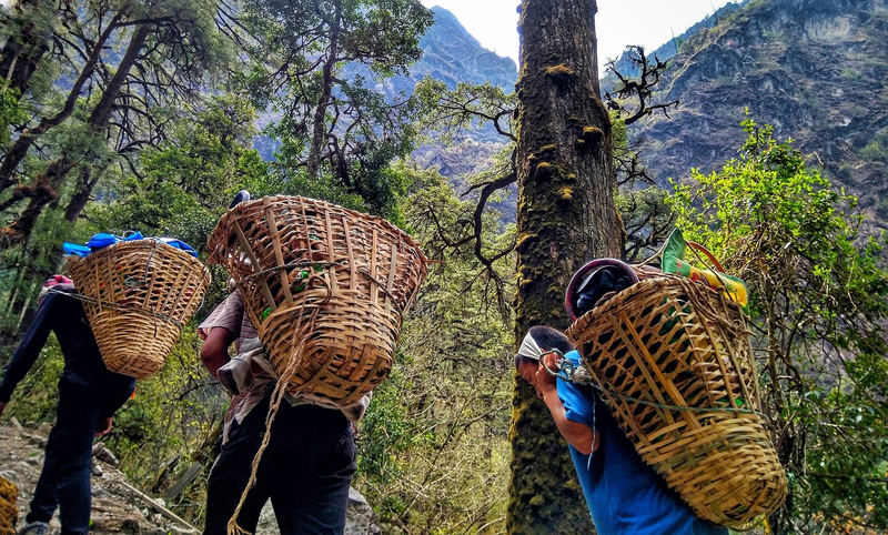
The landscape of Langtang Valley is the direct product of sustained glacial activity over hundreds of thousands of years. The valley's characteristic U-shaped cross-section — broad floor, steep flanking walls — is a textbook signature of glacial carving. The Langtang Khola river, which drains the entire valley system southward into the Trishuli, follows the ancient path of glacial retreat, cutting through moraines and alluvial fans that record successive stages of glacial advance and recession.
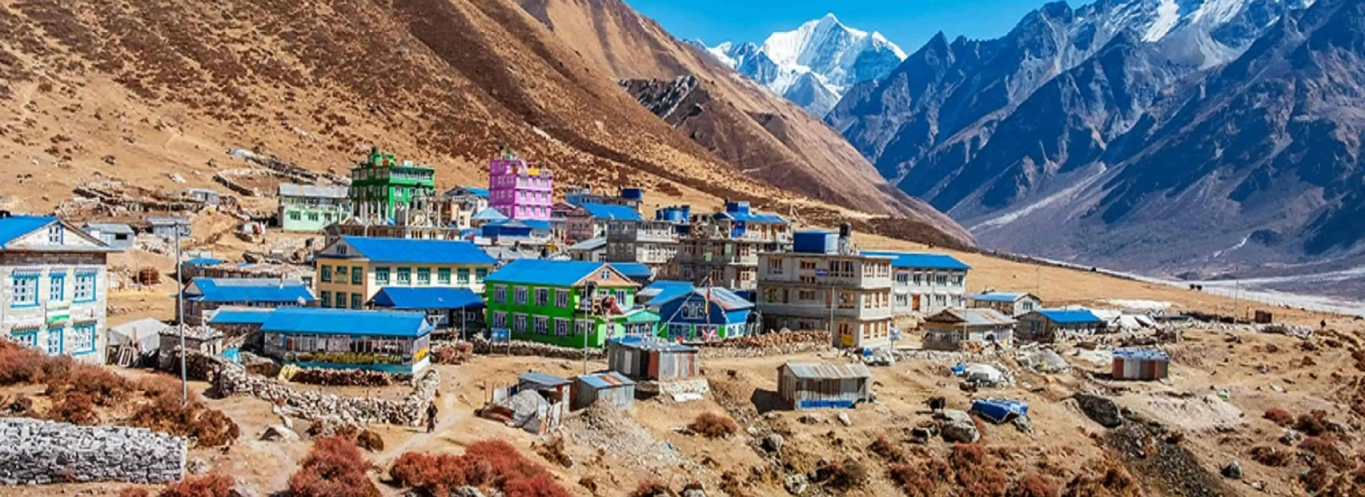
The valley floor at Kyanjin Gompa is a high-altitude glacial plain covered in yak pastures, stone walls, prayer flag lines, and ancient mani stone walls that mark the boundaries of sacred Buddhist space. This section of the valley opens into a wide, wind-scoured basin that feels fundamentally different from the enclosed forest corridor of the lower valley — the contrast between Lama Hotel (2,380 m) and Kyanjin Gompa (3,870 m) captures the entire ecological range of the valley within a single day's transition.
- Valley shape — Classic U-shaped glacial valley with broad floor and steep lateral walls
- Primary river — Langtang Khola, draining southward into the Trishuli River
- Lower valley character — Dense rhododendron and oak forest, bamboo groves, riverine trail
- Upper valley character — Open yak pastures, mani walls, prayer flags, glacial moraine terrain
- Landscape signature — Dark rock ridgelines, white ice faces, turquoise glacially fed streams
Above Kyanjin Gompa, the landscape becomes increasingly morainal and glacial. Terminal and lateral moraines of varying ages form the stepped terrain between the valley floor and the current glacier snouts. The contrast between the dark rock ridgelines, the white ice faces of the peaks, and the turquoise of glacially fed streams and ponds is the defining visual character of the upper Langtang landscape.
Visitors exploring this landscape on foot will find the Langtang Valley Trek the most direct way to experience the full geographical transition from subtropical forest to glacial basin across the valley's elevation range.
How Many Glaciers Are in Langtang Valley?
Langtang National Park contains approximately 17 glaciers, making it one of the most glacier-dense protected areas in Nepal outside of the Everest and Kanchenjunga regions. These glaciers are not uniform in size or character — they range from the massive, debris-covered trunk glaciers of the Langtang Lirung massif to smaller cirque glaciers tucked into the northern ridgeline at altitude.
The largest and most studied is the Langtang Glacier itself, which flows southward from the Langtang Lirung massif (7,234 m) and its neighbouring peaks. The glacier's snout sits above Kyanjin Gompa and is visible from the monastery — a significant and increasingly accessible reference point for glaciological monitoring and climate research.
- Langtang Glacier — largest and most studied; flows from Langtang Lirung (7,234 m)
- Lirung Glacier — steep, fast-retreating; subject of extensive published glaciological research
- Yala Glacier — well-monitored; accessible from the Yala Peak approach
- Kimshung Glacier — contributes to the mid-valley meltwater system
- Total count — approximately 17 named glaciers within Langtang National Park
Other notable glaciers in the Langtang watershed include the Lirung Glacier, which flows steeply off the southern face of Langtang Lirung and has been the subject of substantial glaciological research documenting rapid retreat over recent decades. The Yala Glacier and the Kimshung Glacier contribute to the broader Langtang ice system and feed the network of glacial meltwater streams that define the valley's hydrology.
The Langtang glacier system is scientifically significant far beyond Nepal. Research conducted here has contributed directly to global understanding of Himalayan glacier dynamics, debris-covered glacier behaviour, and the accelerating impact of climate change on high-altitude ice systems. The Langtang glaciers are currently losing mass faster than accumulation can offset — and the downstream hydrological consequences for the Trishuli River and the Narayani River system are well-documented in published glaciology literature.
- Himalayan glacier research from Langtang informs global climate models
- Debris-covered glacier dynamics are particularly well-studied here
- Glacier retreat in this watershed directly affects downstream river flow
- The Lirung Glacier is among Nepal's most-cited examples of accelerating glacial retreat
- Meltwater from Langtang glaciers feeds the Trishuli River, critical for millions downstream
Glacial Lakes in Langtang Valley
The Langtang watershed contains over 100 glacial lakes, ranging from small supraglacial ponds sitting directly on glacier surfaces to larger proglacial lakes that have formed in depressions left by retreating ice. This concentration of glacial lakes is one of the highest in the Nepal Himalayas and reflects the scale of historical and ongoing glacial retreat across the valley.
The most sacred and widely known glacial lake in the broader Langtang region is Gosaikunda (4,380 m), a high-altitude lake of deep religious significance in both Hindu and Buddhist traditions. Located within Langtang National Park above the Lauribina La ridge, Gosaikunda attracts tens of thousands of Hindu pilgrims annually — particularly during the Janai Purnima festival — making it one of Nepal's most culturally significant glacially formed water bodies.
- Total glacial lakes — over 100 in the broader Langtang watershed
- Gosaikunda — 4,380 m; Nepal's most sacred high-altitude lake; Hindu pilgrimage site
- Bhairav Kunda — sacred lake closely associated with Gosaikunda's religious landscape
- Upper valley ponds — visible from Kyanjin Ri (4,773 m); turquoise proglacial pools against grey moraine
- Lauribina La crossing — connects the Langtang lakes zone to the Helambu valley system
Trekkers who want to explore both the Langtang glacial landscape and the sacred lake region can combine these highlights on the Langtang Gosaikunda Trek, a 12-day route that links the valley's glacial scenery with the high-altitude pilgrimage lakes above the Lauribina La.
Other notable glacial lakes include Bhairav Kunda and a series of smaller unnamed proglacial ponds visible from the trail between Langtang Village and Kyanjin Gompa. The formation of new glacial lakes as glaciers retreat is one of the key environmental monitoring concerns in the region. The growth of proglacial lakes increases the risk of Glacial Lake Outburst Floods (GLOFs), which have historically caused catastrophic damage in Himalayan river valleys downstream.
- GLOF risk increases as retreating glaciers create new unstable lake basins
- Langtang's lake inventory is actively monitored by Nepal's Department of Hydrology and Meteorology
- International research institutions collaborate with Nepal on glacial lake mapping here
- The Gosaikunda lake complex is both a scientific monitoring site and an active pilgrimage destination
- From Kyanjin Ri's summit, the upper valley's full concentration of glacial lakes is visible at once
The Langtang Himalayan Range Explained
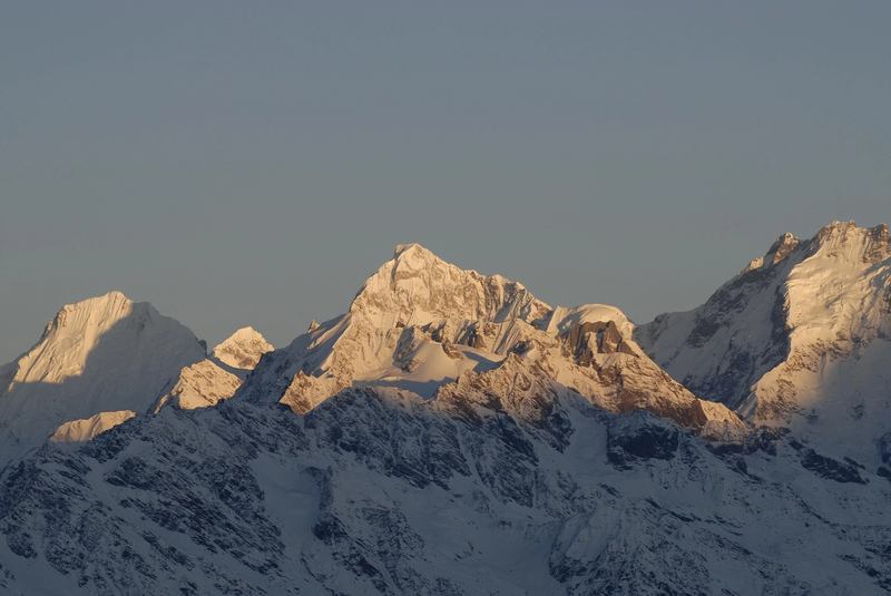
The Langtang Himal is a distinct subrange of the Himalayas running roughly east to west along the Nepal-Tibet border in Rasuwa District. It forms the northern wall of Langtang Valley and contains several significant peaks above 6,000 m, with the highest being Langtang Lirung at 7,234 m — the dominant landmark of the entire valley system.
The Langtang Himal is geologically distinct from the higher ranges to the east (the Mahalangur Himal, which contains Everest) and west (the Annapurna Himal). It belongs to the central Himalayan arc and sits at the convergence of the Indian and Eurasian tectonic plates — the same collision that has been building the Himalayas for approximately 50 million years and continues to raise these peaks by a few millimetres per year.
Major peaks of the Langtang Himal:
- Langtang Lirung — 7,234 m (highest peak; dominates the valley's northern skyline)
- Langtang Ri — 7,205 m (sits on the Nepal-Tibet border)
- Dorje Lakpa — 6,966 m (bisects the national park from west to southeast)
- Langshisa Ri — 6,412 m (glaciated summit in the upper valley)
- Gangchenpo — 6,387 m (prominent from the Kyanjin Gompa viewpoints)
- Naya Kanga / Ganja La Chuli — 5,844 m (popular trekking peak)
The range's proximity to Tibet gives it a markedly drier northern character compared to the heavily monsoon-influenced southern aspects. This creates a strong contrast in vegetation, snowfall, and glacial accumulation between the valley's two flanks — a contrast that is visible from the valley floor in the difference between the dense forested southern slopes and the barren, wind-scoured northern ridgelines above 4,500 m.
Climbers and high-altitude trekkers interested in crossing the Ganja La Pass (5,122 m) — one of the technical high passes that crosses the Langtang Himal — can explore that option through the Ganja La Pass Trek, a challenging 15-day route that traverses the ridge between Langtang Valley and the Helambu region.
Which District Does Langtang Lie In?
Langtang Valley lies primarily in Rasuwa District, Bagmati Province, Nepal. Rasuwa is one of Nepal's least populated districts, composed almost entirely of high-altitude terrain, alpine forest, and glacier-covered peaks. The district headquarters is at Dhunche — a small town that also serves as the checkpoint where Langtang National Park entry permits are issued for foreign trekkers.
Langtang National Park itself spans three districts — Rasuwa, Nuwakot, and Sindhupalchok — but the Langtang Valley proper, from Syabrubesi northward through the glacier zone, falls entirely within Rasuwa. The district's northern border runs along the Tibetan plateau, making it one of Nepal's most strategically positioned frontier districts.
- Primary district — Rasuwa, Bagmati Province
- Park districts — also extends into Nuwakot and Sindhupalchok
- District HQ — Dhunche (permit checkpoint for Langtang National Park)
- Northern border — Tibet Autonomous Region, China
- Historical significance — Traditional trans-Himalayan trade corridor between Nepal and Tibet
Rasuwa District shares its entire northern border with Tibet, and this geographic position has historically made it a corridor for trans-Himalayan trade, cultural exchange, and seasonal migration. The Tibetan cultural influence on Rasuwa's communities — visible in architecture, religious practice, dress, and language — is a direct product of this cross-border geography that has shaped the valley for centuries.
Culture and People of Langtang Valley
The Langtang Valley is home to the Tamang people, a Tibetan-origin Buddhist community whose presence in the region predates written records. The Tamang of Langtang speak a Tibetan dialect, practice Vajrayana Buddhism, and maintain a cultural landscape that reflects centuries of careful adaptation to extreme high-altitude environments.
The most striking cultural landmark in the valley is Kyanjin Gompa — an ancient Buddhist monastery at 3,870 m that has served as the spiritual and social centre of the upper valley community for generations. The gompa is surrounded by a cluster of stone-built tea houses and a working yak cheese factory, the latter representing the integration of traditional pastoral economy with the valley's contemporary life.
- Primary community — Tamang people (Tibetan-Buddhist origin)
- Language — Tamang dialect, closely related to Tibetan
- Religion — Vajrayana Buddhism; mani walls, prayer flags, and chortens throughout
- Cultural landmark — Kyanjin Gompa monastery (3,870 m)
- Traditional economy — Semi-nomadic yak herding and high-altitude pastoralism
The 2015 Gorkha earthquake struck Langtang with particular devastation. A massive ice and rock avalanche triggered by the quake destroyed virtually the entire village of Langtang, killing the majority of its inhabitants and most of its visiting trekkers. The rebuilt Langtang Village — visible today with its newer stone structures and memorial chortens — stands as both a tribute to community resilience and a permanent reminder of the valley's exposure to seismic and glacial hazard.
Traditional Tamang culture in Langtang is organised around semi-nomadic pastoralism — yaks and their crossbreeds are moved seasonally between lower winter pastures and high summer grazing grounds above 4,000 m. Prayer flags, mani walls, and chortens mark the boundaries between human and wild space throughout the valley, creating a religious geography that remains living and active rather than preserved for tourism.
- Yak herding remains the foundation of Tamang livelihoods in the upper valley
- Seasonal vertical migration between pastures is a defining cultural practice
- Memorial chortens in Langtang Village commemorate the 2015 earthquake victims
- The yak cheese factory at Kyanjin Gompa is one of the few operating high-altitude dairies in Nepal
- Tamang architectural traditions — stone-built, low-profile structures — are visible throughout the valley
For a deeper exploration of the Tamang culture and the everyday human experience of the valley, the Why I Chose Langtang Valley Over Everest piece on Himalayan Hero captures the cultural contrast between Langtang and Nepal's more crowded trekking routes.
Langtang National Park Ecosystem
Established in 1976 as Nepal's first Himalayan national park and the country's fourth protected area overall, Langtang National Park covers 1,710 square kilometres across Rasuwa, Nuwakot, and Sindhupalchok districts. Its northern boundary connects directly with the Qomolangma National Nature Preserve in Tibet, forming a transboundary conservation corridor of exceptional ecological value.
The park encompasses five distinct vegetation zones stacked by altitude — from subtropical forest at the valley entrance to permanent snow and ice above 5,000 m. This altitudinal layering produces a biodiversity density that is unusually high for a mountain ecosystem, supporting species from the subtropical lowlands and the high-alpine zone within a single protected area.
Vegetation zones by altitude:
- Subtropical (below 2,000 m) — schima, castanopsis, bamboo
- Temperate broadleaf (2,000–3,000 m) — oak, rhododendron, maple
- Subalpine (3,000–4,000 m) — birch, juniper, rhododendron
- Alpine shrubland (4,000–5,000 m) — dwarf shrubs, sedge grassland
- Nival zone (above 5,000 m) — permanent snow and glacial ice
The park is one of the best places in Nepal to encounter the red panda — a vulnerable species that inhabits the bamboo-rich temperate forest zones between approximately 2,200 and 3,500 m. Other significant wildlife includes snow leopard (above 4,000 m), Himalayan tahr, musk deer, Himalayan black bear, grey langur, and rhesus macaque. Over 250 bird species have been recorded within the park, including Nepal's national bird — the Himalayan monal.
- Red panda — vulnerable species; most frequently encountered between 2,200–3,500 m
- Snow leopard — elusive apex predator; inhabits the high-alpine zone above 4,000 m
- Himalayan tahr — commonly sighted on rocky slopes above Langtang Village
- Bird diversity — 250+ recorded species including the Himalayan monal (Nepal's national bird)
- Transboundary corridor — directly connected to Qomolangma National Nature Preserve, Tibet
Trekkers travelling through the park as part of the Langtang Helambu Trek traverse the full altitudinal range of the ecosystem — from subtropical forest near Syabrubesi, through the temperate zone where red pandas are most commonly encountered, up into the high-alpine landscape above Kyanjin Gompa.
What Does "Langtang" Mean?
The name Langtang is derived from the Tamang language. It is most commonly translated as referring to a "yak pen" or an enclosed valley where yaks graze — a meaning that reflects the pastoral character of the upper valley, where yak herding has been the primary livelihood of high-altitude communities for centuries.
Some linguistic interpretations connect "Lang" to a Tibetan word for yak and "tang" to a flat land or pasture — a compound meaning that describes the high grazing meadows above Kyanjin Gompa with considerable precision. Others suggest a more mythological origin connected to sacred landscape naming in the Tamang Buddhist tradition.
- Language of origin — Tamang (Tibeto-Burman language family)
- Most accepted translation — "yak pen" or high-altitude yak grazing pasture
- Component meanings — "Lang" (yak) + "tang" (flat land / pasture)
- Cultural anchoring — reflects the semi-nomadic pastoral tradition that has shaped the valley for centuries
- Alternative interpretations — some scholars connect the name to sacred landscape terminology in Tamang Buddhism
Regardless of its precise etymology, the name anchors the valley firmly in its pastoral and cultural identity — an identity that remains visible today in the yak herds that still graze the meadows above Kyanjin Gompa every summer.
Why Langtang Matters in Nepal's Himalayas
Langtang Valley occupies a unique position in Nepal's natural and cultural heritage for several converging reasons that extend well beyond its role as a trekking destination.
It is the closest major Himalayan wilderness to Kathmandu, giving it exceptional scientific accessibility for glaciological, ecological, and anthropological research. Decades of data collected here have contributed to the global scientific understanding of Himalayan glacier response to climate change — research that informs policy at the international level.
- Closest major Himalayan wilderness to Kathmandu — critical for scientific field access
- Contains Nepal's first Himalayan national park — a landmark in the country's conservation history
- Preserves a living Tamang Buddhist culture that survived the 2015 earthquake
- Sits at the headwaters of the Trishuli River — a critical water source for millions downstream
- One of the most actively monitored glacier systems in South Asia for climate change research
It contains Nepal's first Himalayan national park, representing a foundational moment in the country's conservation history and providing protected status to an ecosystem of extraordinary biodiversity across five altitudinal zones. It preserves a living Tamang Buddhist culture that represents one of Nepal's most intact indigenous mountain communities — a culture that survived the 2015 earthquake's devastation and continues to shape the valley's identity.
Most critically, Langtang sits at the hydrological headwaters of the Trishuli River system. The health of Langtang's glaciers is, in a very direct sense, connected to the long-term water security of a large portion of South Asia. The meltwater feeds a river network that supports millions of people in Nepal's Terai plains and contributes to the Ganges River catchment — making Langtang's glaciological health a matter of regional, not just local, significance.
For trekkers wanting to understand this landscape through direct experience, the Langtang Valley Trek difficulty guide on Himalayan Hero provides a detailed assessment of what the terrain demands and how to prepare for it.
Frequently Asked Questions
What is Langtang Valley?
Langtang Valley is a high-altitude glacial valley in north-central Nepal, located in Rasuwa District approximately 80 km north of Kathmandu. It lies within Langtang National Park — Nepal's first Himalayan national park — and is home to the Tamang Buddhist community, approximately 17 glaciers, over 100 glacial lakes, and the Langtang Himal subrange of the Himalayas.
Which district does Langtang lie in?
Langtang Valley lies primarily in Rasuwa District, Bagmati Province, Nepal. Langtang National Park, which encompasses the broader Langtang region, also extends into Nuwakot and Sindhupalchok districts.
How many glaciers are in Langtang Valley?
Approximately 17 glaciers exist within Langtang National Park. The most significant include the Langtang Glacier, Lirung Glacier, Yala Glacier, and Kimshung Glacier. The valley's glaciers are among the most actively monitored in Nepal due to their documented rapid retreat linked to climate change.
How many glacial lakes are in Langtang Valley?
The Langtang watershed contains over 100 glacial lakes, ranging from small supraglacial ponds to larger proglacial lakes formed by retreating ice. The most sacred is Gosaikunda at 4,380 m — a major Hindu pilgrimage destination within Langtang National Park.
What is the highest mountain in Langtang Valley?
Langtang Lirung at 7,234 m is the highest peak in the Langtang Himal and the highest point within Langtang National Park. It dominates the northern skyline of the valley and is visible from Kyanjin Gompa.
What does "Langtang" mean?
The name Langtang derives from the Tamang language and is most commonly interpreted to mean a "yak pen" or high-altitude yak grazing pasture — a direct reference to the semi-nomadic pastoral tradition that has defined the upper valley's human landscape for centuries.
What ethnic group lives in Langtang Valley?
The Tamang people are the primary ethnic group of Langtang Valley. A Tibetan-origin Buddhist community, the Tamang practice Vajrayana Buddhism, speak a Tibetan dialect, and maintain a traditional pastoral economy centred on seasonal yak herding.
When was Langtang National Park established?
Langtang National Park was established in 1976, making it Nepal's first Himalayan national park and the country's fourth protected area overall. It covers 1,710 km² across Rasuwa, Nuwakot, and Sindhupalchok districts.
What river flows through Langtang Valley?
The Langtang Khola is the primary river of Langtang Valley. It drains southward, joining the Bhote Koshi near Syabrubesi and flowing into the Trishuli River, which eventually joins the Narayani River — one of the major tributaries of the Ganges.
Is Langtang Valley affected by climate change?
Yes, significantly. The Langtang glaciers are retreating at a documented accelerating rate. The formation of new proglacial lakes, their expansion, and the increased risk of Glacial Lake Outburst Floods (GLOFs) are all direct consequences of warming temperatures in the region. Langtang is one of the most intensively studied sites for Himalayan climate change research in Nepal.