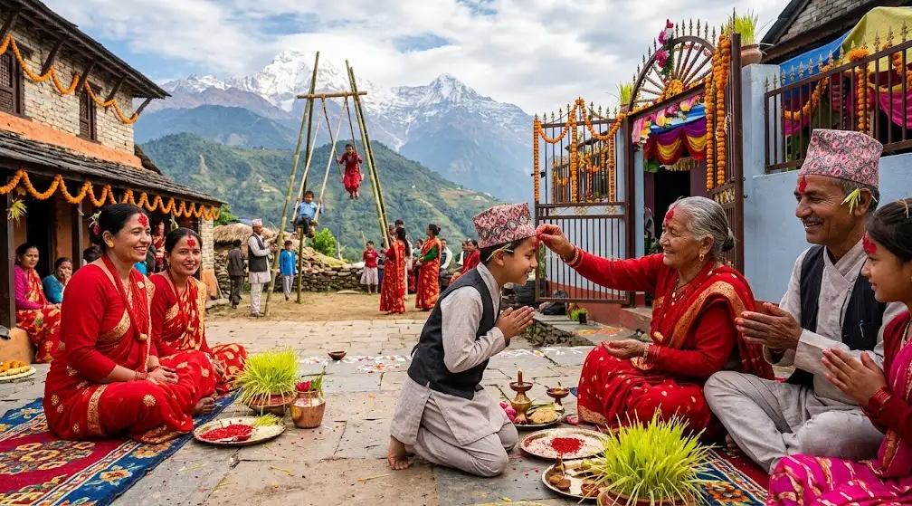
Imagine walking beneath towering Himalayan peaks, passing traditional Sherpa villages, and hearing prayer flags flutter in the mountain wind. Welcome to the Khumbu Valley, a remarkable region in northeastern Nepal where mountain scenery, Buddhist traditions, and everyday village life come together.
Home to Mount Everest and much of Sagarmatha National Park, the Khumbu Valley connects settlements such as Lukla, Namche Bazaar, Dingboche, and Lobuche. Its trails lead to famous destinations, including Everest Base Camp, Gokyo Lakes, and high mountain passes. Beyond trekking, visitors can explore ancient monasteries, learn about Sherpa culture, and experience life at high altitude. Understanding the region's geography, villages, seasons, and trekking routes helps you plan a rewarding journey suited to your interests and experience.
Where Is the Khumbu Valley in Nepal?
The Khumbu Valley lies in the Solukhumbu District of Koshi Province in northeastern Nepal, close to the border with Tibet, China. It forms part of the wider Everest region and is associated with the upper Dudh Koshi river system and the mountain valleys surrounding Mount Everest. The landscape includes steep-sided valleys, forested hills, alpine terrain, glaciers, and some of the highest mountain peaks on Earth. Much of the upper Khumbu falls within Sagarmatha National Park, a protected area established in 1976 and inscribed on the UNESCO World Heritage List in 1979.
Lukla serves as the main air gateway for many trekkers, although road access and transport arrangements depend on the starting point and current conditions. From Lukla, established trails connect Phakding, Namche Bazaar, Tengboche, Dingboche, and settlements farther up the valley. These routes pass through inhabited villages, suspension bridges, forests, and increasingly rugged mountain terrain. The Khumbu Valley is not the same as the Everest Base Camp route: it is a broader geographic and cultural region containing several trekking routes and communities.
Khumbu Valley at a glance
| Feature |
Details |
| Country |
Nepal |
| Province |
Koshi Province |
| District |
Solukhumbu |
| Main trekking gateway |
Lukla |
| Major commercial settlement |
Namche Bazaar |
| Protected area |
Sagarmatha National Park |
| Highest mountain in the region |
Mount Everest, 8,848.86 m |
| Main cultural association |
Sherpa communities and Tibetan Buddhist traditions |
| Popular trekking routes |
Everest Base Camp, Gokyo Lakes, Three Passes, and shorter Khumbu treks |
| Popular trekking seasons |
Spring and autumn |
For authoritative background information, consult the Nepal Tourism Board.
What Is the Geography of the Khumbu Valley Like?
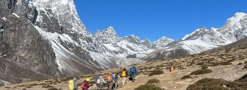
The geography of the Khumbu Valley changes significantly with elevation. Lower sections contain river valleys, forests, cultivated land, and settlements connected by established walking trails. Farther north, the terrain becomes more exposed, with steep mountain slopes, rocky paths, glacial valleys, and high alpine landscapes. The Dudh Koshi river system and its tributaries shape much of the region, while glaciers and surrounding peaks contribute to the distinctive landscape. Vegetation also changes with altitude, from woodland in lower areas to sparse alpine plants and largely rocky terrain at higher elevations.
These geographical differences influence how people live and how visitors travel through the region. Lower villages generally have more vegetation and agricultural land, while higher settlements depend more heavily on tourism, livestock, and supplies transported along the trekking routes. The terrain also affects walking times, accommodation, weather exposure, and access to services. A relatively short distance on a map can involve steep ascents, descents, and considerable physical effort, so trekkers should assess routes by elevation gain and terrain rather than distance alone.
How high is the Khumbu Valley?
The Khumbu Valley does not have one fixed elevation because it covers a large area with settlements at different heights. Namche Bazaar stands at approximately 3,440 meters, while Dingboche is around 4,410 meters, and Lobuche is approximately 4,940 meters. Everest Base Camp is commonly listed at about 5,364 meters, although the exact position of the seasonal camp and individual measurement sources can affect the stated elevation.
These elevation differences matter for both physical preparation and itinerary planning. Travellers moving from lower settlements to higher villages need time to adjust to the reduced oxygen availability at altitude. A sensible itinerary includes gradual ascent, appropriate acclimatization stops, and flexibility if symptoms of altitude illness develop. Read our guide to Everest Base Camp altitude and elevation for more information about elevation changes and their effects on trekkers.
Which Villages Are Found in the Khumbu Valley?
The villages of the Khumbu Valley serve different purposes along the trekking routes. Lukla is an important transport gateway, Phakding is a common first overnight stop, and Namche Bazaar is a major center for supplies, accommodation, and acclimatization. Farther along the trail, Tengboche is known for its monastery, while Dingboche and Lobuche serve as important stops for trekkers heading towards Everest Base Camp. Other settlements, including Khumjung and Pangboche, offer opportunities to understand local village life and explore cultural sites beyond the main commercial centers.
Although many visitors encounter these places as stops on a trekking itinerary, each settlement is part of a living region with its own community, services, and surroundings. The availability of shops, accommodation, medical assistance, and other facilities varies between villages and seasons. Travellers should plan carefully when moving into higher areas, where services become more limited and supplies may cost more to transport. The following table summarizes the main settlements and explains why they are relevant to visitors.
| Village or settlement |
Approximate elevation |
Main features |
Role in trekking |
| Lukla |
2,860 m |
Airport, lodges, shops, and transport services |
Starting or finishing point for many itineraries |
| Phakding |
2,610 m |
Riverside settlement and trekking lodges |
Common first overnight stop |
| Namche Bazaar |
3,440 m |
Markets, shops, accommodation, and viewpoints |
Main service and acclimatization center |
| Khumjung |
3,790 m |
Sherpa village life and cultural sites |
Village excursion from Namche |
| Tengboche |
3,860 m |
Tengboche Monastery and mountain scenery |
Major stop on the Everest Base Camp route |
| Pangboche |
Approximately 3,985 m |
Traditional settlement and monastery |
Stop on routes towards Dingboche. |
| Dingboche |
4,410 m |
High-altitude village and mountain views |
Common acclimatization stop |
| Lobuche |
Approximately 4,940 m |
Alpine landscape and trekking lodges |
Overnight stop before Gorak Shep |
Elevations are approximate and may vary slightly by map or measurement source. Not all settlements listed above lie on every Khumbu trekking itinerary.
What is Namche Bazaar known for?
Namche Bazaar is one of the most important settlements in the Khumbu Valley because it combines local commerce, tourism services, and access to nearby villages. Its hillside location creates a distinctive settlement pattern, with buildings arranged along sloping streets and paths. Visitors can find accommodation, restaurants, bakeries, shops, trekking equipment, and other services. The village also offers views of surrounding mountains when the weather is clear, and nearby trails lead to viewpoints and settlements such as Khumjung.
Namche is also a common place to spend an additional night while adjusting to altitude before continuing higher. Acclimatization walks can take visitors to nearby viewpoints or villages before they return to sleep at a similar elevation. This approach helps travelers plan a gradual ascent, although it cannot eliminate the risk of altitude illness. For visitors who want to experience the area without trekking all the way to Everest Base Camp, the Everest View Trek offers another route to explore the scenery and settlements around Namche.
Why should you visit Khumjung and Pangboche?
Khumjung is a Sherpa settlement above Namche Bazaar, surrounded by cultivated land, mountain slopes, and traditional buildings. It offers a quieter village experience than the main commercial center and can be included in an excursion from Namche or a longer trekking itinerary. Visitors can observe the layout of a Himalayan settlement, learn about local traditions, and explore cultural sites where access is permitted. The village is a useful stop for travellers who want to understand the communities behind the region's well-known trekking routes.
Pangboche lies farther along the route towards Dingboche and Everest Base Camp. It is known for its monastery, traditional settlement, and mountain surroundings. The village provides a different perspective on life at higher elevations, where the landscape becomes less forested and daily activities must adapt to colder conditions and a shorter growing season. Visitors should remember that Khumjung and Pangboche are inhabited communities, not simply sightseeing stops. Respect local customs, ask before photographing people, and follow any instructions at monasteries or other religious sites.
What Is Sherpa Culture Like in the Khumbu Valley?
Sherpa culture is an important part of the Khumbu Valley's identity. Sherpa communities have longstanding cultural and historical connections to the Himalayan region, and Tibetan Buddhist traditions influence religious practices, festivals, monasteries, and many aspects of community life. However, Sherpa identity should not be reduced to mountaineering or tourism. Families also participate in farming, trade, education, business, religious activities, and other occupations that support life in the region. Understanding this wider context helps visitors appreciate the Khumbu Valley as a home to communities rather than treating it only as a destination for adventure.
Tourism has created opportunities in guiding, porter services, accommodation, transport, food supply, and other local businesses. At the same time, increased visitor numbers can place pressure on waste management, natural resources, and community infrastructure. Travellers can contribute positively by using local services, following environmental guidelines, respecting religious traditions, and avoiding unnecessary waste. A more complete understanding of the region also comes from listening to local residents and qualified guides, whose experiences can explain how tourism and changing conditions affect village life.
What role do monasteries play in Khumbu culture?
Monasteries are important religious and community institutions in the Khumbu region. Tengboche Monastery is one of the best-known examples, attracting visitors because of its Buddhist significance and mountain setting. Other settlements have their own religious buildings, prayer wheels, mani walls, and chortens. These features are part of everyday religious practice and should not be treated simply as decorative elements along a trekking route. The history and role of each site can differ, so visitors should rely on local explanations rather than assuming that every monastery follows identical traditions.
When visiting religious places, travellers should dress respectfully, follow posted rules, and ask permission before photographing people or ceremonies. Where local custom calls for walking clockwise around a mani wall or chorten, follow that practice and avoid stepping over religious objects. Some buildings or rooms may be restricted to worshippers or community members, so entry should never be assumed. Travellers interested in visiting Tengboche as a destination in its own right can explore the Everest-Tengboche Trek to learn about a route focused on the monastery and its surrounding landscape.
What festivals and traditions can travellers experience?
Buddhist festivals and ceremonies form part of community life in the Khumbu Valley, although their timing and customs vary between villages and religious institutions. Some events follow the Tibetan lunar calendar, which means their dates can change from year to year on the Gregorian calendar. Travellers interested in attending a festival should confirm dates with local communities or reliable tourism sources before finalising their itinerary. They should also check whether an event is open to visitors, as not every ceremony is intended as a public attraction.
Traditional architecture, religious art, local food, and community gatherings can also provide insight into cultural life. Rather than expecting every village to offer the same experience, visitors should allow time to observe the differences between settlements and learn from local residents. Asking respectful questions, supporting locally owned businesses, and following community guidance can make these encounters more meaningful. A first-hand account from a Khumbu resident or experienced local guide would further help readers understand how cultural practices and village life have changed over time.
Which Trekking Routes Can You Follow Through the Khumbu Valley?
The Khumbu Valley contains several established trekking routes, each offering a different combination of scenery, village experiences, altitude, and physical demands. The Everest Base Camp route is the best known, but travelers can also explore Gokyo Lakes, cross high mountain passes, or choose a shorter itinerary focused on villages and viewpoints. Route selection should consider more than the destination: daily walking time, sleeping elevation, major ascents, acclimatization days, and seasonal conditions all affect the experience. A shorter trek may suit someone with limited time, while a longer circuit can provide access to more remote sections of the region.
Before choosing an itinerary, compare the route's total duration, highest overnight elevation, major ascents, and any high passes. Travellers should also understand whether a route follows established trails throughout or includes sections that require more demanding navigation and mountain experience. The itinerary should allow for rest and changes in conditions rather than relying on a rigid schedule. The following comparison outlines the main options, with links to relevant Himalayan Hero itineraries for readers who want to explore each route in more detail.
| Trekking route |
Typical duration |
General difficulty |
Main attraction |
| Short Khumbu Valley trek |
Several days |
Easy to challenging, depending on the itinerary |
Villages, cultural sites, and mountain views |
| Everest Base Camp trek |
Around 12 to 14 days |
Moderate to challenging |
Everest Base Camp and Kala Patthar |
| Gokyo Lakes trek |
Around 12 to 14 days |
Moderate to challenging |
High-altitude lakes and Gokyo Ri |
| Gokyo and Cho La Pass |
Depends on itinerary |
Challenging |
Gokyo Lakes, Cho La Pass, and possible connection to Everest Base Camp |
| Three Passes Trek |
Around 17 to 21 days |
Challenging to strenuous |
Three high passes and a wider Khumbu circuit |
Durations are planning estimates, not fixed standards. Starting points, side trips, acclimatization schedules, weather, and travel arrangements can change the total number of days.
What can you expect on the Everest Base Camp trek?
The Everest Base Camp trek typically begins in Lukla and continues through Phakding and Namche Bazaar before heading towards Tengboche, Pangboche, Dingboche, and Lobuche. From the upper settlements, trekkers generally continue towards Gorak Shep and Everest Base Camp. Many itineraries also include Kala Patthar, a viewpoint known for its views of Everest and surrounding peaks when visibility permits. The route combines village life, monasteries, suspension bridges, mountain scenery, and high-altitude walking, making it a varied introduction to the Khumbu region.
Although the route is well established, it is physically demanding because of its length and elevation. Trekkers should expect several hours of walking on many days, steep sections, uneven trails, and colder conditions at higher elevations. A well-planned itinerary includes acclimatization stops and time to respond to changing conditions. For a detailed itinerary, see the 14-day Everest Base Camp Trek. Travellers who prefer to avoid the usual flight access can also read the Everest Base Camp Trek by Road beginner's guide to understand the alternative approach and its planning considerations.
Why choose the Gokyo Lakes trek?
The Gokyo Lakes trek offers an alternative to the standard Everest Base Camp route by leading towards a series of high-altitude lakes and the settlement of Gokyo. The route passes through mountain villages and increasingly open terrain, with opportunities to view surrounding peaks and glacial landscapes. Gokyo Ri is a popular viewpoint for the lakes and surrounding mountains, although visibility depends on weather and seasonal conditions. The trek can provide a different perspective on the Khumbu region for visitors who want to explore beyond the busiest sections of the Everest Base Camp trail.
Some itineraries connect Gokyo with the Everest Base Camp route by crossing Cho La Pass. This creates a longer and more demanding journey that requires careful planning, suitable conditions, and appropriate experience. High passes can be affected by snow, ice, and poor visibility, so they should not be treated as simple walking shortcuts. Travellers interested in this landscape can compare the Gokyo Lakes Trek with the Gokyo and Cho La Pass Trek to understand the difference between a lake-focused itinerary and a route that crosses a high pass.
Is the Three Passes Trek suitable for everyone?
The Three Passes Trek is a demanding circuit through the Khumbu region that traditionally crosses Kongma La, Cho La, and Renjo La. Depending on the itinerary, it may also include Everest Base Camp, Kala Patthar, and Gokyo. The route provides access to a wider range of landscapes and viewpoints than many standard itineraries, but it also involves substantial elevation exposure, long walking days, and more challenging terrain. Snow, ice, and changing weather can affect high-pass crossings, so the route requires careful preparation and flexibility.
This trek is best suited to travelers with appropriate trekking experience, good physical preparation, sufficient time, and a realistic understanding of high-altitude risks. It is not simply a longer version of the standard Everest Base Camp trek, because the passes introduce additional challenges. Travellers should discuss route conditions with a qualified guide and avoid committing to a fixed schedule that leaves no room for weather delays. Read about the Everest Three Passes Trek to review the itinerary and understand whether it matches your experience and travel plans.
Can you explore the Khumbu Valley on a short trek?
A shorter Khumbu Valley trek can focus on Namche Bazaar, nearby villages, cultural sites, and mountain viewpoints. Depending on the available time and chosen route, visitors may include Khumjung or Tengboche without continuing to Everest Base Camp. This option allows travelers to experience the region's landscapes and community life while spending fewer days at high elevations. It can also suit people who prefer a less demanding itinerary, provided the route is chosen according to their fitness and experience rather than duration alone.
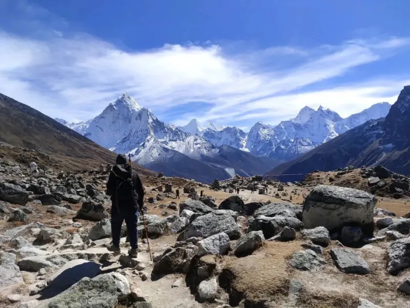
A short trek still requires preparation, because even lower Khumbu routes include steep ascents, uneven paths, and changes in elevation. Travellers should allow enough time to reach each overnight stop comfortably and should not remove essential acclimatisation time simply to fit more destinations into the schedule. Travellers with very limited time can also consider an Everest Mountain Flight for an aerial view of the Himalayas or an Everest Helicopter Tour for a different way to experience the mountain region. These options are not substitutes for a trek and offer a different type of visit.
What Is the Best Time to Visit the Khumbu Valley?
Spring and autumn are generally the most popular trekking seasons in the Khumbu Valley. Spring, from March to May, brings gradually warmer temperatures and seasonal changes in lower forests, while autumn, from September to November, often offers favorable trekking conditions after the main monsoon period. October is a popular month for the Everest region, although clear skies, comfortable temperatures, and trail conditions cannot be guaranteed. Conditions also differ between lower villages and high-altitude settlements, so the best time depends partly on the route and the traveller's priorities.
Winter and monsoon travel require more careful planning. Winter can bring very cold nights, snow, and ice, particularly at higher elevations and on exposed routes. During the monsoon, rain and cloud can affect visibility, trail conditions, and transport connections, although weather patterns vary across the region. Some routes may remain possible, but travelers should check current conditions before departing. For more detailed seasonal guidance, read the best time to do the Everest Three Passes Trek and compare the conditions with your chosen route.
| Season |
Months |
General conditions |
Planning considerations |
| Spring |
March to May |
Gradually warmer weather and seasonal flowers at suitable elevations |
Popular trekking period; high areas may retain snow |
| Autumn |
September to November |
Often favorable trekking conditions and mountain visibility |
Busy season; accommodation should be planned ahead. |
| Winter |
December to February |
Cold temperatures and possible snow or ice |
Check high-route conditions and service availability. |
| Monsoon |
June to August |
Increased rainfall and more cloud in many areas |
Prepare for wet trails, limited visibility, and transport changes. |
What Permits Do You Need to Visit the Khumbu Valley?
Permit and entry requirements depend on the route, protected areas visited, traveller category, and regulations in effect at the time of travel. For many established routes in the upper Khumbu, visitors need to consider Sagarmatha National Park entry requirements and the applicable local entry fee or permit arrangements administered by Khumbu Pasang Lhamu Rural Municipality. These are separate administrative considerations, so travelers should not assume that one payment automatically covers every requirement. Fees and procedures can change, making current official guidance more reliable than old blog posts or unverified package descriptions.
Before departure, confirm the requirements for your exact itinerary and check whether any additional permissions or guide arrangements apply. The relevant local authority or a reputable trekking operator can help clarify current local entry procedures. Travellers should also carry the required identification and permit documentation and follow instructions at official checkpoints. Verify the latest applicable rates before relying on a specific price.
What should you check before starting the trek?
- National park entry: Confirm the applicable Sagarmatha National Park entry requirements.
- Local entry arrangements: Check current Khumbu Pasang Lhamu Rural Municipality fees or permits.
- Route-specific rules: Ask whether your selected itinerary has additional requirements.
- Guide arrangements: Confirm the current regulations and whether a qualified guide is required for your route.
- Documentation: Carry the identification and permit records required for the journey.
- Emergency preparation: Understand the evacuation arrangements and insurance coverage included in your travel plan.
Requirements should be checked close to departure rather than copied from a previous year's itinerary. This is especially important when travelling independently or combining multiple routes. A trekking operator should be able to explain which permits are needed, who arranges them, and which costs are included in the package price. Clear documentation helps prevent confusion at checkpoints and makes it easier to understand your responsibilities before entering the protected area.
How Difficult Is Trekking in the Khumbu Valley?
Trekking difficulty depends on elevation, daily walking time, terrain, weather, route length, and individual health. A short trek around Namche Bazaar is very different from the Everest Base Camp trek, while a circuit crossing three high mountain passes involves additional demands. Even established trails can include steep stone steps, uneven ground, suspension bridges, and long ascents or descents. Trekkers should consider the overall itinerary rather than judging difficulty by distance alone, especially when the route includes several consecutive days of walking.
Altitude is one of the most important risks in the Khumbu Valley. As elevation increases, the body receives less oxygen with each breath, and altitude illness can affect people regardless of fitness. Symptoms may include headache, nausea, dizziness, and unusual fatigue. Worsening symptoms require stopping the ascent and seeking appropriate assistance; severe symptoms can require immediate descent and emergency care. Read our guide to acclimatizing for the Everest Base Camp trek for more information about gradual ascent and altitude precautions. Travellers should also consult a qualified medical professional before departure if they have health concerns.
What should you prepare for a Khumbu trek?
Preparation should cover physical fitness, suitable clothing, personal equipment, health, and contingency planning. Training that includes regular walking, uphill exercise, and longer outings can help prepare you for consecutive trekking days. However, fitness alone does not prevent altitude sickness, so a carefully designed itinerary remains essential. Clothing should be suitable for changing temperatures, including cold evenings, wind, and possible precipitation. Footwear should be comfortable and appropriate for uneven trails, while trekking poles may help some travelers manage steep ascents and descents.
Before leaving, check that your travel insurance covers trekking at the elevations on your itinerary and explicitly confirm whether helicopter evacuation is included. Carry essential personal medication, sun protection, water treatment where needed, and a way to manage unexpected delays. The availability of medical services varies along the route, and higher settlements have fewer facilities than larger centers. Travellers should discuss medical concerns with a qualified professional, follow advice from their guide, and be willing to change plans if symptoms or conditions make continuing unsafe.
Essential preparation checklist
- Train for consecutive walking days and sustained uphill sections.
- Pack warm layers, waterproof clothing, suitable boots, and sun protection.
- Allow time for gradual ascent and acclimatization.
- Confirm current route conditions with a qualified local guide.
- Check insurance coverage for high-altitude trekking and emergency evacuation.
- Carry required permits, identification, and emergency contact information.
- Keep contingency funds for unexpected transport or accommodation changes.
- Follow recognized altitude-safety guidance, and do not continue ascending when experiencing symptoms that may indicate altitude illness.
How Much Does a Khumbu Valley Trek Cost?
The cost of trekking in the Khumbu Valley varies according to itinerary length, group size, transport, accommodation, food, guide and porter arrangements, and included services. A shorter village trek may require fewer nights and less transport than an Everest Base Camp or Three Passes itinerary, but the total price still depends on how the trip is organized. Independent arrangements, private guided trips, and group packages may have different cost structures. Travellers should compare what each price includes rather than assuming that similar-looking itineraries offer the same services.
The main expenses usually include transport to the trekking area, accommodation, meals, park and local fees, guide or porter services, equipment, insurance, and personal spending. Costs can rise at higher elevations because supplies must be transported into remote settlements, and facilities may be more limited. Before booking, ask for an itemized breakdown and check the policy for changes, cancellations, and unexpected delays. Keep additional funds available for expenses not included in the package, and do not treat an old online price as a reliable estimate of current costs.
| Expense |
What affects the cost? |
What to confirm |
| Flights or road transport |
Route, season, and availability |
Included transfers and possible extra travel |
| Park and local fees |
Current rules and traveler category |
Which permits and fees are included? |
| Guide and porter services |
Duration, group size, and service level |
Staff arrangements and baggage limits |
| Accommodation |
Village, season, and room availability |
Room type and whether meals are included |
| Food and drinks |
Location and menu choices |
Included meals and personal expenses |
| Equipment |
Existing gear and rental requirements |
What you need to bring or rent |
| Insurance |
Coverage limits, activity, and elevation |
High-altitude trekking and helicopter evacuation |
| Contingency funds |
Unexpected delays or route changes |
Extra nights, transport, and emergency expenses |
When comparing packages, look beyond the headline price. A transparent itinerary should identify the services included, exclusions, permit arrangements, accommodation standard, and emergency support. Travellers should also check whether guides and porters are appropriately equipped and treated fairly. A lower price may not represent better value if essential services are excluded or the itinerary allows insufficient time for safe acclimatization. Choosing a suitable route and a transparent operator can make the overall experience more predictable.
How Can You Travel Responsibly in the Khumbu Valley?
Responsible travel helps protect the Khumbu Valley's natural environment while respecting the communities that live and work there. Visitors can reduce waste, use local businesses, follow designated trails, and avoid disturbing wildlife or damaging vegetation. Reusable bottles and suitable waste-management practices can help limit disposable packaging, although travelers should follow local guidance about drinking-water treatment and waste disposal. Because services become more limited at higher elevations, planning supplies carefully and carrying out waste where required can make a meaningful difference.
Cultural respect is equally important. Monasteries, chortens, mani walls, and prayer flags have religious significance, while homes, fields, and village paths are part of everyday life. Ask permission before photographing people, follow instructions at religious sites, and avoid entering private property without consent. Using locally owned accommodation and services can help tourism support the regional economy. Visitors should also remember that weather, transport, and trail conditions may change, so responsible travel includes following local advice and avoiding unnecessary risks simply to maintain a fixed itinerary.
Practical ways to be a responsible visitor
- Carry reusable items and reduce unnecessary packaging.
- Follow local waste-disposal rules and leave no rubbish on trails.
- Respect religious sites and follow local customs.
- Ask before photographing residents or ceremonies.
- Support local businesses where practical.
- Follow designated trails and avoid disturbing wildlife.
- Respect private homes, cultivated land, and community spaces.
- Listen to qualified local guides about route conditions and cultural practices.
Explore the Khumbu Valley with Himalayan Hero
The Khumbu Valley offers much more than a route to Everest Base Camp. Its villages, monasteries, mountain landscapes, and high-altitude trails provide different ways to experience Nepal's Everest region. From the commercial centre of Namche Bazaar to the quieter settlements of Khumjung and Pangboche, each part of the valley offers a different perspective on local life and the Himalayan environment.
Choosing the right itinerary depends on your available time, interests, physical preparation, and comfort with altitude. Travellers should compare routes carefully, confirm current permit requirements, and allow sufficient time for acclimatisation. Explore Himalayan Hero to learn more about trekking in Nepal and compare routes through the Everest region.
Frequently Asked Questions About the Khumbu Valley
Is the Khumbu Valley the Same as the Everest Region?
No. The Khumbu Valley is a smaller area within the wider Everest region of Nepal.
What Is the Main Village in the Khumbu Valley?
Namche Bazaar is the main trading and trekking centre, with shops, hotels, restaurants, and other services.
Can You Visit the Khumbu Valley Without Trekking to Everest Base Camp?
Yes. You can enjoy shorter treks around Namche Bazaar, nearby villages, monasteries, and mountain viewpoints.
Do You Need a Guide to Trek in the Khumbu Valley?
Guide rules depend on the route and current local regulations. Check the latest requirements before your trek.
What Is the Best Month to Visit the Khumbu Valley?
October is a popular month, while April and May are also good choices for trekking and mountain views.