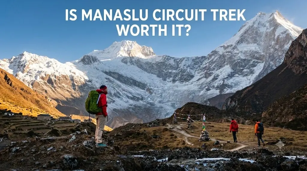
Ever wondered what Nepal's trails looked like before they became highways for trekkers? The Manaslu Circuit Trek circles the country's eighth-highest peak through restricted territory that most Himalayan trekkers never see. While the Annapurna and Everest regions draw crowds, this 14- to 17-day route delivers the same caliber of mountain scenery with a fraction of the foot traffic.
The Manaslu Circuit Trek highlights include the 5,160-meter Larkya La Pass crossing, ancient Tibetan Buddhist monasteries, glacial lakes, and villages where yak caravans still trade with Tibet. This guide covers the 15 must-see attractions that define the circuit, from Samagaun's Tibetan heritage to Birendra Lake's turquoise waters, plus practical comparisons with the Annapurna and Everest regions.
What makes the Manaslu Circuit Trek unique
The Manaslu Circuit Trek circles the world's eighth-highest mountain (8,163 meters), crossing Larkya La Pass at 5,160 meters while passing through remote Tibetan Buddhist villages that see far fewer visitors than the Annapurna or Everest regions. The route sits within a restricted conservation zone, meaning the Nepali government limits access through special permits and mandatory licensed guides. This permit system preserves both the cultural authenticity and environmental integrity of the region.
What sets Manaslu apart is the sense of genuine remoteness. While the Annapurna Circuit now shares sections with motorable roads and the Everest region sees thousands of trekkers daily during peak season, the Manaslu trail maintains the character of classic Himalayan trekking from decades past.
- Restricted conservation zone: Permit requirements limit trekker numbers and help preserve traditional village life along the route
- Full mountain circumnavigation: The trail forms a complete loop around Manaslu, offering constantly changing perspectives of the massif
- Tibetan Buddhist heritage: Villages like Samagaun and Samdo maintain strong cultural ties to Tibet, with active monasteries and traditional stone architecture
- Diverse ecological zones: Trekkers pass through subtropical jungle, rhododendron forests, alpine meadows, and high-altitude desert within a single journey
15 must-see attractions on the Manaslu Circuit Trek
The Manaslu Circuit delivers a concentrated sequence of natural and cultural landmarks that define high-altitude trekking in Nepal. From glacial lakes and 8,000-meter peaks to active monasteries and traditional Tibetan villages, each attraction reveals a different dimension of the Himalayan experience. These 15 highlights represent the essential stops that make the circuit one of Nepal's most rewarding mountain journeys.
Unlike the Everest region's focus on a single destination or the Annapurna Circuit's sprawling diversity, Manaslu's attractions follow a logical progression that mirrors the trek's physical journey. The lower valleys introduce you to Nepal's subtropical ecology and farming communities, the middle sections immerse you in Tibetan Buddhist culture, and the high-altitude zones deliver the raw mountain scenery that defines Himalayan trekking. Each highlight builds on the previous one, creating a narrative arc that reaches its climax at Larkya La before descending back into civilization.
Larkya La Pass at 5160 metres
The Larkya La is the physical and emotional climax of the entire trek. At 5,160 meters, this high pass demands an early morning start (typically around 3 or 4 AM) to cross before afternoon clouds roll in. The word "la" is Tibetan for pass.
From the summit, the panorama includes Himlung Himal, Cheo Himal, Kang Guru, and Annapurna II stretching across the horizon. The crossing takes 8 to 10 hours from Dharmasala to Bhimthang, making it the longest and most demanding day of the trek.
Mount Manaslu summit views
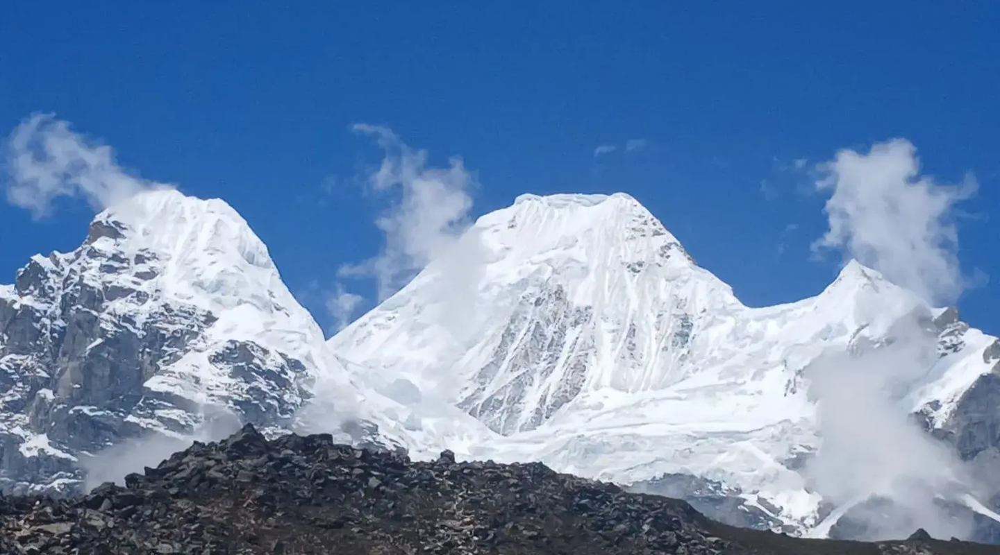
The 8,163-meter summit of Manaslu dominates the skyline for much of the upper circuit. The best views come from Samagaun village and the trail to Manaslu Base Camp, where the mountain's distinctive summit ridge appears close enough to touch. Japanese climbers made the first successful ascent in 1956, and the mountain's sheer scale becomes apparent only when you stand beneath it.
The peak's name derives from the Sanskrit word "manasa," meaning "mountain of the spirit." Unlike Everest's crowded viewing points, Manaslu's perspectives remain intimate and uncrowded, allowing trekkers to absorb the mountain's presence without jostling for position or competing for photographs.
Samagaun village and Tibetan heritage
Samagaun is the largest settlement on the circuit and serves as the primary acclimatization stop before ascending toward Larkya La. The village sits at 3,530 meters and features traditional stone houses, active yak herding, and a strong Tibetan Buddhist character.
Most itineraries include a rest day here, which proves essential for proper acclimatization before the high pass crossing. That time is well spent exploring the village, visiting nearby monasteries, or hiking to Birendra Lake or Manaslu Base Camp.
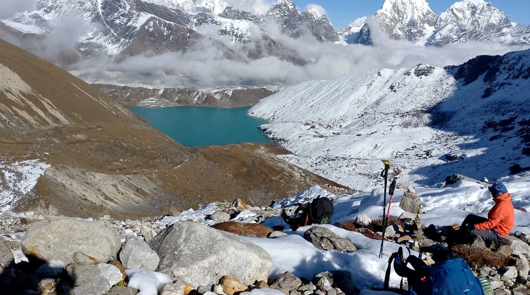
Birendra Lake below Manaslu Glacier
This glacial lake sits at approximately 3,450 meters, a 2 to 3 hour walk from Samagaun. Named after Nepal's late King Birendra, the turquoise waters reflect Manaslu's north face on calm mornings. The hike to Birendra Lake doubles as excellent acclimatization and offers some of the trek's best photography opportunities.
The trail to the lake climbs gradually through alpine meadows where yaks graze during summer months. Most trekkers make the journey during their rest day in Samagaun, returning by early afternoon to avoid cloud cover that typically rolls in after midday. The lake's color shifts from deep turquoise to pale blue depending on sunlight and glacial melt, creating different photographic conditions throughout the day.
Ancient Pungyen Monastery
Perched on a hillside above Samagaun, Pungyen Gompa offers both spiritual significance and sweeping mountain views. The monastery remains active, with resident monks maintaining daily prayer rituals. Visitors can observe the prayer halls, spin prayer wheels, and experience the meditative atmosphere that defines Buddhist practice in this region.
The 30-minute climb to the monastery from Samagaun village provides excellent acclimatization exercise during your rest day. Inside, butter lamps flicker before ancient thangka paintings, while the scent of juniper incense fills the prayer hall. The monastery's elevated position delivers unobstructed views across the valley to Manaslu's north face, making it a popular spot for sunrise photography when the first light strikes the summit.
Budhi Gandaki River gorge
The first half of the trek follows the Budhi Gandaki River through increasingly dramatic canyon scenery. "Budhi Gandaki" translates to "old Gandaki" in Nepali. The trail crosses numerous suspension bridges, passes thundering waterfalls, and navigates narrow gorge sections where the valley walls rise hundreds of meters on either side. This lower section provides a gradual introduction to the terrain before the high-altitude challenges ahead.
The gorge section between Jagat and Philim presents some of the trek's most dramatic river scenery, where the trail clings to cliff faces and crosses swaying bridges suspended above churning rapids. During monsoon season, waterfalls cascade directly onto the path, while spring brings snowmelt that transforms the river into a roaring torrent. These lower valleys remain warm and humid compared to the high-altitude sections ahead.
Remote Samdo village near Tibet border
Samdo sits at 3,860 meters, just a few kilometers from the Tibetan border. The village maintains active trading connections with Tibet, and yak caravans still pass through during summer months. The stone houses, prayer flags, and unhurried pace of life here offer a glimpse into traditional Himalayan existence that has changed little over centuries.
The village serves as the final settlement before the high-altitude wilderness leading to Larkya La. Most trekkers spend a night here for acclimatization, exploring the narrow lanes between stone dwellings or hiking toward the Tibetan border viewpoint. The thin air and stark landscape create an atmosphere of profound remoteness.
Dharmasala high camp at Larke Phedi
Dharmasala, also called Larke Phedi, is the final overnight stop before crossing Larkya La. At 4,460 meters, the basic stone lodge provides shelter in an otherwise stark alpine environment. Most trekkers arrive by early afternoon, eat dinner at sunset, and attempt to sleep before the 3 AM wake-up call for the pass crossing.
The accommodation here is deliberately spartan: shared dormitories with thin mattresses and no heating beyond the communal dining room stove. Sleep comes fitfully at this altitude, where the thin air and pre-crossing nerves keep most trekkers tossing through the night. The experience strips trekking down to its essentials: shelter, warmth, and the mental preparation required for the challenge ahead.
Manaslu Conservation Area wildlife
The Manaslu Conservation Area protects diverse wildlife across its ecological zones. Himalayan tahr and blue sheep (bharal) inhabit the higher slopes, while langur monkeys and barking deer appear in the forested sections. Birdwatchers may spot Himalayan griffon vultures, lammergeiers, and various pheasant species throughout the trek.
Wildlife sightings require patience and early morning timing when animals are most active. The red panda occasionally appears in the rhododendron forests between 2,500 and 3,500 meters, though encounters remain rare. Snow leopards inhabit the highest reaches near the Tibetan border, leaving paw prints in fresh snow but rarely revealing themselves to trekkers. The conservation area's protection has allowed these populations to recover from decades of hunting pressure.
Nubri Valley mountain settlements
The Nubri Valley contains a string of traditional villages, including Lho, Shyala, and Sama, inhabited by the Nubri people. The Nubri are a Tibetan-speaking ethnic group with distinct cultural traditions. The valley's relative isolation has preserved customs, dialects, and architectural styles found nowhere else in Nepal.
Walking through these settlements feels like stepping back in time. Stone houses with flat roofs cluster around ancient chortens, while villagers still practice traditional agriculture and animal husbandry methods unchanged for generations. The Nubri maintain strong spiritual connections to the surrounding peaks, which they consider sacred. Most families send at least one son to study at monasteries, continuing a tradition that has sustained Buddhist practice in this remote corner of the Himalayas for centuries.
Rhododendron and alpine forest zones
Spring trekkers (March to May) witness the rhododendron forests in full bloom, with red, pink, and white flowers covering entire hillsides. The ecological transitions are dramatic: subtropical vegetation gives way to temperate forest, then alpine meadows, and finally the barren high-altitude landscape near Larkya La.
The forest zones between 2,500 and 3,500 meters harbor the densest rhododendron concentrations, where ancient trees reach heights of 15 meters or more. These same forests provide habitat for red pandas, Himalayan black bears, and over 110 bird species. Autumn trekkers trade the floral displays for crystal-clear mountain visibility and golden larch forests that glow against the snow-covered peaks above.
Prayer flags and mani walls along the trail
Buddhist prayer flags and mani walls appear throughout the circuit. Mani walls are long stone structures carved with the mantra "Om Mani Padme Hum." Trail etiquette requires passing them on the left, keeping the wall on your right as you walk clockwise. These features mark the landscape as sacred space and remind trekkers they're walking through a living Buddhist culture.
The prayer flags themselves carry mantras and prayers that Buddhists believe are released into the wind with each flutter. Locals replace faded flags during auspicious occasions, creating layers of color that fade from vibrant to pale over months of exposure. The flags' five colors (blue, white, red, green, and yellow) represent the five elements, while their constant movement symbolizes the impermanence central to Buddhist philosophy.
Traditional teahouse lodge experience
Unlike camping treks, the Manaslu Circuit uses Manaslu Circuit tea house lodges. These are simple guesthouses offering basic rooms and communal dining areas heated by wood stoves. Meals center on dal bhat (lentils and rice), the staple dish of Nepal. The teahouse system creates natural opportunities for cultural exchange with local families who run these establishments.
The evening routine at these lodges follows a predictable rhythm that becomes comforting as the trek progresses. Trekkers gather around the central stove after sunset, sharing stories while lodge owners prepare dinner in adjacent kitchens. The communal atmosphere breaks down barriers between strangers, creating temporary communities that dissolve each morning as groups depart at different paces toward the next village.
Machha Khola to Jagat riverside trails
The early days of the trek pass through Machha Khola and Jagat, where the trail follows the river through lush vegetation and terraced farmland. These lower sections (1,000 to 1,400 meters) offer gentler walking before the serious climbing begins.
The riverside path between these villages showcases Nepal's agricultural heartland, where farmers cultivate rice, millet, and vegetables on impossibly steep terraces. Stone houses with slate roofs cluster along the trail, while suspension bridges provide regular crossings over the churning Budhi Gandaki. This section allows your body to adjust gradually to trekking rhythms before the altitude demands serious attention.
Himalayan blue sheep sightings near Larkya La
Blue sheep, called bharal locally, graze on the high slopes near Samdo and around Larkya La. These sure-footed animals blend remarkably well with the rocky terrain, though patient observers often spot herds in the early morning or late afternoon.
The Manaslu Circuit Trek highlights showcase Nepal's most authentic Himalayan experience, where each day reveals new dimensions of mountain culture and landscape. From the Larkya La Pass crossing to ancient monasteries and glacial lakes, these attractions form a concentrated sequence that defines high-altitude trekking. The circuit's restricted status preserves the traditional character that made Nepal's trails legendary, delivering the raw mountain experience that drew adventurers here decades ago.
Why Manaslu Circuit beats the Annapurna and Everest trails
The Manaslu Circuit beats the Annapurna and Everest trails because it delivers the same caliber of mountain scenery with far fewer trekkers on the path. The mandatory guide requirement and restricted permits keep numbers low, while the absence of motorable roads preserves the traditional trekking experience that made Nepal's trails legendary.
Best side trips from the Manaslu Circuit
The main circuit delivers exceptional mountain scenery, but several best side trips from the Manaslu Circuit trek extend the adventure into even more remote territory. These detours add days to your itinerary while revealing hidden valleys, sacred sites, and perspectives on the massif that most trekkers never witness. Each side trip requires additional permits and careful acclimatization planning.
The most popular extensions include the Manaslu Base Camp day hike, the week-long Tsum Valley detour, and the connection route to the Annapurna Circuit. These options transform the standard circuit into a more comprehensive Himalayan journey, though they demand extra time, fitness, and budget.
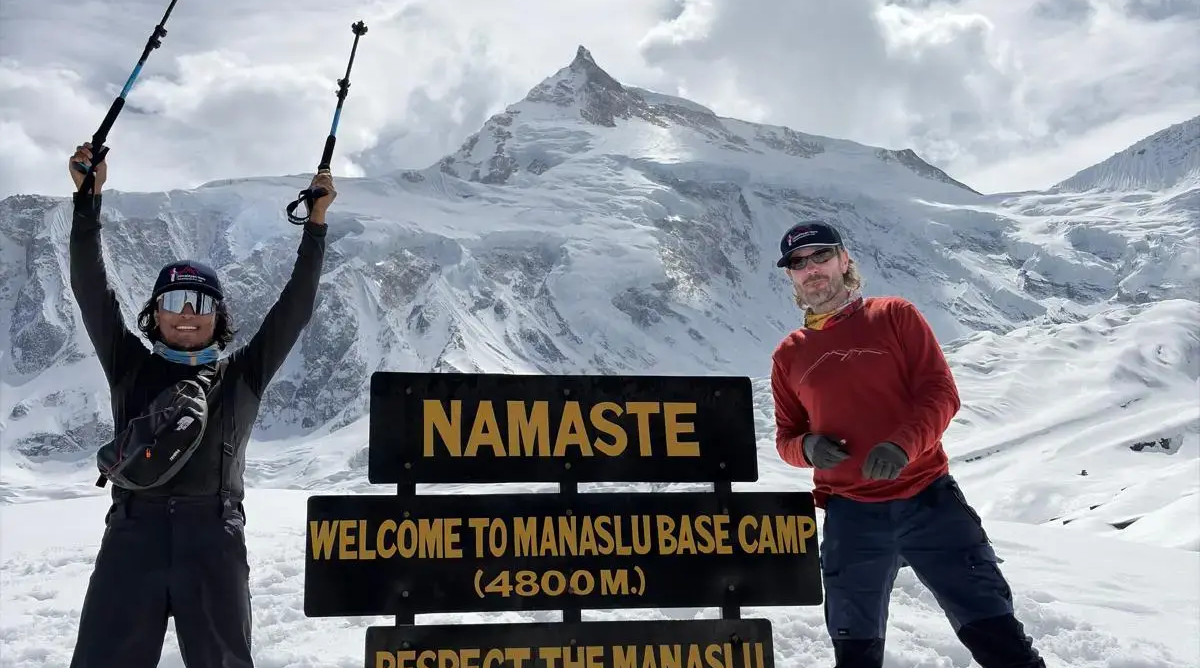
Manaslu Base Camp day hike
The hike to Manaslu Base Camp (4,800 meters) from Samagaun takes 6 to 8 hours round trip and provides close-up views of the glacier and icefall. This excursion works perfectly as an acclimatization day before continuing toward Larkya La.
Tsum Valley extension trek
The Tsum Valley, known as the "hidden valley of happiness," branches off the main circuit near Chumling. This extension adds 7 to 9 days and visits sacred Buddhist sites, ancient monasteries, and villages that remained closed to outsiders until 2008.
Annapurna Circuit connection route
After descending from Larkya La to Dharapani, trekkers can continue directly onto the Annapurna Circuit rather than returning to Kathmandu. This combination creates one of Nepal's grand traverses, though it requires 25 to 30 days total.
Plan your Manaslu Circuit Trek with local experts
The mandatory guide requirement makes choosing an experienced operator essential. Licensed agencies handle the complex permit process, including the Restricted Area Permit (RAP), Manaslu Conservation Area Permit (MCAP), and Annapurna Conservation Area Permit (ACAP) required for the exit through Dharapani.
- Permit processing: Restricted area permits require booking through a registered agency at least several days before departure
- Local guide expertise: Guides familiar with the route know teahouse owners, current trail conditions, and can communicate in local dialects
- Acclimatisation planning: Well-designed itineraries include rest days at Samagaun to reduce altitude sickness risk
- Safety protocols: Reputable operators carry first-aid supplies, monitor for altitude symptoms, and have evacuation procedures in place
Explore our Manaslu Circuit Trek
FAQs about Manaslu Circuit Trek highlights
How many days does the Manaslu Circuit Trek take to complete?
The standard circuit takes 14 to 17 days depending on acclimatization needs and pace. Adding the Tsum Valley extension increases the total to 21 to 25 days.
What is the best season to see Manaslu Circuit highlights?
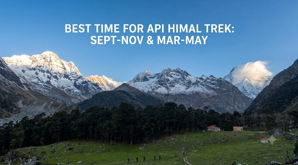
Autumn (September to November) offers the clearest skies and most stable weather. Spring (March to May) brings warmer temperatures and rhododendron blooms, though visibility can be hazier.
Is the Manaslu Circuit Trek harder than the Annapurna Circuit?
The two treks are comparable in difficulty, though Manaslu's more remote terrain, longer daily stages, and less developed facilities make it slightly more demanding overall.
Can trekkers complete the Manaslu Circuit without a guide?
No. Guides are legally mandatory in this restricted area. Solo or independent trekking is not permitted by the Nepali government.
What camera gear works best for photographing Manaslu Circuit highlights?
A versatile setup with a wide-angle lens (16 to 35mm) for landscapes and a telephoto (70 to 200mm) for wildlife and distant peaks covers most situations. Extra batteries are helpful since cold temperatures drain them quickly at altitude.