Where does the Manaslu Circuit Trek start? For many trekkers, the answer is Machha Khola, a riverside settlement in Gorkha that has become the practical gateway to the Manaslu region. After the long road journey from Kathmandu, Machha Khola marks the point where buses and jeeps give way to walking trails, suspension bridges, steep hillsides, and the quieter mountain landscape.
In this guide, we’ll look at Machha Khola as more than just an overnight stop. In this para, you’ll discover its location, elevation, road access, weather, transport options, and what to expect on the Machha Khola to Jagat section, while also understanding why this village works as the transition point between Nepal’s road journey and the real Manaslu Circuit trekking experience.
Where Is Machha Khola in Nepal?
Machha Khola is a riverside settlement in Gorkha District of Gandaki Province, Nepal, located along the Budhi Gandaki River. It lies on the lower approach to the Manaslu region and is commonly used as a road-accessible gateway for trekkers entering the Manaslu Conservation Area.
From Kathmandu, Machha Khola is reached by road through Nepal’s hilly countryside, with Arughat and Soti Khola among the better-known settlements along the approach. After Machha Khola, the route continues through places such as Khorlabesi and Jagat before entering deeper into the Manaslu trekking landscape.
Is Machha Khola in Gorkha?
Yes, Machha Khola is in Gorkha District of Gandaki Province, Nepal. Its location along the Budhi Gandaki River makes it closely connected with the lower Manaslu trekking route.
Machha Khola is commonly associated with the Manaslu Circuit because it is one of the main road-accessible settlements used by trekkers before continuing toward Jagat and the higher Manaslu villages. For many itineraries, it is the point where a long vehicle journey starts turning into a genuine Himalayan trekking experience.
Why Is Machha Khola Important for the Manaslu Circuit Trek?
Machha Khola is important because it serves as a practical roadhead and common starting point for the walking section of the Manaslu Circuit Trek. Trekkers can reach the settlement by local bus or jeep and then continue on foot beside the Budhi Gandaki River toward Jagat, Deng, Namrung, and Samagaon.
The first walking stages from Machha Khola introduce trekkers to the character of the Manaslu route, with suspension bridges, forest trails, river valleys, waterfalls, and gradually rising terrain. That combination of road access and immediate trekking terrain is what makes Machha Khola such a useful starting point for the Manaslu Circuit.
How High Is Machha Khola?
Machha Khola sits at roughly 900 meters (2,950 feet) above sea level, making it a relatively low-altitude starting point for the Manaslu Circuit Trek. Different sources commonly place its elevation between 869 m and 930 m, mainly because GPS readings can vary and measurements may be taken from different points within the village. Machha Khola is usually the first overnight stop after driving from Kathmandu, although some itineraries include a stop around Soti Khola depending on road conditions and the day's schedule. The village lies beside the Budhi Gandaki River, which stays close to the trail for much of the first few days.
Why Starting Low Is Useful for Acclimatization
Beginning the trek at around 900 m allows your body to gain altitude gradually instead of making a sudden jump into the high mountains. This gradual ascent helps reduce the risk of Manaslu altitude sickness as you move toward higher elevations. The lower section also gives trekkers time to settle into the walking routine, eat properly, sleep well, and allow guides to observe how they are responding to the increasing altitude. It can be tempting to rush through the lower villages because the air is still relatively comfortable, but these early days are an important part of the acclimatization process.
The elevation increases steadily after Machha Khola, reaching around 1,340 m at Jagat, then continuing through Deng, Namrung and Lho before reaching Samagaon at about 3,530 m. The landscape changes with the altitude too, moving from green, warm river valleys toward more open alpine surroundings. Once the trek rises above 3,000 m, altitude becomes a much greater concern, which is why a rest and acclimatization day is commonly included around Samagaon before heading toward Samdo and Larkya La Pass at approximately 5,106 m. Trekkers who feel strong at Machha Khola should not assume they can maintain the same pace at higher elevations.
Machha Khola Height Compared With Kathmandu
Seeing Machha Khola alongside the major points of the Manaslu Circuit makes the scale of the climb easier to understand. Kathmandu is around 1,400 m, while Machha Khola is only about 900 m, meaning the journey by road can actually take you lower before the real ascent begins. From there, the route gradually climbs through Jagat, Namrung and Samagaon before reaching the highest point at Larkya La Pass.
| Place |
Approx. elevation |
| Kathmandu |
1,400 m |
| Machha Khola |
~900 m |
| Jagat |
~1,340 m |
| Namrung |
~2,630 m |
| Samagaon |
~3,530 m |
| Larkya La Pass |
~5,106 m |
The main takeaway is the 4,200 m-plus elevation gain from Machha Khola to Larkya La Pass. This gradual change is one of the reasons the Manaslu Circuit is designed around several trekking days and acclimatization periods rather than a rapid climb.
How Do You Get From Kathmandu to Machha Khola?
Getting from Kathmandu to Machha Khola usually involves a 7 to 10-hour road journey by jeep or bus, as there is no railway or flight connection to Machha Khola. The route heads west from Kathmandu through Dhading Besi, Arughat and Soti Khola before reaching Machha Khola, around 160 km from the capital. For most trekkers, this drive is considered the first travel day of the Manaslu Circuit Trek, rather than a separate sightseeing journey.
The road becomes part of the adventure itself. After Dhading Besi, the smoother sections gradually turn into rough, winding mountain roads passing through small villages, terraced farmland and narrow river valleys along the Budhi Gandaki River. Because road conditions can change, especially during the monsoon, choosing between a jeep and bus can make a noticeable difference to both comfort and travel time.
Kathmandu to Machha Khola by Jeep
A private or shared jeep is the most common transport choice for trekkers traveling from Kathmandu to Machha Khola. Jeeps are better suited to the rougher sections of the road because of their higher ground clearance and stronger suspension. A private jeep also gives your group more flexibility for stops, while a shared jeep is cheaper but normally follows a fixed departure schedule and leaves once enough seats are filled.
The journey by jeep generally takes around 8 to 10 hours, although this should only be treated as an estimate. Rain, road construction, traffic, landslides and rough sections beyond Dhading Besi can all extend the journey. If you are traveling during the monsoon or immediately after heavy rainfall, it is sensible to allow extra time rather than planning around an exact arrival hour.
Kathmandu to Machha Khola by Bus
A public bus is generally the more budget-friendly option, although the journey can be longer and less comfortable than traveling by jeep. Depending on the current transport arrangement, travelers may need to take a bus toward the Gorkha, Arughat or Soti Khola area and then continue toward Machha Khola by another local bus or shared vehicle. Services can change according to road conditions and the season, so current departure information should be confirmed before leaving Kathmandu.
Bus travel can take 9 to 10 hours or longer, particularly when you include frequent stops, transfers and slower driving on rough mountain roads. It may not be the easiest option with a large trekking backpack, but for travelers focused on saving money and experiencing local transport, it remains a practical choice.
Can You Take a Direct Bus From Kathmandu to Machha Khola?
A direct bus may not operate consistently throughout the year, as routes, departure points and services can change with road conditions and the season. Many travelers therefore travel toward Soti Khola or Arughat first and continue to Machha Khola by a connecting bus or shared jeep. Rather than relying on an old timetable found online, check the current service shortly before your trip.
If you are traveling as part of an organized Manaslu Circuit Trek, your trekking agency or guide can usually arrange or confirm the latest transportation option from Kathmandu. This is particularly useful during periods of heavy rain, when road conditions can change quickly.
How Long Does It Take to Travel From Kathmandu to Machha Khola?
Most travelers should allow around 7 to 10 hours for the journey from Kathmandu to Machha Khola, but there is no guaranteed travel time. The actual duration depends heavily on the condition of the mountain road and the type of vehicle being used. During good conditions, the journey may stay within the expected range, while rain, road damage or delays can make it considerably longer.
The main factors affecting the journey include road conditions, weather, traffic, landslides, vehicle type and stops along the way. For this reason, it is better to treat Kathmandu to Machha Khola as a full travel day and keep some flexibility in your itinerary. If you are planning a Manaslu Circuit Trek, avoid scheduling an important flight or other fixed activity immediately after the drive, as delays are possible.
What Is the Road From Kathmandu to Machha Khola Like?
The road from Kathmandu to Machha Khola starts on relatively smooth paved roads and gradually becomes rougher as it moves toward the Manaslu region. The first section toward Dhading Besi is mostly paved, but after that, the route changes into a mix of gravel, dirt and rocky mountain roads through Arughat and Soti Khola. The final sections can be narrow, dusty and winding, so trekkers should expect a bumpy ride rather than a typical highway journey.
During the dry season, dust can be noticeable, particularly around the rougher sections, while the monsoon months can bring mud, slippery roads and occasional landslides. Road construction and changing conditions can also cause short delays or temporary changes to the route. Because of this, a jeep is generally more practical than a standard bus, especially on rough sections where higher ground clearance makes it easier to handle uneven and muddy roads. Traveling during daylight and allowing extra time is also a good idea.
Is the Kathmandu to Machha Khola Road Difficult?
The Kathmandu to Machha Khola road is manageable but tiring, rather than extremely difficult. The paved section near Kathmandu is generally comfortable, while the journey becomes more demanding after Dhading Besi because of bumps, narrow turns, dust and rough mountain sections. The condition of the road also depends heavily on the season, with dry autumn weather usually providing a smoother journey than periods of heavy monsoon rain.
The long drive itself can be tiring, and travelers who are prone to motion sickness may find the winding sections uncomfortable. Taking appropriate motion-sickness medication before the journey, carrying water and keeping small snacks within reach can make the ride easier. A private or shared jeep is usually the more comfortable choice when road conditions become rough.
Is It Safe to Travel to Machha Khola by Road?
Traveling by road to Machha Khola is generally safe when you use an experienced local driver and travel according to the road and weather conditions. Drivers familiar with the route understand the narrow turns, rough surfaces and difficult sections, which is particularly important on the road beyond Dhading Besi. Traveling during daylight is preferable because visibility is better on narrow mountain roads and around blind corners.
Weather is the main factor that can change the safety and condition of the journey. Heavy monsoon rain can increase the possibility of muddy sections and landslides, so checking the latest road conditions before leaving Kathmandu is sensible. With a reputable transport provider, an experienced driver and enough flexibility in the schedule, the journey to Machha Khola is a normal and manageable part of the Manaslu Circuit Trek.
What Is Machha Khola Bazar Like?
Machha Khola Bazar is a small mountain settlement along the Budhi Gandaki River, rather than a large town with extensive facilities. It has developed around the needs of trekkers and local communities, so you can find basic guesthouses, local restaurants, small shops and the everyday essentials needed for the next few days of the Manaslu Circuit Trek. Accommodation is generally simple, with basic rooms and shared facilities, while electricity is available for charging in many places, although facilities can be more limited than in Kathmandu.
You may also find some trekking supplies and snacks in Machha Khola, along with bottled water, drinks and other last-minute necessities. Mobile connectivity can be available in parts of the area, but coverage and internet quality should not be treated as reliable throughout the route. Machha Khola is best viewed as a last convenient place to check your supplies and prepare for the more remote sections ahead, rather than somewhere to expect city-style shopping or services.
Can You Buy Trekking Supplies in Machha Khola?
You can buy some basic trekking supplies in Machha Khola, but the selection is limited compared with Kathmandu. Small shops may carry snacks, drinks, toiletries, batteries and a few basic trekking necessities, but you should not depend on Machha Khola for specialized equipment, proper trekking clothing or medication that you may need during the trek. It is better to purchase important gear and personal supplies in Kathmandu before starting the journey.
Use Machha Khola mainly for last-minute items, such as snacks, water, simple toiletries or other small necessities you may have forgotten. If you need trekking poles, quality rain gear, warm layers, specific medicines or technical equipment, arrange these before leaving Kathmandu.
Are There ATMs in Machha Khola?
You should not rely on an ATM or card payment in Machha Khola. Banking facilities are very limited in remote Manaslu settlements, and even where digital payment or connectivity is available, it may not always work reliably. Carry enough Nepalese rupees in cash from Kathmandu to cover accommodation, meals, drinks, charging, snacks, transport and other personal expenses throughout the trek.
It is also wise to carry some extra cash as a buffer because the Manaslu Circuit passes through increasingly remote areas where withdrawing money later may not be possible. Planning your cash before leaving Kathmandu is much easier than trying to find an ATM once you are already on the trail.
What Is Machha Khola Weather Like?
Machha Khola weather is generally warmer than the higher parts of the Manaslu Circuit because the village sits at around 900 m. Spring and autumn usually bring comfortable trekking conditions, summer and monsoon are warmer and wetter, while winter has cooler days and colder nights. Rain can make the road from Kathmandu rougher, muddy, and slower during the monsoon. For a detailed seasonal guide, see our best time to visit Manaslu Circuit Trek.
Is Machha Khola Hotter Than the Higher Manaslu Villages?
Yes, Machha Khola is generally hotter than higher villages such as Namrung and Samagaon. During the day, the lower valley can feel warm while walking, but temperatures drop as you gain altitude. This means you do not need to wear your heaviest mountain layers from the first day.
What Should You Wear in Machha Khola?
Light, breathable clothing is usually best for daytime walking in Machha Khola. A T-shirt or lightweight base layer with trekking trousers works well, while a fleece or light jacket can be added during cooler mornings and evenings. Keep a waterproof jacket easily accessible because rain is possible, especially during the monsoon. As you climb higher, gradually switch to warmer layers.
What Is the Machha Khola to Jagat Trek Like?
The Machha Khola to Jagat trek is usually around 22 km and takes about 6 to 7 hours, depending on the route, road conditions and walking pace. The trail follows the Budhi Gandaki River through forested hills, small settlements, waterfalls, rocky sections and several suspension bridges. You gradually gain elevation from Machha Khola at around 900 m to Jagat at about 1,340 m, with plenty of ups and downs along the way. Tea houses are available in villages for meals, drinks and overnight stays.
Unlike the higher Manaslu sections, this part of the trek is still relatively warm and green. You will spend much of the day close to the river, crossing bridges and passing through small villages before reaching Jagat. The combination of heat, uneven terrain and repeated climbs can make the day feel longer than the elevation gain suggests, but it is also a scenic introduction to the Manaslu Circuit.
Is Machha Khola to Jagat Difficult?
The Machha Khola to Jagat section is moderately difficult rather than extremely challenging. The altitude is still low, so altitude sickness is generally less of a concern, but the trail has frequent ups and downs, rocky sections, bridges and some steep stretches. Warm weather and a long walking day can also make it tiring, especially if you are not used to trekking.
What Comes After Jagat?
After Jagat, the Manaslu Circuit continues through Deng, Namrung and Samagaon before reaching Samdo and the challenging Larkya La Pass, at around 5,106 m. From the pass, the route descends toward Dharapani in the Annapurna region. As you move from Jagat toward Samagaon, the landscape gradually changes from warm river valleys and green forests to cooler alpine terrain and high mountain scenery.
How Many Days Do You Need for the Manaslu Circuit From Machha Khola?
The Manaslu Circuit from Machha Khola typically takes around 10 to 14 trekking days, depending on the itinerary and pace. The total duration can change based on acclimatization days, the Larkya La Pass crossing, transportation, side trips, weather and road conditions. Trekkers starting from an earlier point may need additional days, while those beginning directly from Machha Khola can follow a shorter itinerary.
A realistic itinerary should allow enough time to adjust to increasing altitude rather than focusing only on completing the route quickly. A common progression is Machha Khola → Jagat → Deng → Namrung → Samagaon, with an acclimatization day around Samagaon before continuing toward Samdo, Larkya La and Dharapani. Weather or road delays can also add an extra day, so keeping some flexibility is useful.
Can You Start the Manaslu Circuit Directly From Machha Khola?
Yes, Machha Khola is a common starting point for the Manaslu Circuit Trek. Improved road access has allowed trekkers to travel farther up the Budhi Gandaki Valley by jeep or bus, so many modern itineraries no longer begin the walking section from Soti Khola. Starting from Machha Khola also reduces the number of trekking days while still allowing you to experience the main Manaslu Circuit route.
From Machha Khola, the walking route continues toward Jagat and then deeper into the Manaslu region. The exact starting point can vary depending on current road conditions and the itinerary arranged with your trekking agency.
What Permits Do You Need for the Manaslu Trek From Machha Khola?
Starting the Manaslu Circuit Trek from Machha Khola requires the Manaslu Restricted Area Permit (RAP), Manaslu Conservation Area Permit (MCAP), and Chumnubri Permit, officially issued by Tsum Nubri Rural Municipality, which costs NPR 1,000. Depending on the route, the Annapurna Conservation Area Permit (ACAP) and TIMS may also be required. For a complete breakdown of requirements and fees, see our Manaslu Circuit Trek permit guide.
Trekkers must also follow restricted-area rules, including traveling with a licensed guide and an eligible group through a registered trekking agency. Permit fees and seasonal rules can change, so it is best to confirm the latest requirements before starting your trek.
Can You Trek the Manaslu Circuit Alone From Machha Khola?
No, you generally cannot trek the Manaslu Circuit independently from Machha Khola. Because the route enters the Manaslu Restricted Area, trekkers must follow the group and licensed-guide requirements and obtain permits through a registered trekking agency. Starting from Machha Khola does not remove these restrictions.
What Should You Know Before Spending Your First Night in Machha Khola?
Before arriving in Machha Khola, prepare for a simple mountain stay rather than city-style facilities. Carry enough Nepalese cash, charge your phone and power bank in Kathmandu, download offline maps, and bring water purification tablets or a filter. Keep your permits accessible, pack a light rain jacket and clothing layers, and do not rely on ATMs or strong mobile connectivity.
The road to Machha Khola can also face delays because of traffic, weather, road construction or landslides, so avoid making your itinerary too tight. Accommodation is generally basic, and electricity or charging may not always be convenient. If you are flying internationally after the trek, leave a comfortable buffer rather than scheduling your international flight immediately after your expected return to Kathmandu.
What Can You See Around Machha Khola?
Machha Khola is more than just the starting point of the Manaslu Circuit. The surrounding area gives you a beautiful introduction to the lower Manaslu landscape:
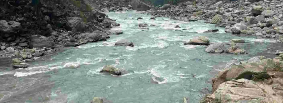
- Budhi Gandaki River: Follow the rushing river through the valley, with its sound accompanying much of the journey.
- Waterfalls: You can spot waterfalls along the hillsides, especially impressive after rainfall.
- Suspension Bridges: Cross suspension bridges over the Budhi Gandaki and enjoy views deep into the river valley.
- Terraced Hillsides: Green terraces cover the steep slopes around villages, showing how local communities farm the mountain land.
- Rural Villages: Small settlements along the route offer a glimpse into everyday life in the remote Himalayan foothills.
- Traditional Houses: Stone and locally built houses add a distinct character to the villages.
- Local Communities: Meet local people and see the simple lifestyle, farming and hospitality that make the Manaslu region special.
- Lower-Manaslu Landscapes: Green forests, rocky hills, river valleys and waterfalls create a completely different atmosphere from the colder, higher sections ahead.
Machha Khola vs Soti Khola: Where Should You Start the Manaslu Trek?
Both Machha Khola and Soti Khola are used as starting points for the Manaslu Circuit Trek, but Machha Khola has become a more practical starting point in many modern itineraries because road access now extends farther into the valley. Starting from Soti Khola means adding more walking distance, while Machha Khola can save trekking days. The better choice depends on current road conditions, your available time and whether you want a longer approach.
| Factor |
Machha Khola |
Soti Khola |
| Road access |
Road access commonly reaches Machha Khola, although conditions can change with weather and construction. |
Road access also reaches Soti Khola and is commonly used as an earlier access point. |
| Walking distance |
Shorter walking itinerary because you start farther up the valley. |
Longer walking approach with more distance before reaching the upper Manaslu villages. |
| Accommodation |
Basic tea houses and guesthouses are available. |
Basic tea houses and guesthouses are available. |
| Trek experience |
A more practical modern starting point for trekkers looking to reduce road and walking days. |
An earlier traditional starting point that gives you more time on the lower section of the route. |
| Best for |
Travelers who want to save trekking days and reach the main trekking section sooner. |
Travelers who prefer a longer approach and want to experience more of the lower valley on foot. |
Machha Khola vs Jagat: Which Is Better as a Starting Point?
Both Machha Khola and Jagat can be used as practical starting points for the Manaslu Circuit Trek, but they offer different experiences. Machha Khola sits at around 900 m, while Jagat is higher at about 1,340 m. Starting from Jagat saves an additional day or more of walking, but beginning at Machha Khola gives you more time to experience the lower Budhi Gandaki Valley and gradually gain elevation.
| Factor |
Machha Khola |
Jagat |
| Elevation |
Around 900 m |
Around 1,340 m |
| Transportation |
Road access commonly reaches Machha Khola |
Road access can reach Jagat, but conditions vary |
| Trekking experience |
More time walking through the lower valley |
Starts closer to the main Manaslu trekking section |
| Acclimatization |
Allows a slower and more gradual elevation gain |
Starts higher, so the elevation increases sooner |
| Walking days saved |
More trekking days compared with starting farther up |
Saves walking days by starting higher |
| Road conditions |
Rough mountain roads can affect travel time |
Road conditions can be more challenging farther into the valley |
Ready to Start Your Manaslu Adventure From Machha Khola?
A great Manaslu trek starts with good preparation. From choosing the right itinerary to arranging permits, transport and acclimatization days, planning early can make the journey much easier and more enjoyable. Whether you dream of crossing Larkya La, exploring Tsum Valley or simply experiencing the quieter side of the Himalayas, now is a good time to start planning before your preferred trekking dates fill up.
Explore our Manaslu Circuit Trek, Short Manaslu Circuit Trek 10 Days, Manaslu Base Camp Trek, or Manaslu Tsum Valley Trek and find the journey that fits your time and trekking goals. A little preparation now can bring you one step closer to the mountains you have been dreaming about.
Frequently Asked Questions About Machha Khola
Where is Machha Khola?
Machha Khola is a small settlement in Gorkha District, Gandaki Province, Nepal, along the Budhi Gandaki River. It lies on the lower section of the Manaslu Circuit route and is commonly used as a road-access starting point for the trek.
How high is Machha Khola?
Machha Khola is approximately 900 meters above sea level, although commonly cited elevations vary from about 869 m to 930 m depending on the exact location measured.
How do I get from Kathmandu to Machha Khola?
You can reach Machha Khola from Kathmandu by jeep or bus, traveling through Dhading Besi, Arughat and Soti Khola. The journey is entirely by road and is usually treated as the first travel day of the Manaslu Circuit Trek.
How long does it take from Kathmandu to Machha Khola?
The drive from Kathmandu to Machha Khola generally takes around 7 to 10 hours, but travel time can be longer because of road conditions, traffic, weather, construction and landslides.
Is there a bus from Kathmandu to Machha Khola?
Yes, buses and local transport services can operate toward Machha Khola, but schedules and direct services can change. Many trekkers prefer a shared or private jeep because it is generally more practical on the rough mountain road.
How much does a jeep from Kathmandu to Machha Khola cost?
The jeep cost varies depending on whether you choose a private or shared vehicle, the season and current road conditions. It is best to confirm the latest fare with your trekking agency or local transport provider before traveling.
What is Machha Khola weather like?
Machha Khola has a warmer climate than the higher Manaslu villages because of its low elevation. Spring and autumn are generally comfortable, summer and monsoon are warmer and wetter, while winter brings cooler days and colder nights.
Is Machha Khola the starting point of the Manaslu Circuit Trek?
Machha Khola is a common modern starting point for the Manaslu Circuit Trek because road access now reaches farther into the Budhi Gandaki Valley. Some itineraries still begin from Soti Khola or another point depending on road conditions and the number of trekking days available.
How difficult is Machha Khola to Jagat?
The Machha Khola to Jagat section is moderately difficult. The altitude is still relatively low, but the route includes frequent ups and downs, rocky sections, suspension bridges and a long walking day, which can feel tiring in warm weather.
Can beginners do the Manaslu Circuit Trek?
Yes, fit beginners can complete the Manaslu Circuit Trek with proper preparation, a suitable itinerary and an experienced guide. However, it is a challenging high-altitude trek because of long walking days, changing terrain and the 5,106 m Larkya La Pass, so good fitness and gradual acclimatization are important.